These are available in the Dynamic Mapping Suite both as interactive reference maps and base maps for your own plottings
-
 Clean Air Zones / LEZ / ULEZ / ZEZ / CCZ + postcodes + congestion + route directions
The essential map for planning deliveries and service routes in and around the country’s rapidly expanding Clean Air and Low Emission Zones. Quickly find all postcode areas, districts, sectors and units in the context of ULEZ, CAZ, LEZ, DVS, ZEZ and CCZ zones, plus borough and county boundaries, and options to highlight an A to B driving route and see recent traffic congestion data
-
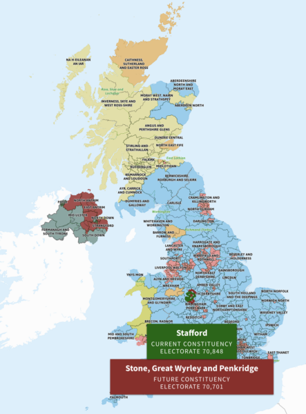 Parliamentary Constituencies: compare pre- and post- General Election 2024 boundary changes
The Westminster Parliamentary Constituency boundaries are changing significantly for the next General Election. This map has double active layers as you mouseover or touch scroll, highlighting both the current and future boundaries.
-
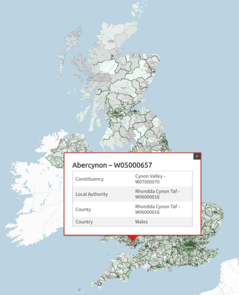 Electoral Wards
8,694 interactive Electoral Wards with ONS codes in context with Westminster and Scottish Parliamentary Constituencies and Local Authorities
-
 Counties and Unitary Authorities
A high tier of authority used by local government in the UK. Dynamic search plus postcodes and colour classification toggling
-
 Local Authorities
The UK’s 361 Local Authorities reflecting boundary changes in North Yorkshire, Somerset and Cumbria in April 2023
-
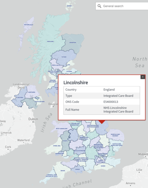 Health Authorities
The 68 principal health authority areas of the UK. Includes England’s Integrated Care Boards and sub-Locations, plus old Clinical Commissioning Group boundaries.
-
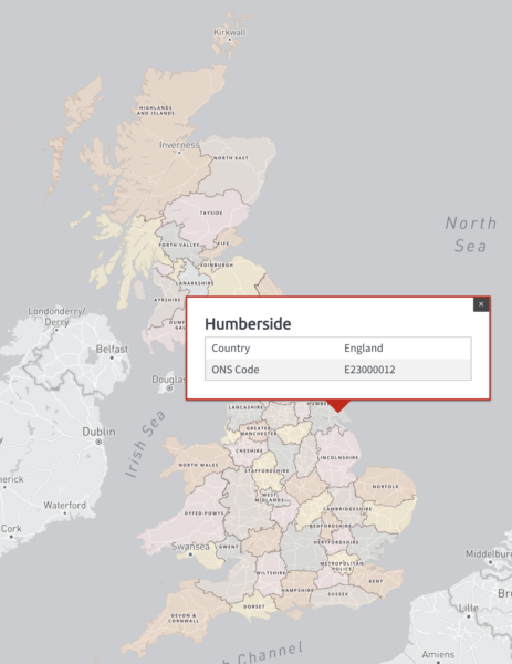 Police Force Areas
The 56 Police Force Areas of England, Wales and Scotland