Maproom

Editable & interactive digital maps

  • about
  • news & blog
  • contact
  • 0 items
Log in
    • Home
  • Britain & Ireland maps
    • Britain and Ireland
    • UK - United Kingdom
    • Ireland
    • England
    • Scotland
    • Wales
    • Northern Ireland
    • Isle of Man
    • Channel Islands
  • City maps
    • Birmingham
    • Brighton
    • Bristol
    • Cardiff
    • Edinburgh
    • Exeter
    • Glasgow
    • Liverpool
    • London
    • Manchester
    • Oxford
  • Postcode maps
    • Overview
    • Dynamic postcode mapping tools
    • Downloadable postcode maps
  • Admin / region maps
    • UK administrative regions
    • County maps
    • Local authority maps
    • London borough maps
    • Transport maps
    • National park maps
  • World maps
    • World maps
    • Europe maps
    • Map of EU countries 2026
    • Maps of France
    • Maps of Germany
    • Maps of New York and environs
  • DYNAMIC MAPPING
    • Showcase
    • Dynamic Mapping Suite info
    • PASS PRICING
  • BESPOKE

DYNAMIC MAPPING SUITE PORTAL

  • Dynamic Mapping Suite
  • Pass Pricing
  • Login

Tools in the Dynamic Mapping Suite

  • Locations Plotter examples
  • Radius plotting
  • Quick Select Postcodes
  • Bulk postcodes plotting
  • Mapping with spreadsheets
  • Dynamic postcodes with census data
  • Dynamic UK administrative maps
  • Clean Air Zones + route planning
  • Dynamic maps for MRP polling data

Mapping with spreadsheets

We have three main systems inside the Dynamic Mapping Suite: the Locations Plotter, Quick Select Postcodes and Choropleth Maps. Each system is geared up for spreadsheet import and export. Indeed, the Choropleth mapping system is primarily about feeding spreadsheet data to polygons.

This image has an empty alt attribute; its file name is postcode-clusters-on-postcodes-base-map.png
LOCATIONS PLOTTER

Copy in a spreadsheet column of postcodes, or import your spreadsheet with geocoded locations for instant bulk plotting on a choice of base maps

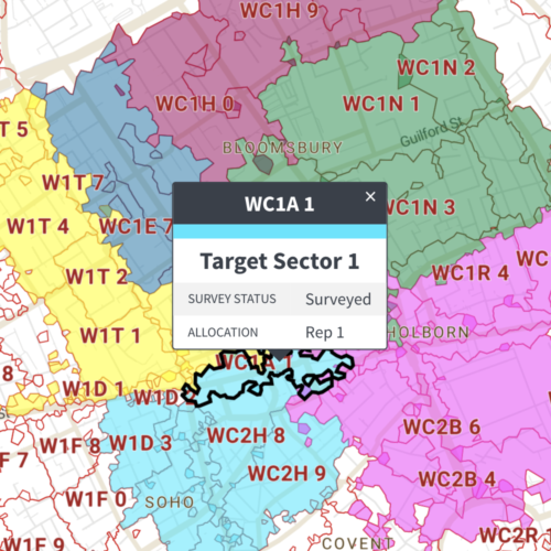
QUICK SELECT POSTCODES

Use the point-and-click Quick Select Postcodes interface to select your postcodes, then export to spreadsheet columns including population and households data for your selected postcodes
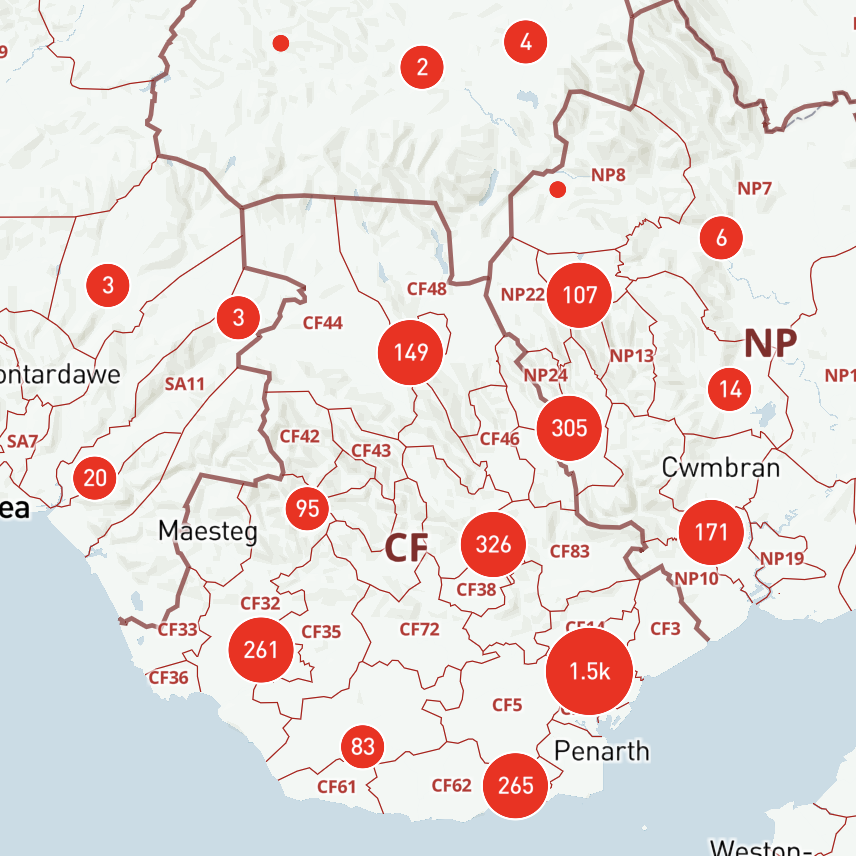
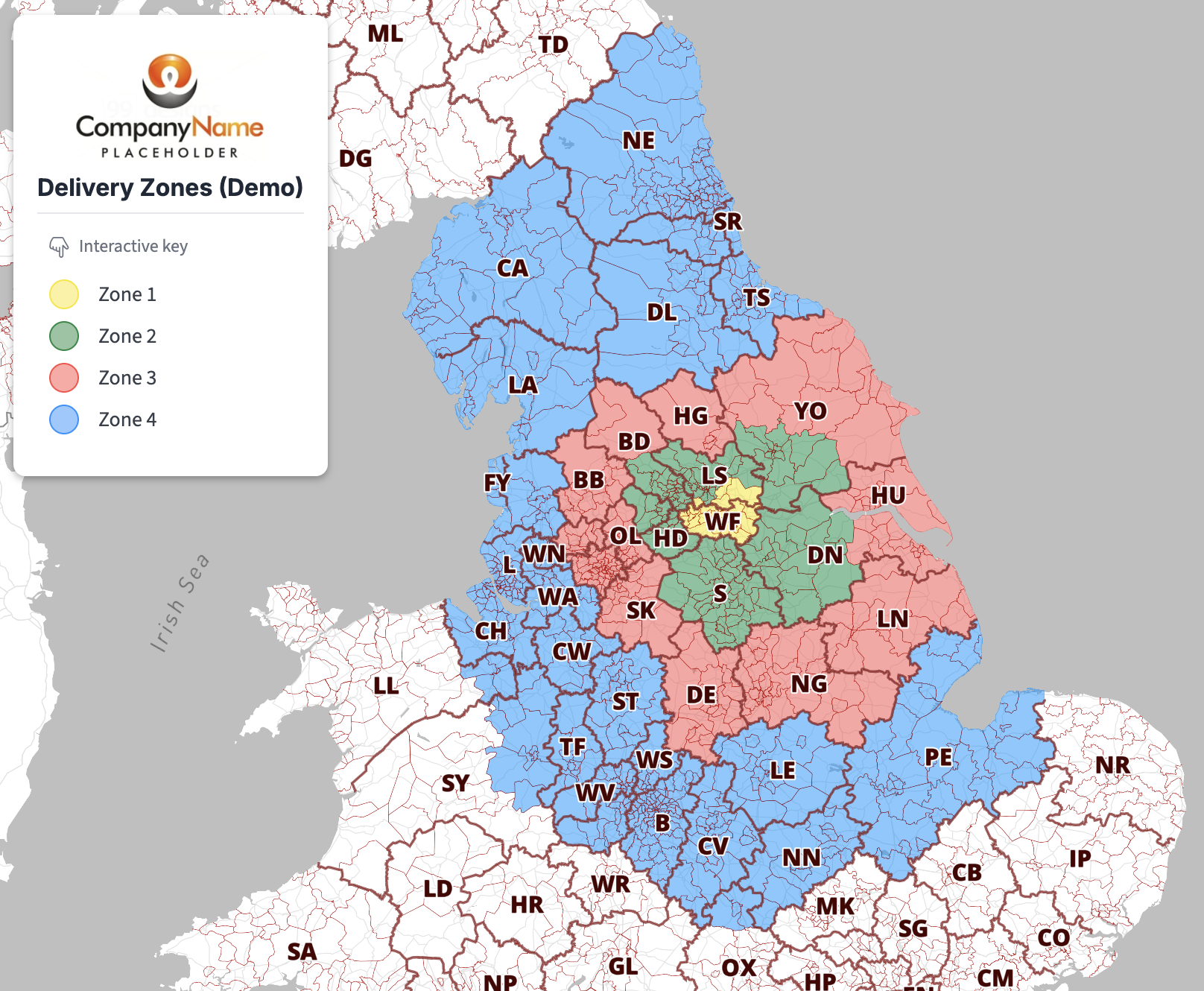
Postcode sectors mapping
CHOROPLETH – SPREADSHEETS TO POLYGONS

Available for:
Ceremonial Counties
Counties and Unitary Authorities
Local Authorities
Constituencies
Postcode Districts
Postcode Sectors

Try the Dynamic Mapping Suite

GET TEST PASS

No payment card required. Access all mapping tools in Test Mode.

Or buy a full pass from only £25

  • Standard royalty free terms for downloadable maps
  • Licensing terms for downloadable postcode maps
  • Licensing terms for dynamic online maps
  • How to edit the downloadable maps
  • Refund, tax and pricing policies
  • Privacy & cookies

All content © Maproom at Blue Island Media · Award winning media projects