County maps
We have a growing series of individual county maps which are scaled for A3+ printing. Please contact us if the county you are interested in is not listed here, because we may be able to prioritise it on our "To Do" list if you request it.
We also have a dynamic online map of Counties and Unitary Authorities in the Dynamic Mapping Suite. A Single Month Premium Pass for the Dynamic Mapping Suite is bundled with all of the downloadable county maps.
Showing all 25 results
-
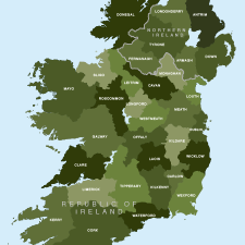
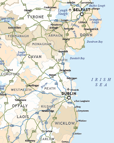
Map of Irish counties
£40.00All the counties in the Republic of Ireland and Northern Ireland
PDFsSVGLayered AI file -
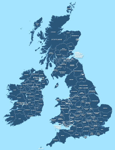
County maps of Britain and Ireland
£45.00Shows all the counties of Britain and Ireland and includes option layers for changing the colour fills and showing county boundaries.
PDFsSVGLayered AI file -
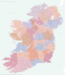
Best detailed map of Ireland
£70.00Approximately 1,400 towns and villages, 17,000+ roads, all the counties and a huge wealth of coastal detail, rivers, urban backdrop and green areas are plotted on our most detailed map of Ireland.
PDFsSVGLayered AI file -
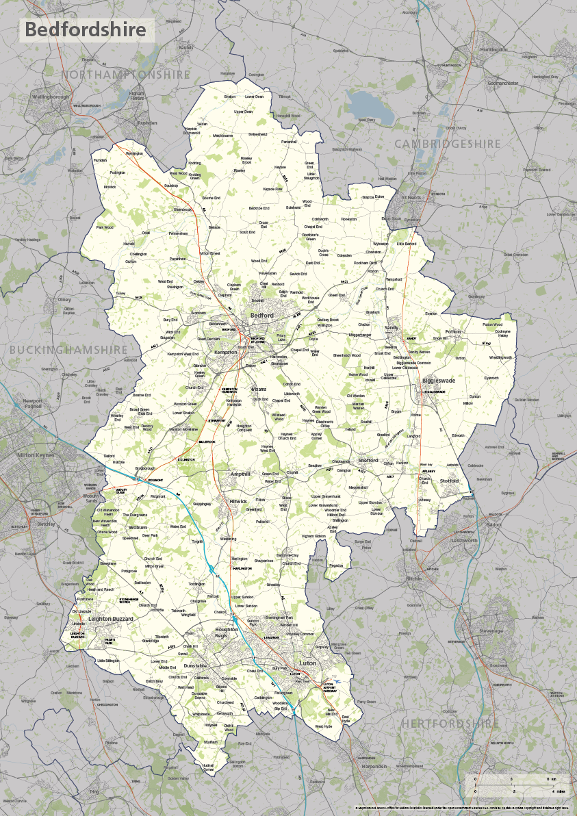
Bedfordshire county map
£40.00The ceremonial county of Bedfordshire is highlighted along with towns, villages, roads, railway lines, lakes, rivers, woodland and green spaces. Scaled for A3+ printing
PDFSVGLayered AI file -
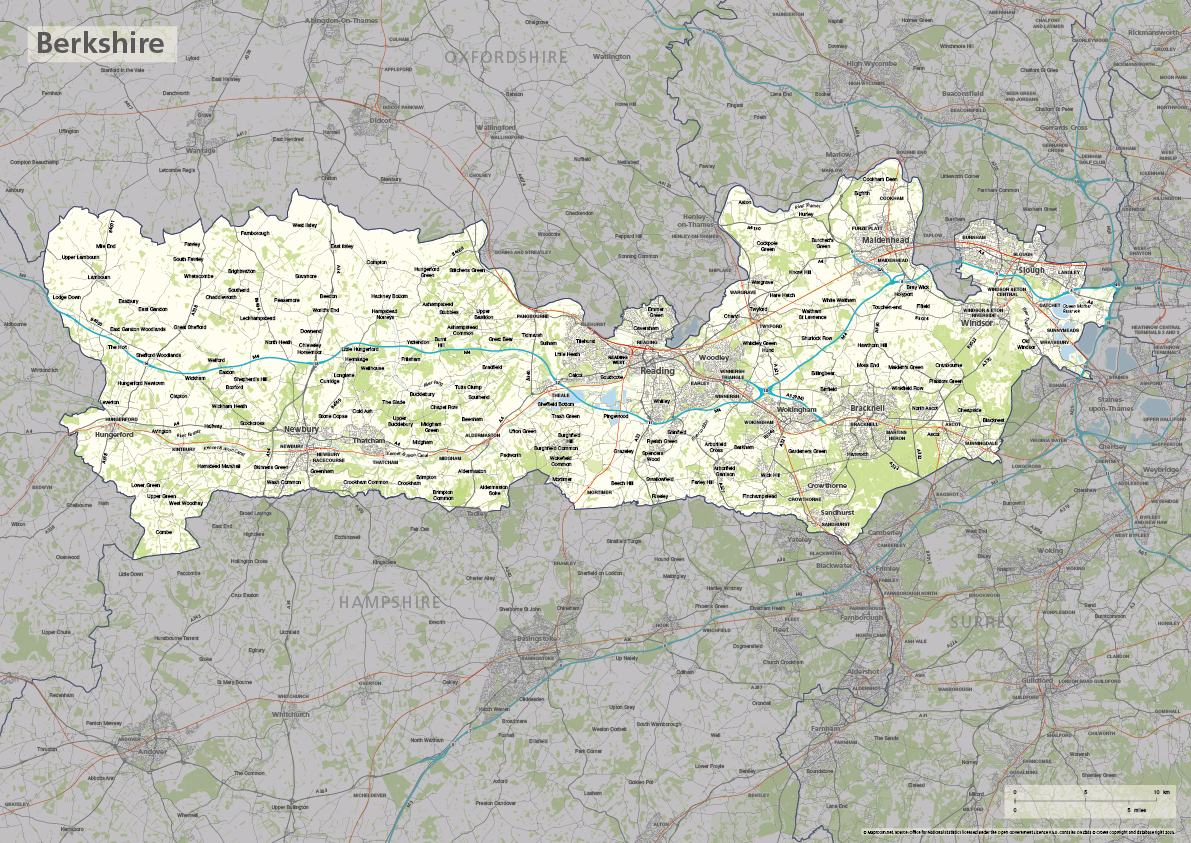
Berkshire county map
£40.00The ceremonial county of Berkshire is highlighted along with towns, villages, roads, railway lines, lakes, rivers, woodland and green spaces. Scaled for A3+ printing
PDFSVGLayered AI file -
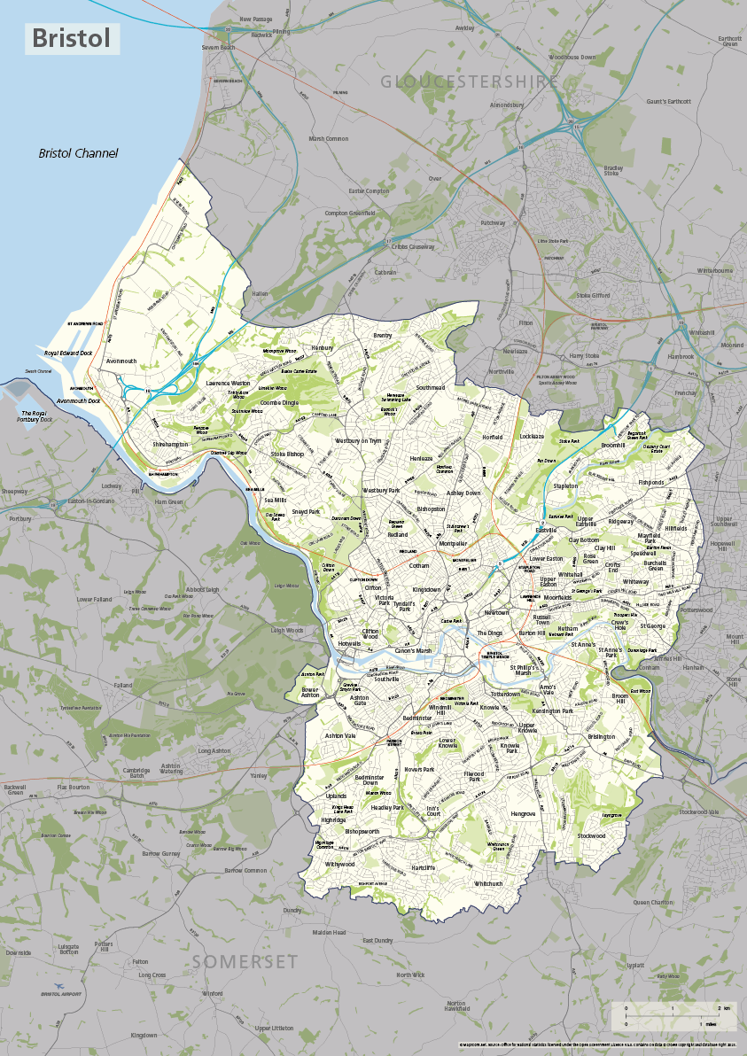
Bristol county map
£40.00The ceremonial county / unitary authority of Bristol is highlighted along with towns, villages, roads, railway lines, lakes, rivers, woodland and green spaces. Scaled for A3+ printing
PDFSVGLayered AI file -

Buckinghamshire county map
£40.00The ceremonial county of Buckinghamshire is highlighted along with towns, villages, roads, railway lines, lakes, rivers, woodland and green spaces. Scaled for A3+ printing
PDFSVGLayered AI file -
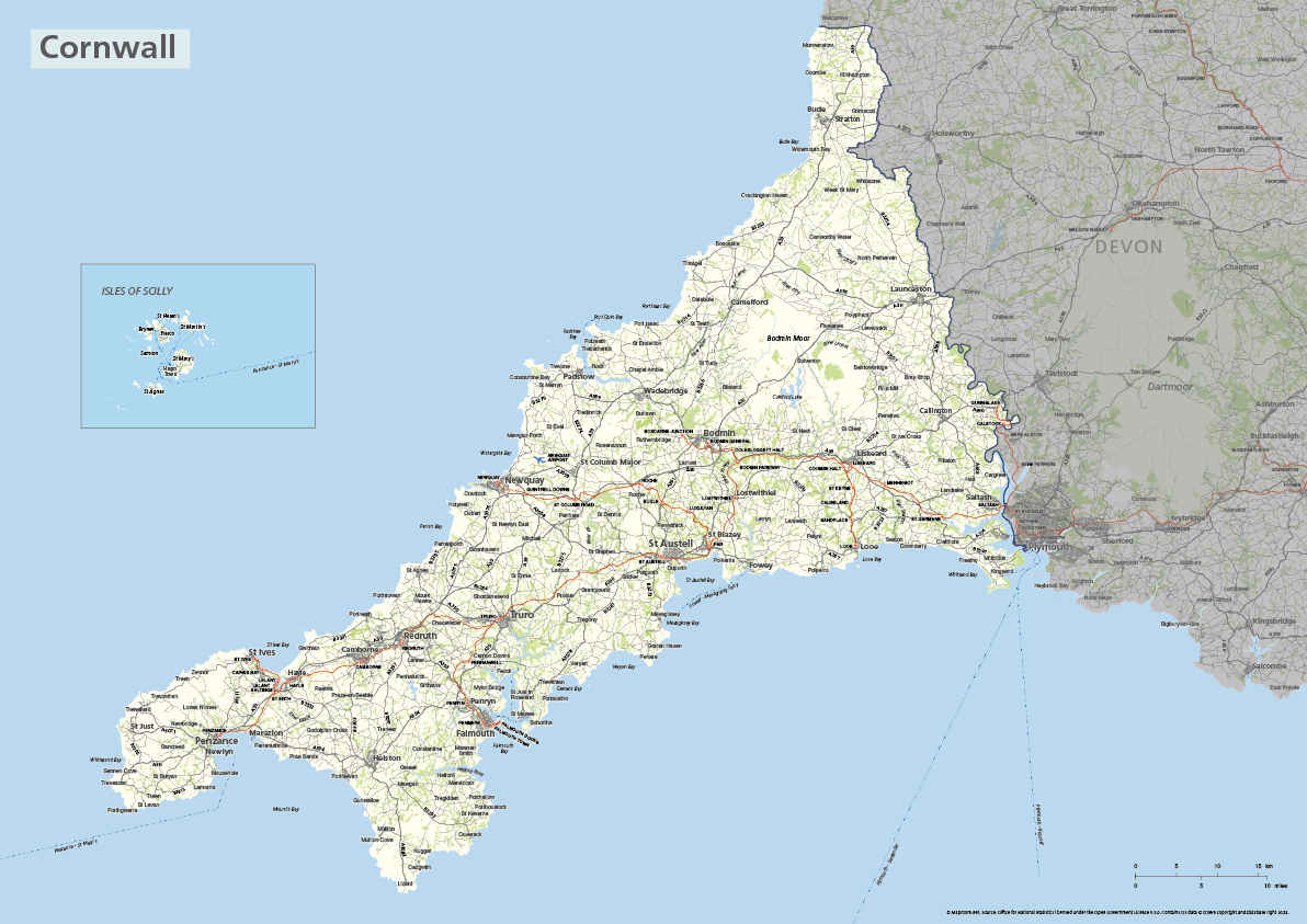
Cornwall county map with Isles of Scilly
£40.00The ceremonial county of Cornwall is highlighted along with towns, villages, roads, railway lines, lakes, rivers, woodland and green spaces. The Isles of Scilly are optionally shown in their natural geographic position or in an inset box. Scaled for A3+ printing
PDFSVGLayered AI file -

Devon county map
£40.00The ceremonial county of Devon is highlighted along with towns, villages, roads, railway lines, lakes, rivers, woodland and green spaces. Scaled for A3+ printing
PDFSVGLayered AI file -
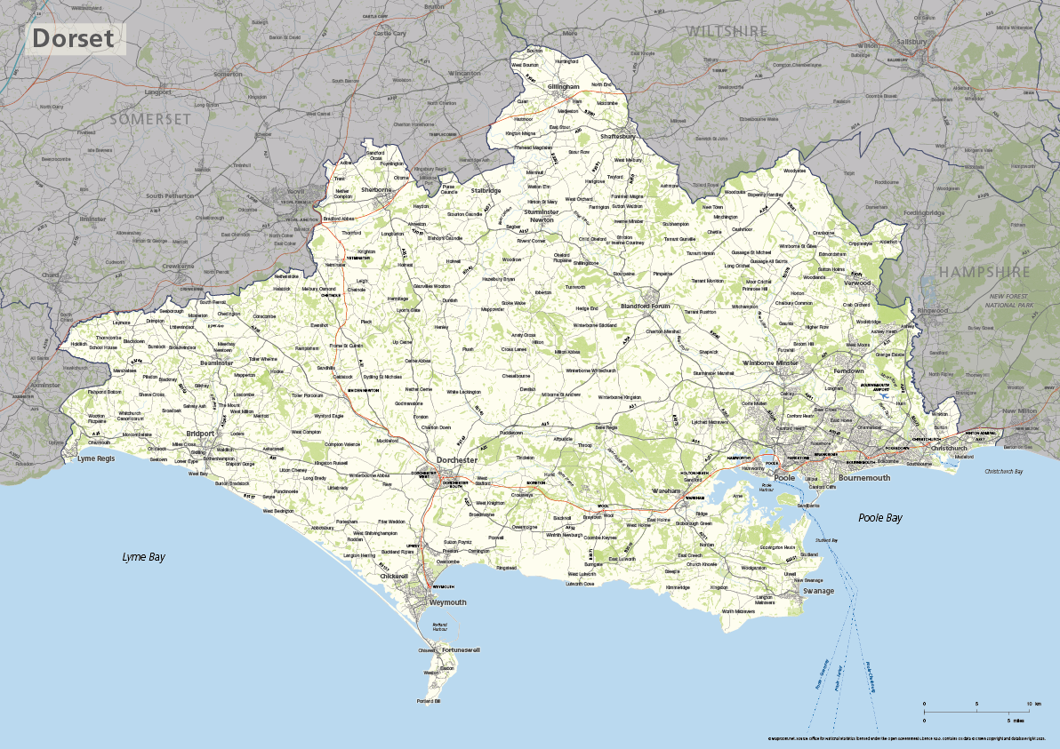
Dorset county map
£40.00The ceremonial county of Dorset is highlighted along with towns, villages, roads, railway lines, lakes, rivers, woodland and green spaces. Scaled for A3+ printing
PDFSVGLayered AI file -
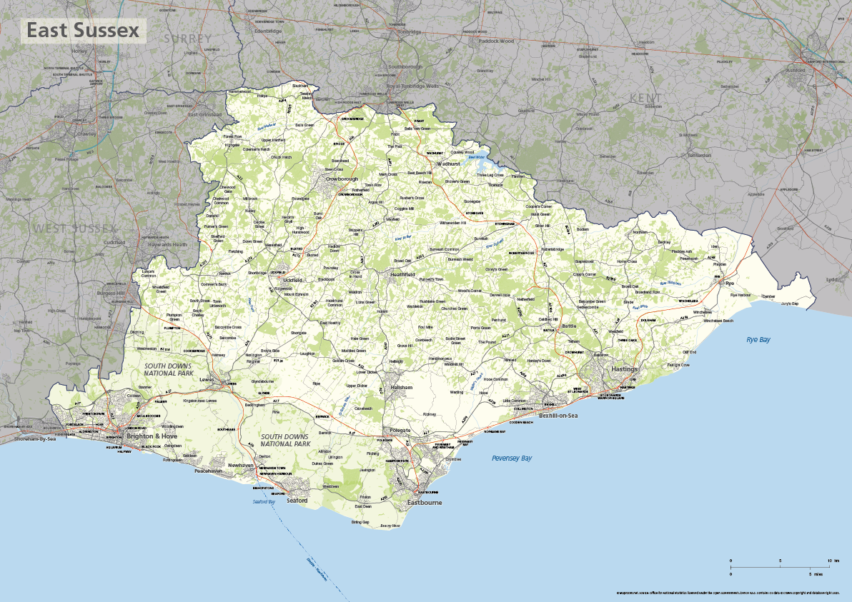
East Sussex county map
£40.00The ceremonial county of East Sussex is highlighted along with towns, villages, roads, railway lines, lakes, rivers, woodland and green spaces. Scaled for A3+ printing
PDFSVGLayered AI file -
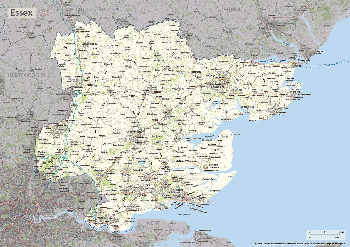
Essex county map
£40.00The ceremonial county of Essex is highlighted along with towns, villages, roads, railway lines, lakes, rivers, woodland and green spaces. Scaled for A3+ printing
PDFSVGLayered AI file -
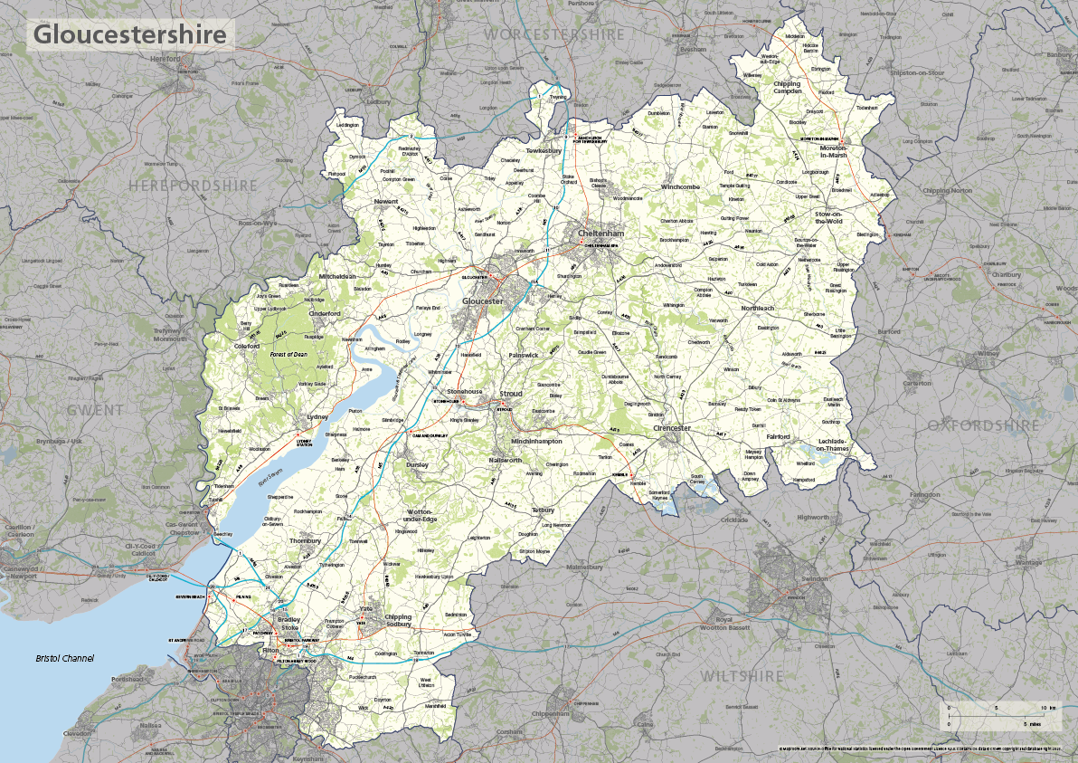
Gloucestershire county map
£40.00The ceremonial county of Gloucestershire is highlighted along with towns, villages, roads, railway lines, lakes, rivers, woodland and green spaces. Scaled for A3+ printing
PDFSVGLayered AI file -
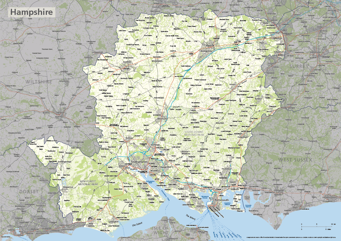
Hampshire county map
£40.00The ceremonial county of Hampshire is highlighted along with towns, villages, roads, railway lines, lakes, rivers, woodland and green spaces. Scaled for A3+ printing
PDFSVGLayered AI file -
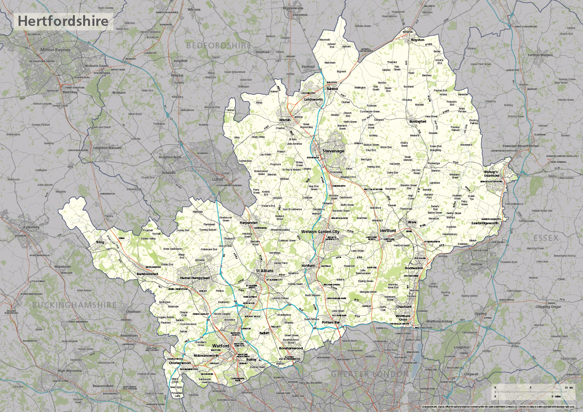
Hertfordshire county map
£40.00The ceremonial county of Hertfordshire is highlighted along with towns, villages, roads, railway lines, lakes, rivers, woodland and green spaces. Scaled for A3+ printing
PDFSVGLayered AI file -
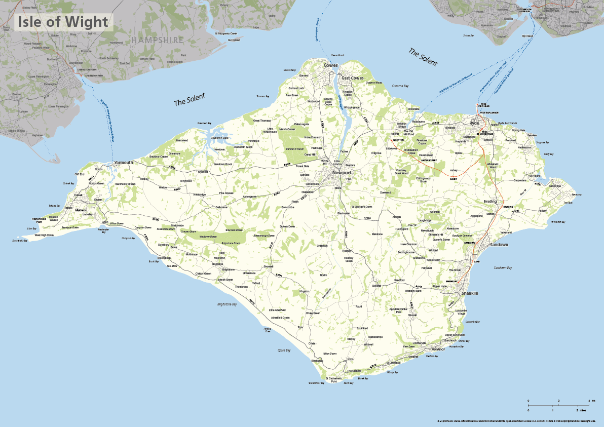
Isle of Wight map
£40.00The ceremonial county of the Isle of Wight is highlighted along with towns, villages, roads, railway lines, lakes, rivers, woodland and green spaces. Scaled for A3+ printing
PDFSVGLayered AI file -

Kent county map
£40.00The ceremonial county of Kent is highlighted along with towns, villages, roads, railway lines, lakes, rivers, woodland and green spaces. Scaled for A3+ printing
PDFSVGLayered AI file -
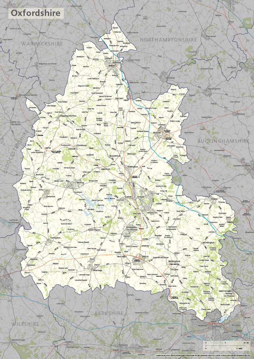
Oxfordshire county map
£40.00The ceremonial county of Oxfordshire is highlighted along with towns, villages, roads, railway lines, lakes, rivers, woodland and green spaces. Scaled for A3+ printing
PDFSVGLayered AI file -
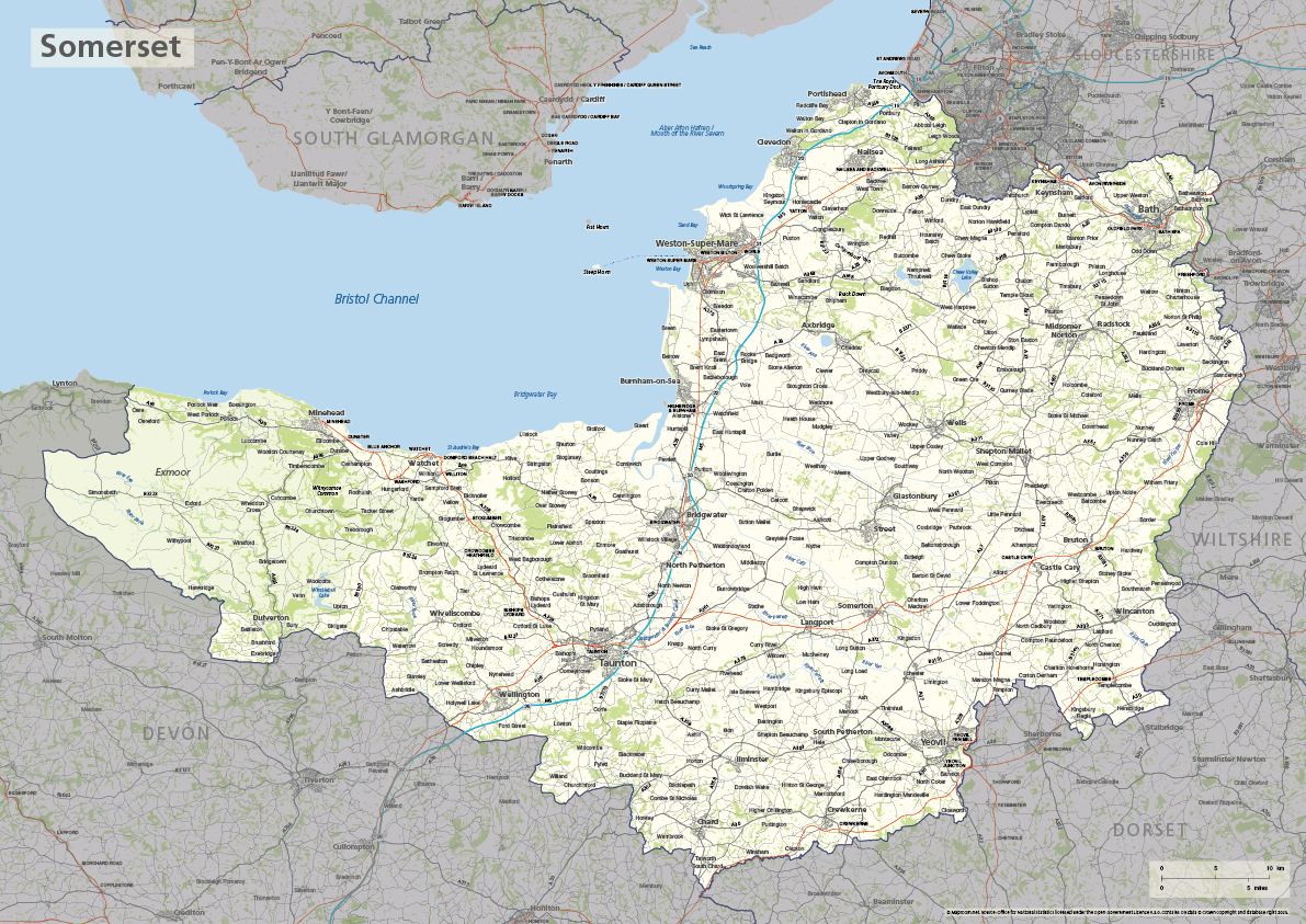
Somerset county map
£40.00The ceremonial county of Somerset is highlighted along with towns, villages, roads, railway lines, lakes, rivers, woodland and green spaces. Scaled for A3+ printing
PDFSVGLayered AI file -
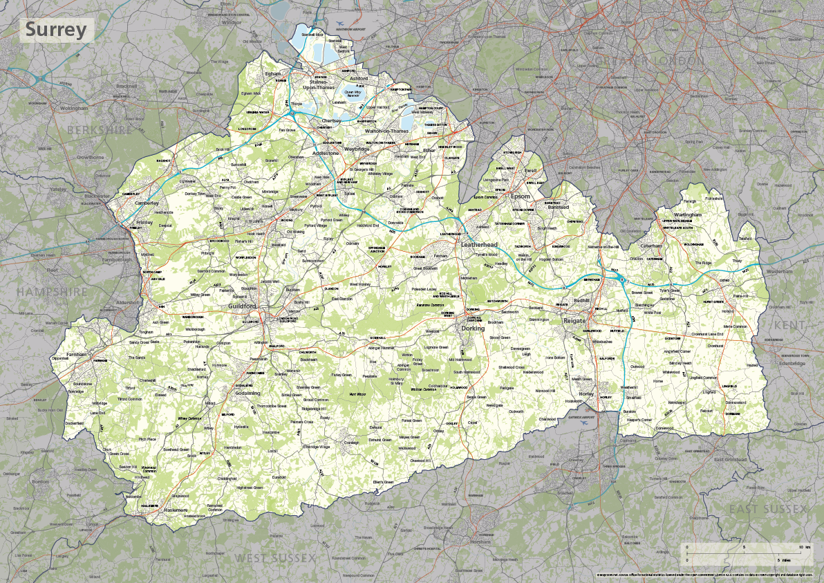
Surrey county map
£40.00The ceremonial county of Surrey is highlighted along with towns, villages, roads, railway lines, lakes, rivers, woodland and green spaces. Scaled for A3+ printing
PDFSVGLayered AI file -
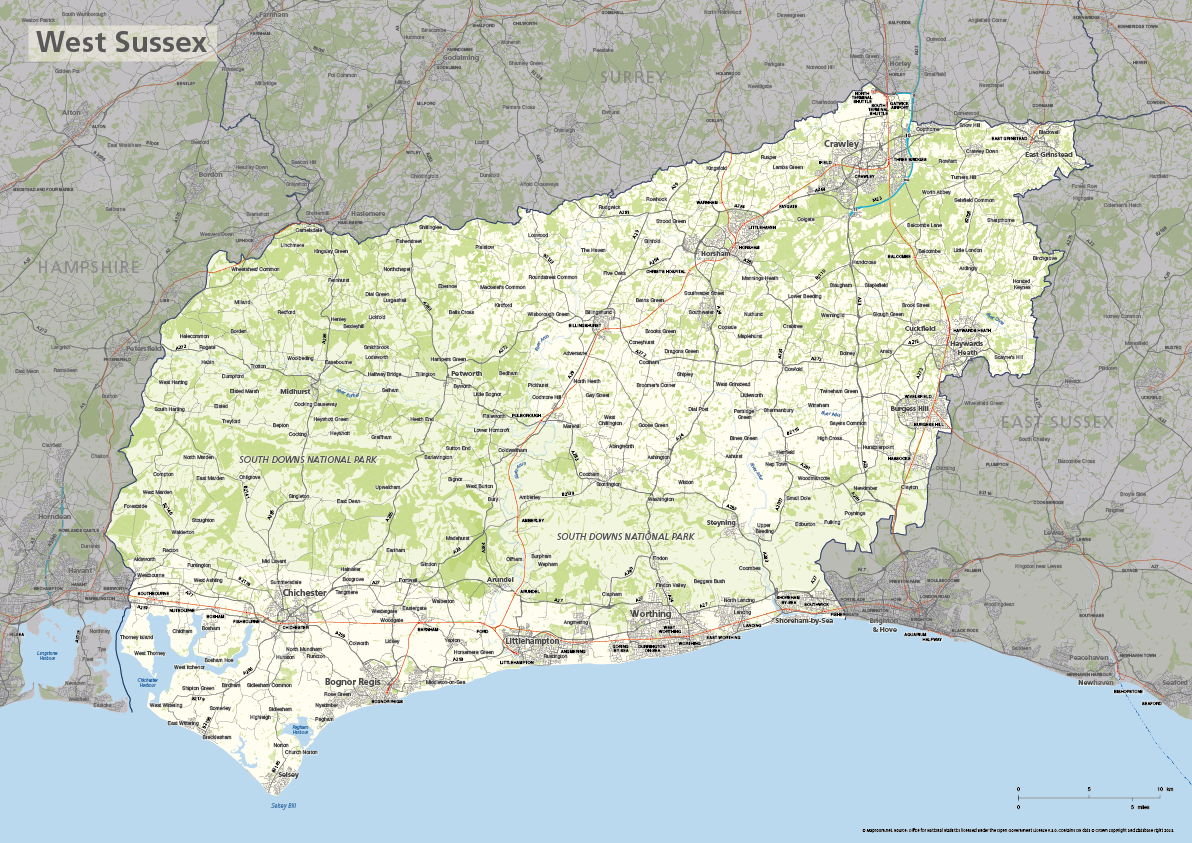
West Sussex county map
£40.00The ceremonial county of West Sussex is highlighted along with towns, villages, roads, railway lines, lakes, rivers, woodland and green spaces. Scaled for A3+ printing
PDFSVGLayered AI file -
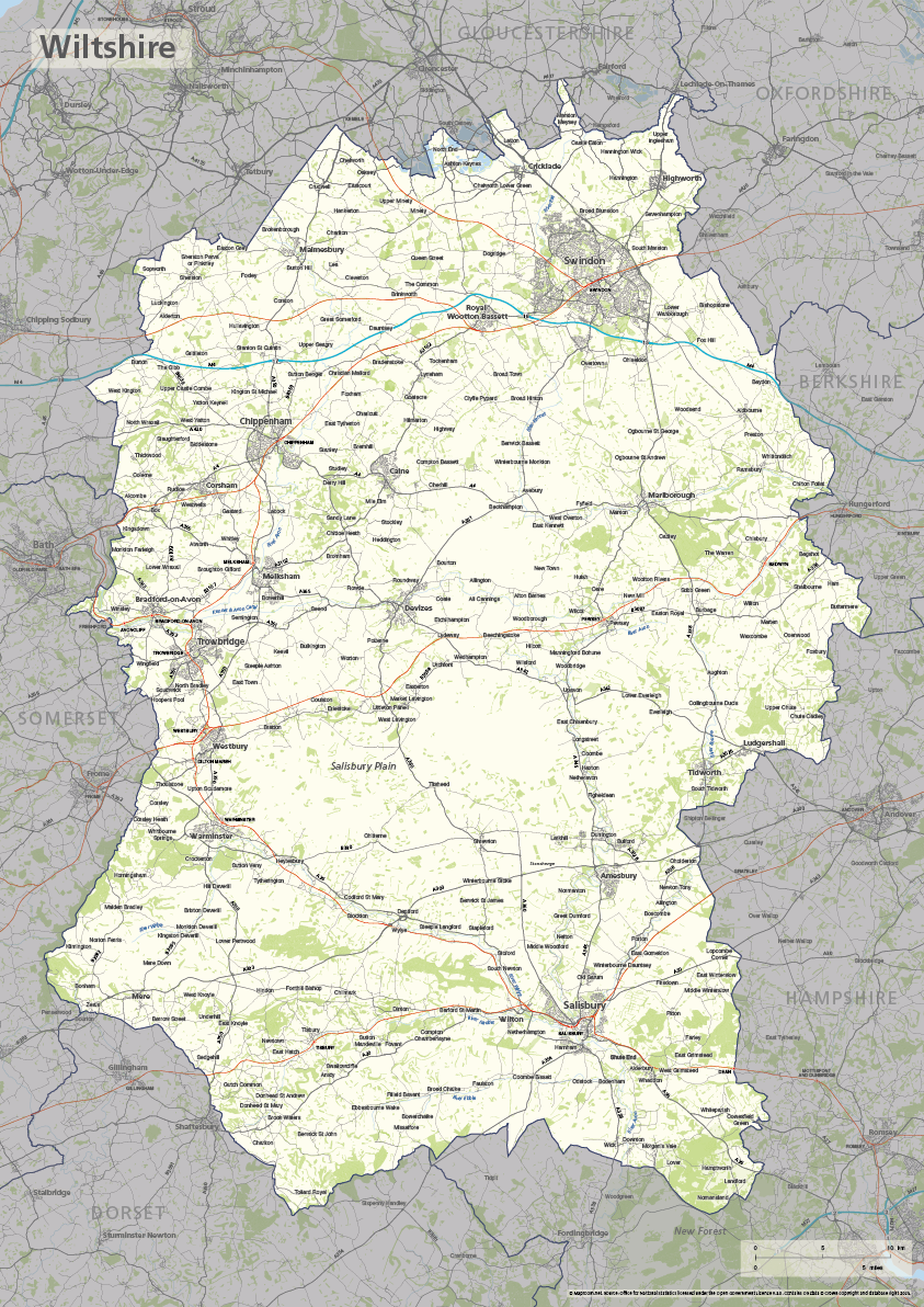
Wiltshire county map
£40.00The ceremonial county of Wiltshire is highlighted along with towns, villages, roads, railway lines, lakes, rivers, woodland and green spaces. Scaled for A3+ printing
PDFSVGLayered AI file -
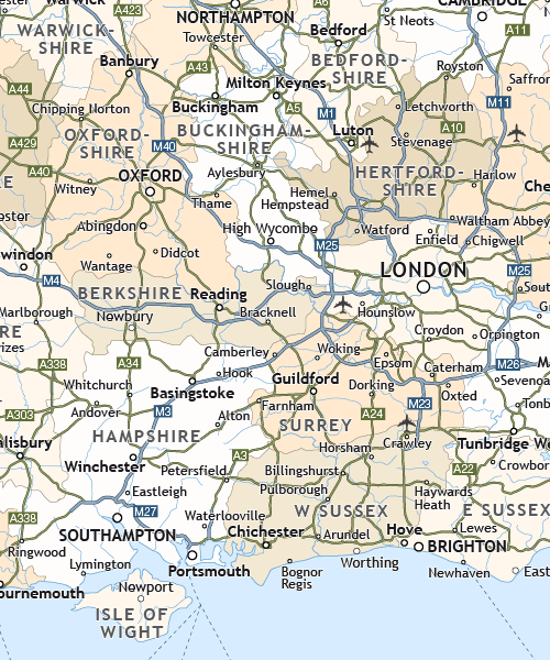
Political map of England
£40.00Shows all the counties of England, plus the principal towns and transport network.
PDFsSVGLayered AI file -
Political map of Ireland
£40.00Shows all the counties plus the principal towns and transport systems across both the Republic of Ireland and Northern Ireland.
PDFsSVGLayered AI file -
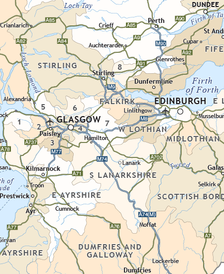
Political map of Scotland
£40.00Includes all the modern counties of Scotland, plus the principal towns and transport network.
PDFsSVGLayered AI file