Maproom

Editable & interactive maps

MENUMENU
  • about
  • news
  • contact
  • 0 items
LOGIN
    • Home
  • Britain & Ireland maps
    • Britain and Ireland
    • UK - United Kingdom
    • Ireland
    • England
    • Scotland
    • Wales
    • Northern Ireland
    • Isle of Man
    • Channel Islands
  • City maps
    • Birmingham
    • Brighton
    • Bristol
    • Cardiff
    • Edinburgh
    • Glasgow
    • Liverpool
    • London
    • Manchester
    • Oxford
  • Postcode maps
    • Overview
    • Online postcode mapping tools
    • Downloadable postcode maps
  • Boundary & transport maps
    • Boundary and ONS maps
    • Local authority maps
    • County maps
    • Transport maps
  • World maps
    • World maps
    • Europe maps
    • Map of EU countries 2023
    • Maps of France
    • Maps of Germany
    • Maps of New York and environs
  • DYNAMIC
    • Showcase
    • Dynamic Mapping Suite information and demos
    • GET A PASS
  • BESPOKE
    • Bespoke mapping services
    • Bespoke static maps
    • Bespoke dynamic maps
    • Search

General Advice About Vector Artwork

  • How to edit the downloadable maps
  • Editing colours
  • Scaling recommendations
  • Dealing with text
  • About hillshading layers
  • Outputting for websites or apps
  • Outputting for print

Illustrator Tutorials

  • Understanding the map layers
  • Special option layers
  • Advanced editing of strokes in Illustrator
  • Video – How to use the map layers in Illustrator
  • Video – how to change map colours in Illustrator

Photoshop Tutorials

  • How to change the colour of a hillshading / relief layer in Photoshop

Customisation service

We offer a range of services if you need help to customise your map. Our rates are competitive and we will waive the price of the base map itself if you have already purchased one.

See bespoke services

Advanced editing of strokes in Illustrator

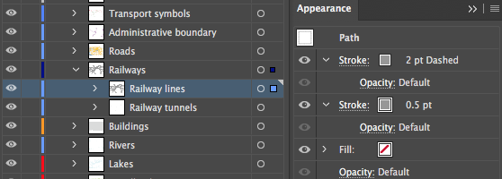
Some layers in our detailed map bases have more complex appearances than simple colour fills and strokes. Their appearance can be edited, just like any other layer in Illustrator.

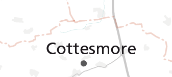
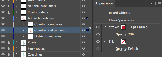
Boundary layers often have a dashed stroke and low opacity.

Stroke panel in Illustrator
Stroke panel in Illustrator – typical settings on a boundary layer

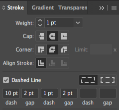
To edit the dash, select the boundary layer, then open the Stroke panel. Here you can change the weight of the stroke and also the length of the dashes and gaps of a boundary line. The Dashed Line settings in the Stroke panel shown here create a boundary with alternating long lines and dots.

boundary line
The appearance of the dash-dot boundary line on the map

Most of our map bases use rounded caps and corners for strokes. This is because at deep zoom levels, squared caps and corners can take on a jagged, undesirable appearance.

The opacity of a boundary line is best edited in the Appearance panel in Illustrator. Select your boundary layer, then expand the stroke element in the Appearance panel to access the opacity. (Click the chevron.)

Access the opacity of a boundary layer in the Appearance panel rather than the Transparency panel
NOTE: There is a quirk in Illustrator whereby the Transparency panel and Opacity control on the top bar may misleadingly show your layer as having 100% opacity when clearly it hasn’t!

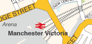
Railway lines are sometimes styled as a double layer on our maps, or a single layer with two strokes. Again, these settings can be accessed and edited in the Appearance panel.

railway styling on map
This is just one type of styling for railways used on some of our maps.
railway double stroke
The railway shown in the map above has a double stroke – the top one dashed, the lower one a simple line – which can be edited in the Appearance panel
  • Standard royalty free terms for downloadable maps
  • Licensing terms for downloadable postcode maps
  • Licensing terms for dynamic online maps
  • How to edit the downloadable maps
  • Pricing & refund policies
  • Privacy & cookies
  • Maproom on Twitter

All content © Maproom at Thameside Media · Award winning media projects