Maproom

Editable & interactive digital maps

MENUMENU
  • about
  • news & blog
  • contact
  • 0 items
LOGIN
    • Home
  • Britain & Ireland maps
    • Britain and Ireland
    • UK - United Kingdom
    • Ireland
    • England
    • Scotland
    • Wales
    • Northern Ireland
    • Isle of Man
    • Channel Islands
  • City maps
    • Birmingham
    • Brighton
    • Bristol
    • Cardiff
    • Edinburgh
    • Exeter
    • Glasgow
    • Liverpool
    • London
    • Manchester
    • Oxford
  • Postcode maps
    • Overview
    • Online postcode mapping tools
    • Downloadable postcode maps
  • Region maps
    • Region maps
    • County maps
    • Local authority maps
    • Transport maps
    • National park maps
  • World maps
    • World maps
    • Europe maps
    • Map of EU countries 2024
    • Maps of France
    • Maps of Germany
    • Maps of New York and environs
  • DYNAMIC
    • Showcase
    • Dynamic Mapping Suite information and demos
    • GET A PASS
  • BESPOKE
    • Bespoke mapping services
    • Bespoke static maps
    • Bespoke dynamic maps
    • Search

Maproom News & Blog

  • Greater London map used in Silent Witness
  • A to B driving route plotter added to our dynamic online Clean Air Zones map
  • New Local Authorities maps from April 2023 – Cumberland, Westmorland and Furness, North Yorkshire and Somerset
  • Mapping from spreadsheets system launched in our Dynamic Mapping Suite
  • New census mapping
  • Our 3d map of British and Irish mountains is an immersive demo of new techniques with advanced satellite imagery and filters
  • Europe and world maps updated for geopolitical events in 2022
  • Mapping the Elizabeth Line
  • Mapbox and Google Maps fees for high web traffic
  • The Dulwich Estate goes live with a public swipe-comparison map we built for them
  • Try our new Quick Select online editing system to colour and caption postcode maps
  • New interactive online map published – Listed Buildings of Historic England
  • Displaying Shetland in a box on maps is now banned by law on official documents. Seriously.
  • Our London base map used in BBC drama Bodyguard
  • Maps for travel guide to islands in the River Thames
  • China is now censoring world maps
  • Only In Edinburgh – beautiful and erudite new travel guide using Maproom maps
  • Animated map of EU Countries, Schengen Area, Eurozone, Single Market and Hard Brexit
  • The surprising story of Thomas Hardy in Surbiton
  • 2,500 map plottings for Betjeman’s Best British Churches

Mapping from spreadsheets system launched in our Dynamic Mapping Suite

1 November 2022
Filed Under: Interactive Mapping, Maproom News

A powerful yet easy to use system of connecting spreadsheets to colour and label polygon maps is now available in our Dynamic Mapping Suite, and it costs only a very modest £35 to use.
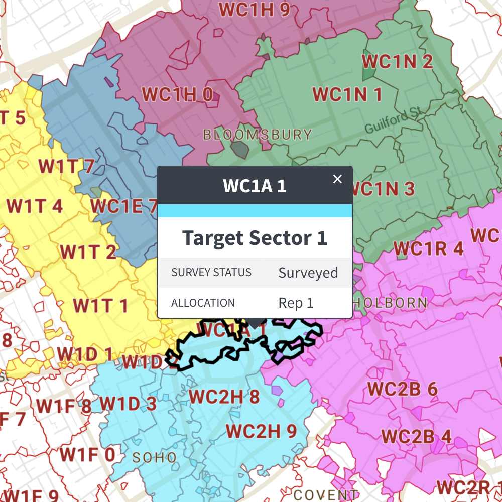
Postcode sectors preview map
Static preview of dynamic map connected to a spreadsheet

Currently available for dynamically colouring and captioning from spreadsheet:

  • Postcode Districts
  • Postcode Sectors
  • Ceremonial Counties
  • Counties and Unitary Authorities
  • Local Authorities

See a live example of a postcode district polygons map connected to a spreadsheet and learn more about mapping from spreadsheets.

  • Standard royalty free terms for downloadable maps
  • Licensing terms for downloadable postcode maps
  • Licensing terms for dynamic online maps
  • How to edit the downloadable maps
  • Pricing & refund policies
  • Privacy & cookies

All content © Maproom at Blue Island Media · Award winning media projects