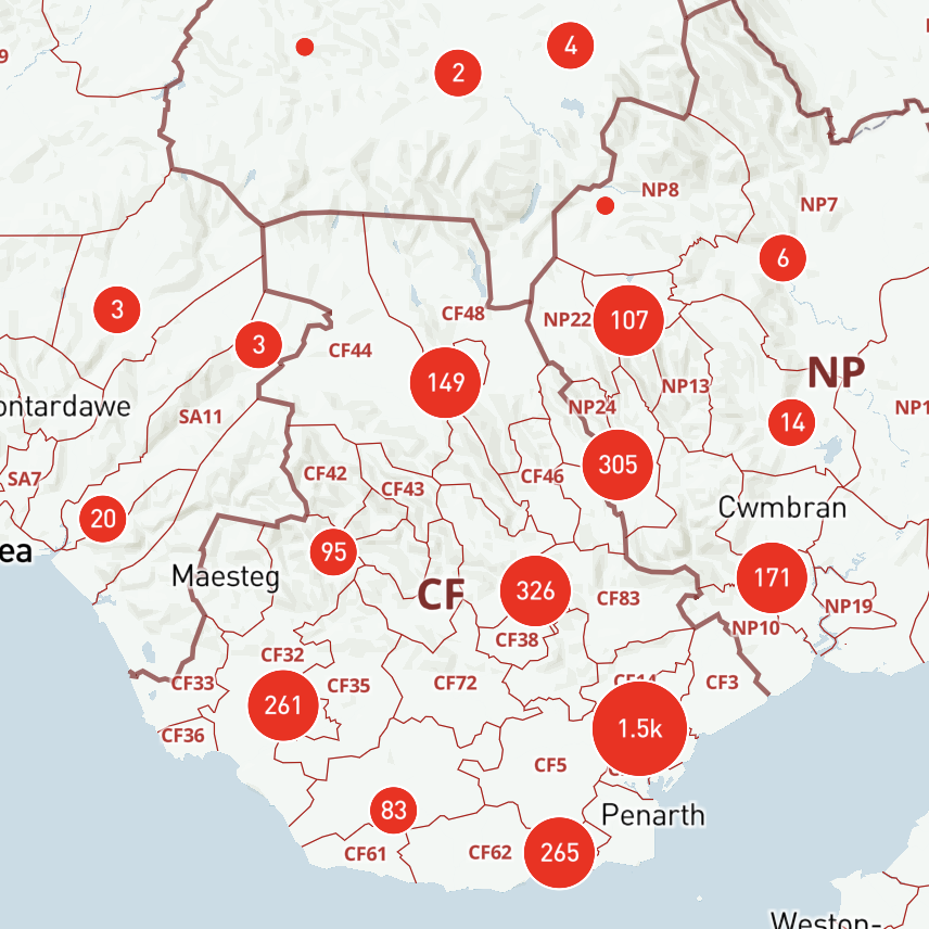
BULK POSTCODES PLOTTER
Upload your list of postcodes to plot as circles on a choice of map bases
See example
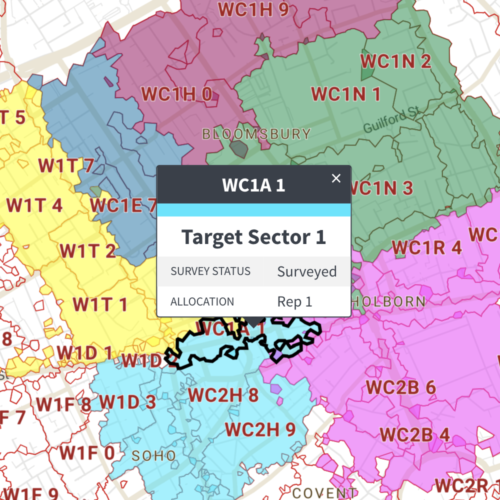
SPREADSHEETS TO POLYGONS
Available for:
Postcode Districts
Postcode Sectors
Ceremonial Counties
Counties and Unitary Authorities
Local Authorities from Apr 23
Local Authorities before Apr 23
See example
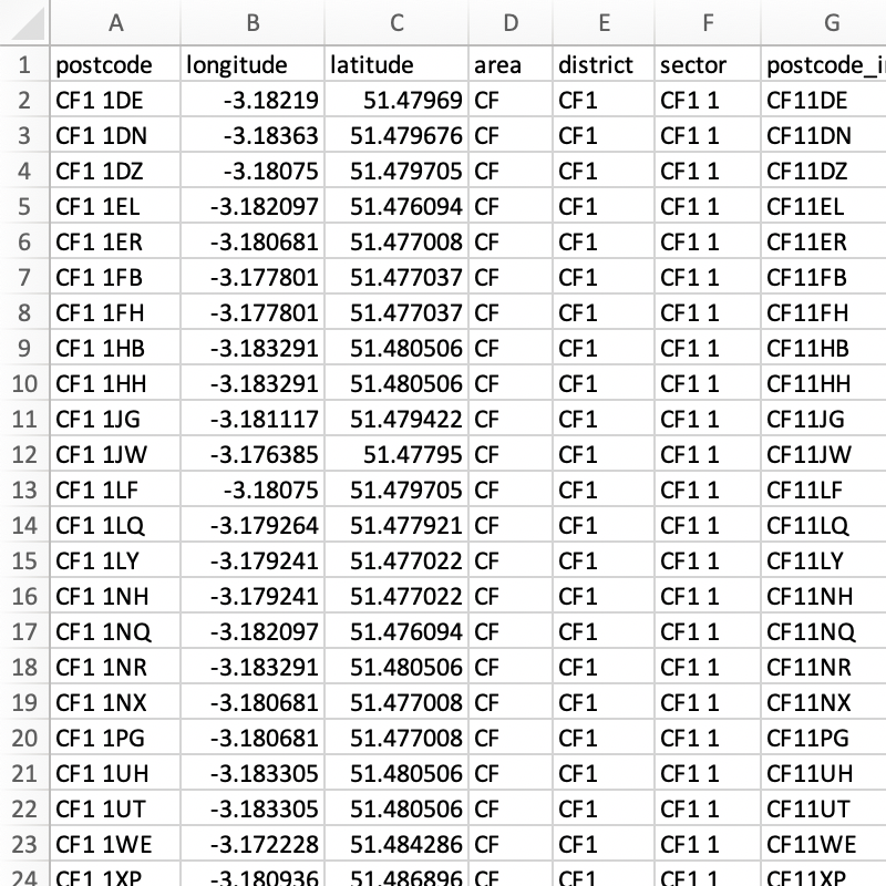
POSTCODES GEOCODER
Get postcode coordinates and grouping attributes, and check batches for errors