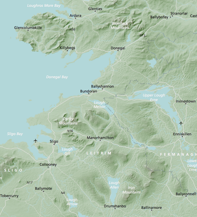
Britain and Ireland physical map with hillshading / relief layer (high-resolution)
Downloadable royalty free vector artwork High-resolution PDFsSVGLayered Adobe Illustrator filePrice £60.00

This bundle contains a detailed map of Britain and Ireland with a hillshading / relief layer giving a beautiful sculpted backdrop for the landmass. Every part of the map is editable and suitable for high-resolution professional printing up to A0 poster size.
The bundle of files includes the following:
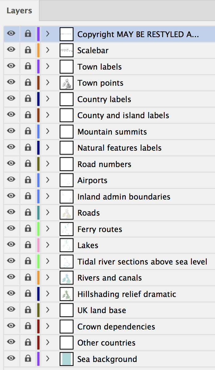
- Vector artwork (Illustrator master file) for the roads, sea, lakes, rivers and over 2,000 placenames. The linked hillshading / relief layers are perfectly positioned within the vector artwork.
- Raster artwork for the hillshading / relief backdrop in three versions – soft, dramatic and monochrome silver. Each version is supplied as a separate Photoshop file linked to the Illustrator master file, and also embedded in the PDF versions.
- Layered and flattened PDFs. The layered PDFs can be opened in Illustrator with all layers intact. The flattened (unlayered) PDFs are smaller in file size and ready for high-resolution printing.
- Large PNGs and medium-size JPEGs
- Our older touring / physical map of Britain and Ireland (worth £29.99) is also included in this bundle. The older map is much lower in resolution, and with fewer placenames, and thus suitable for small-scale printing or web use but without the poster size capabilities of the detailed base.


Details about the Britain and Ireland hillshading / relief raster artwork layer

We have constructed the hillshading / relief artwork layer using specialist software and techniques to stitch together elevation data from 110 files sourced from NASA’s Shuttle Radar Topography Mission. The artwork is rasterised, which means it is composed of pixels like a digital photograph. It can be opened and edited in Photoshop, and separate Photoshop files are provided for each version. There are also full-size PNGs and medium-resolution JPEGs of the hillshading / relief versions.
For professional designers interested in the print scaling possibilities of this layer: at 100% resolution and 300dpi, the hillshading / relief artwork of the whole British Isles, from Shetland in the north to the Channel Islands in the south, and the west coast of Ireland in the west to the edge of France in the east, is 8,479 pixels x 11,786 pixels. This equates to the whole image being approximately A0 size (841 mm x 1,189 mm) if printed at 300dpi.
As a further indication of scale if using only part of the artwork – Wales, for example, is approximately A4 size when output at 300dpi. If using portions for screens, you will be able to zoom in quite a bit deeper without noticeable loss of resolution. In our opinion the pixellation of the hillshading / relief layer starts to become noticeable from about 300% zoom.

The rest of the artwork is vector, so not limited by pixel resolution. Placenames, roads and other vector elements will be sharp at any size you scale them to. The sea background is transparent, so you can overlay the land relief over any background or colour of your choice. You can also drop the raster hillshading / relief layer for unlimited possibilities with flat colours and ways to use this versatile map base of Britain and Ireland in any way you choose for different projects on royalty-free terms.

In its opening state, the Illustrator master file has been scaled to A0 size to contain the raster hillshading / relief layers at 100%, and with town names legible at 4pt font size. If you want to output the full map smaller than A0 then you will need to increase the font size and/or suppress placename layers for legibility. You can of course zoom into smaller parts of the map or tile it and add extra labels.
If you edit the linked Photoshop relief files, they should automatically update in the Illustrator master file too without needing to reimport. The silver version is perfect for adding a colour mask for easy colour change. See the tutorial: How to change the colour of a hillshading / relief layer in Photoshop.

Please note, the high-resolution files, being large and aimed primarily at professional graphic designers, are best edited on a reasonably powerful desktop computer. As typical of high-res image files, they may take a while to load and look blurry or blank until fully loaded.
Download sample strips from the live files here
Upgrade from low-resolution physical maps at a discount
Please contact us if you purchased one of our older physical maps and want to upgrade to this higher resolution version. We can provide a discount coupon code to the value of the map you purchased previously.
Specifications
Price £60.00
Product code: MR152
Licensing terms
This editable map base is suitable for commercial and professional uses
See standard royalty free terms for downloadable maps
How to edit
Adobe Illustrator, CorelDRAW, PDF editors etc
See how to edit the downloadable maps
Recommended scaling
Approx A0 paper size at 100%
For more guidance see scaling recommendations
Vector map layers in Illustrator

