Maps of London
Showing all 56 results
-
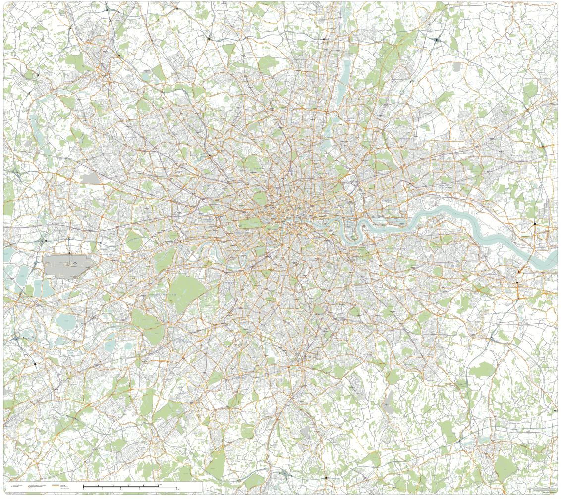
Greater London detailed map with all roads, transport, institutions, green areas
£150.00Detailed vector map of the whole of Greater London – all roads, stations, airports, rivers, green areas. A fantastic resource for professional designers and commercial projects. Provided in 2 versions for different scaling needs.
PDFsSVGLayered AI file -

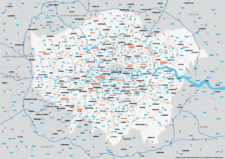
Supersize map of Greater London postcode districts with full road network
£75.00Editable postcodes artwork scaled at 4.3 x 3.8 metres in its opening state. The full road network of Greater London is the backdrop, with major road names legible at large-scale printing.
PDFsLayered AI file -

Interactive map of London Low and Ultra-low Emission Zones (LEZ / ULEZ), Congestion Charge Zone (CCZ), with all postcodes
£45.00London’s Low Emission Zone and Driver Vision Standard (LEZ / DVS), Ultra-low Emission Zone (ULEZ), and Congestion Charge Zone (CCZ) juxtaposed with postcodes and local authority / London borough boundaries – this interactive online map is aimed primarily at businesses needing help to plan deliveries, driving routes and sales territories through and around London.
-
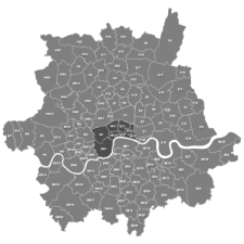
Map of Greater London postcode districts plus boroughs and major roads
£15.00All the postcode districts in Greater London, shown in context with the London boroughs, post towns, major roads and surrounding counties. Scaled for A3 and above.
PDFsSVGLayered AI file -
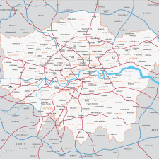
Map of Greater London districts and boroughs
£30.00Our editable vector map of Greater London has all the London boroughs and main towns, districts and suburbs within the M25.
PDFsSVGLayered AI file -
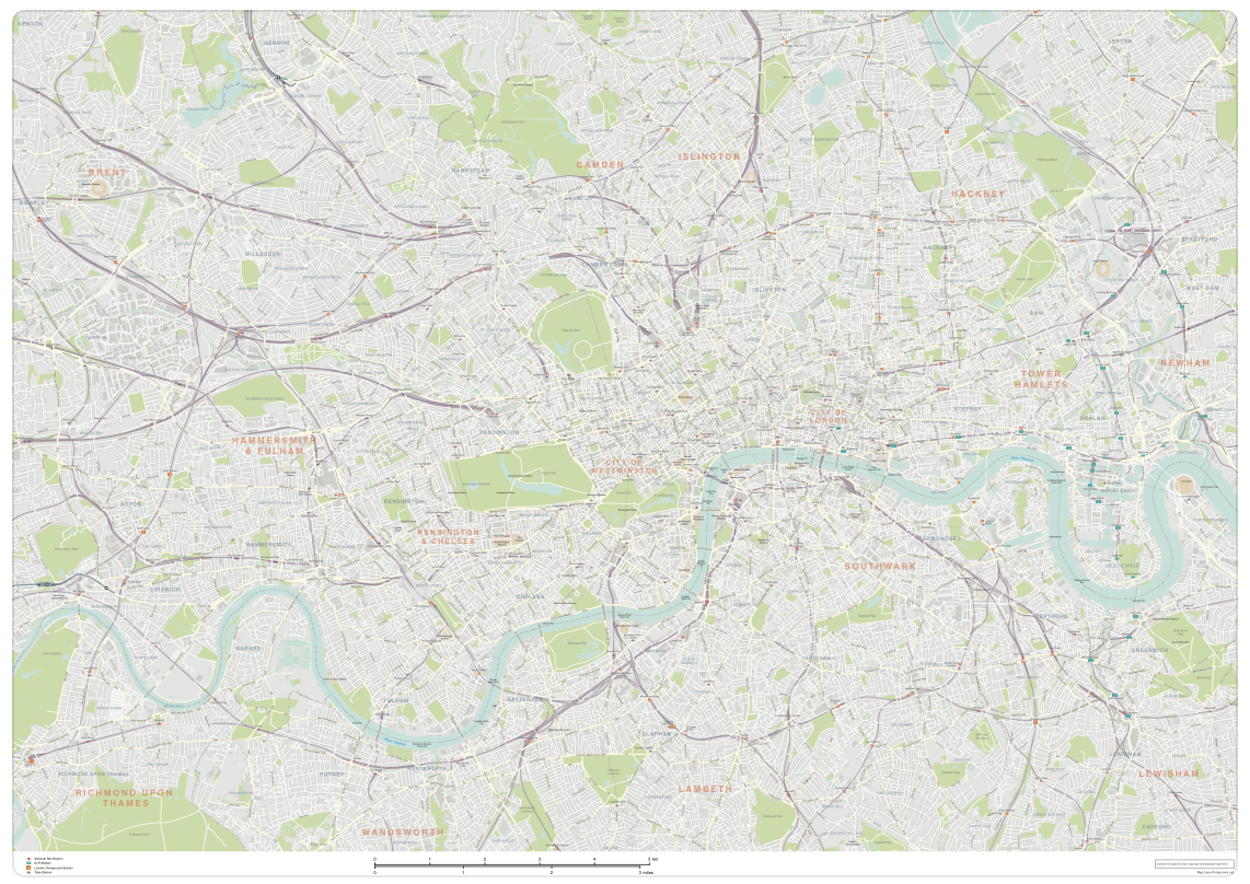
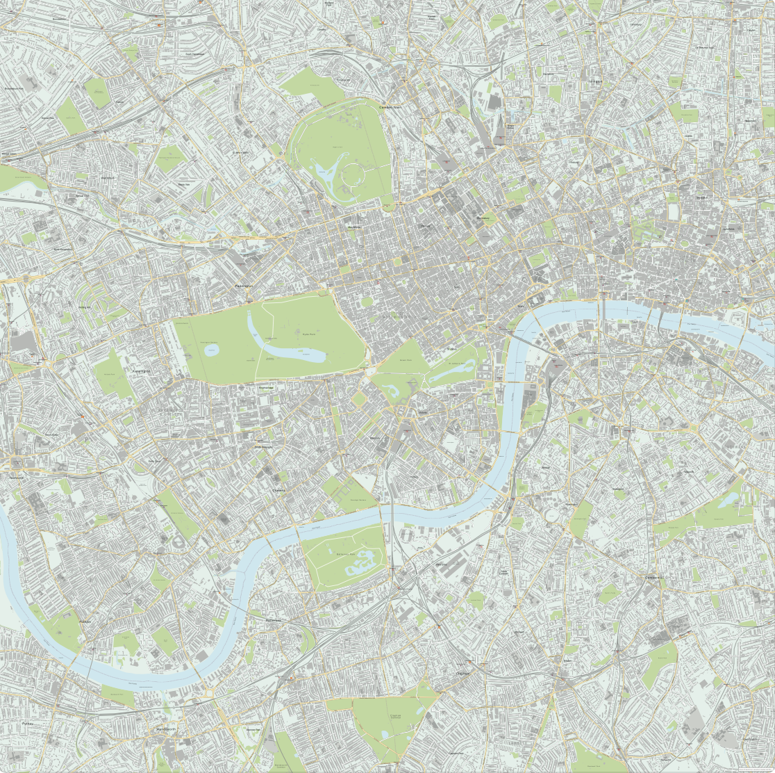
London map with roads, buildings, districts, boroughs, transport, landmarks
£100.00A superb general purpose editable map of London, with a wealth of detail including buildings, roads, railway lines, train stations, borough boundaries, rivers, canals, parks and landmarks
PDFsLayered AI file -
Central London detailed street map
£75.00Our most detailed map of central London, including buildings and street names across a large area
PDFsSVGLayered AI file -
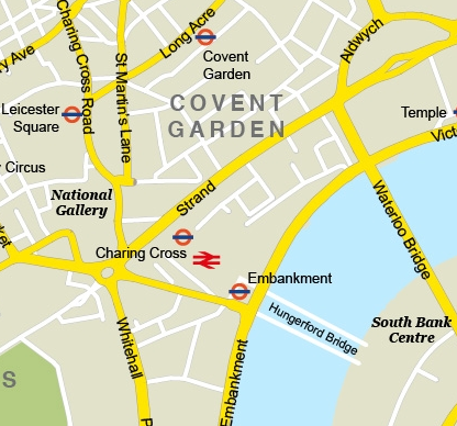
Central London – simple map with major features
£35.00Major roads, landmarks, Tube stations etc of central London
PDFsSVGLayered AI file -
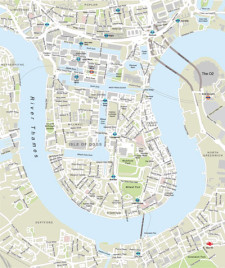
London Docklands with Canary Wharf map
£35.00Focus on the business area of Canary Wharf and Docklands, with a locator map showing the district’s geographicl relationship with the rest of London
PDFsSVGLayered AI file -

Map of London boroughs
£25.00All the London boroughs with options for showing the Thames.
PDFsSVGLayered AI file -
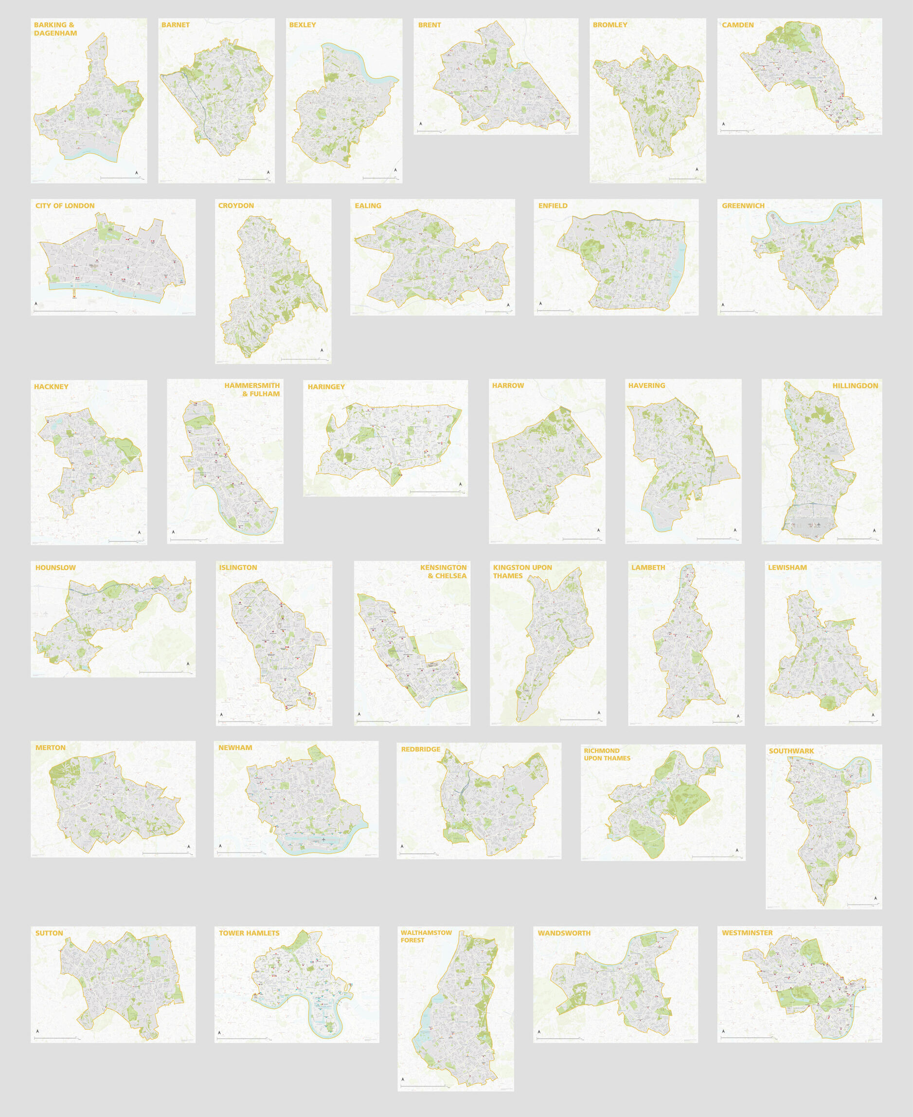
London Borough Maps: FULL SET of 34 maps
£300.00PDFsSVGLayered AI file -
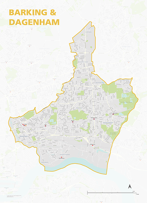
Barking & Dagenham – London borough map
£40.00Map of the London Borough of Barking and Dagenham, detailing the road and public transport network, as well as parks and other open areas. Designed for A1+ printing or editing for other uses.
PDFSVGLayered AI file -
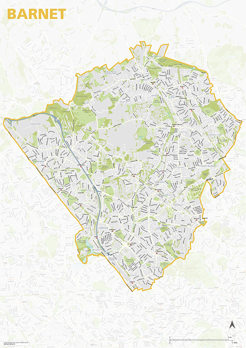
Barnet – London borough map
£40.00Map of the London Borough of Barnet, detailing the road and public transport network, as well as parks and other open areas. Designed for A1+ printing or editing for other uses.
PDFSVGLayered AI file -
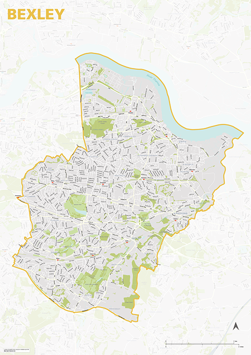
Bexley – London borough map
£40.00Map of the London Borough of Bexley, detailing the road and public transport network, as well as parks and other open areas. Designed for A1+ printing or editing for other uses.
PDFSVGLayered AI file -
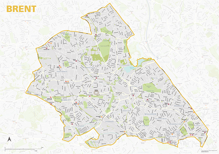
Brent – London borough map
£40.00Map of the London Borough of Brent, detailing the road and public transport network, as well as parks and other open areas. Designed for A1+ printing or editing for other uses.
PDFSVGLayered AI file -
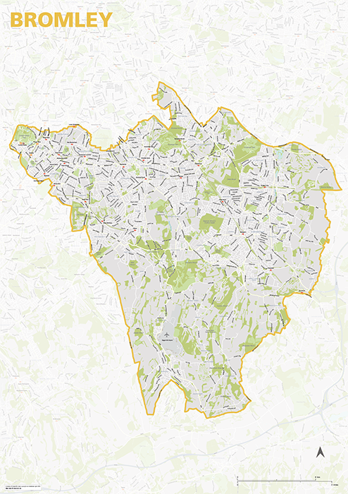
Bromley – London borough map
£40.00Map of the London Borough of Brent, detailing the road and public transport network, as well as parks and other open areas. Designed for A1+ printing or editing for other uses.
PDFSVGLayered AI file -

Camden – London borough map
£40.00Map of the London Borough of Camden, detailing the road and public transport network, as well as parks and other open areas. Designed for A1+ printing or editing for other uses.
PDFSVGLayered AI file -
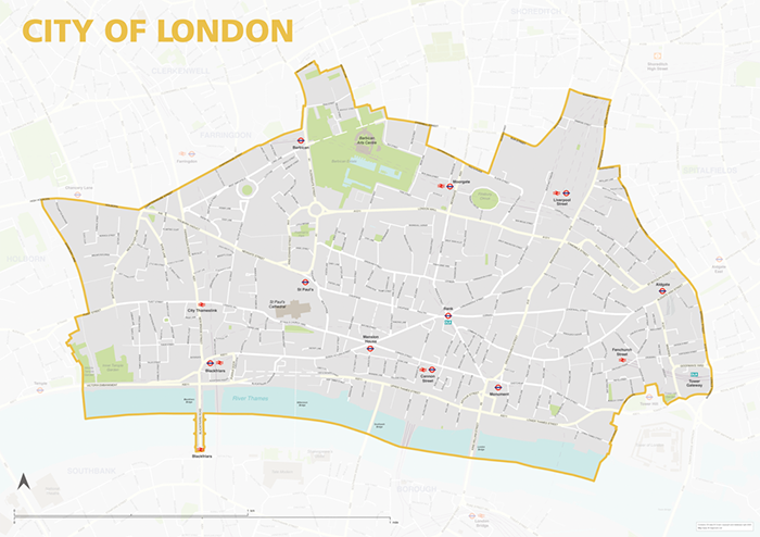
City of London – borough style map
£40.00Map of the City of London, detailing the road and public transport network, as well as park squares and other open areas. Designed for A1+ printing or editing for other uses.
PDFSVGLayered AI file -
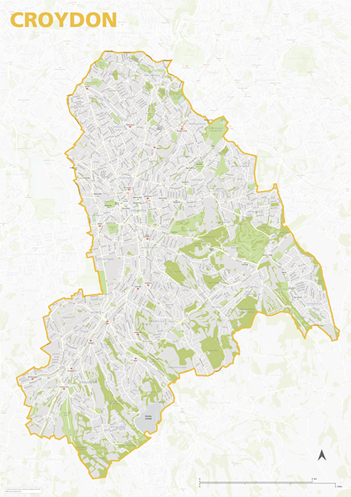
Croydon – London borough map
£40.00Map of the London Borough of Croydon, detailing the road and public transport network, as well as parks and other open areas. Designed for A1+ printing or editing for other uses.
PDFSVGLayered AI file -
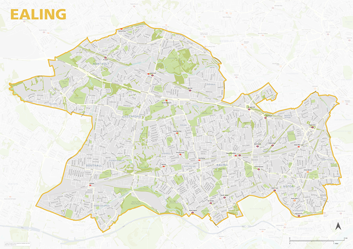
Ealing – London borough map
£40.00Map of the London Borough of Ealing, detailing the road and public transport network, as well as parks and other open areas. Designed for A1+ printing or editing for other uses.
PDFSVGLayered AI file -
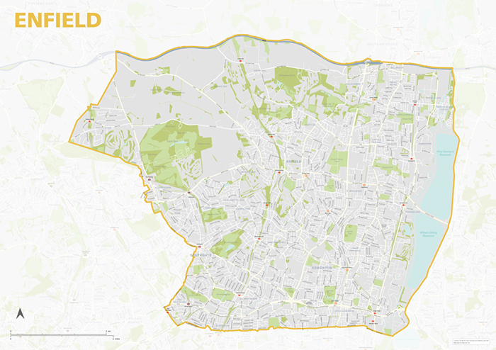
Enfield – London borough map
£40.00Map of the London Borough of Enfield, detailing the road and public transport network, as well as parks and other open areas. Designed for A1+ printing or editing for other uses.
PDFSVGLayered AI file -
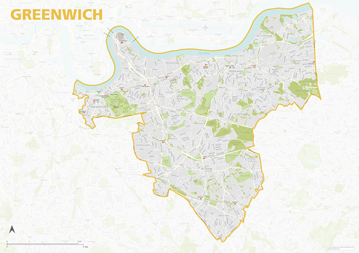
Greenwich – London borough map
£40.00Map of the London Borough of Greenwich, detailing the road and public transport network, as well as parks and other open areas. Designed for A1+ printing or editing for other uses.
PDFSVGLayered AI file -
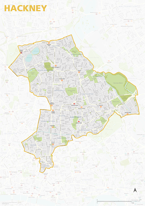
Hackney – London borough map
£40.00Map of the London Borough of Hackney, detailing the road and public transport network, as well as parks and other open areas. Designed for A1+ printing or editing for other uses.
PDFSVGLayered AI file -
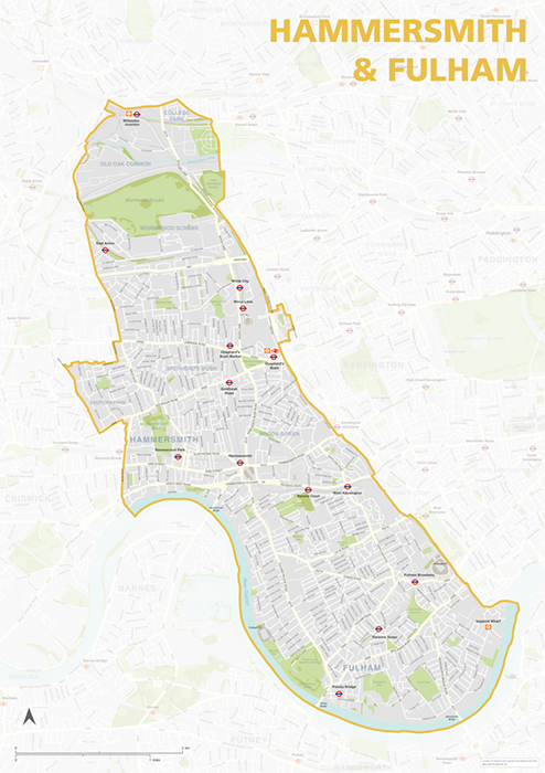
Hammersmith & Fulham – London borough map
£40.00Map of the London Borough of Hammersmith & Fulham, detailing the road and public transport network, as well as parks and other open areas. Designed for A1+ printing or editing for other uses.
PDFSVGLayered AI file -
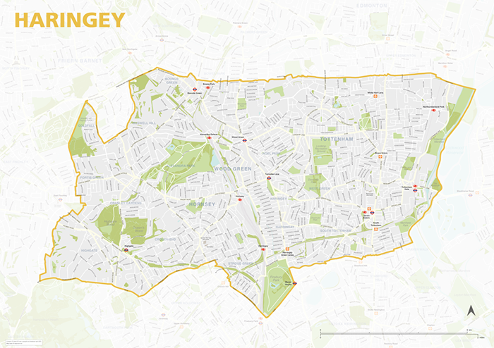
Haringey – London borough map
£40.00Map of the London Borough of Haringey, detailing the road and public transport network, as well as parks and other open areas. Designed for A1+ printing or editing for other uses.
PDFSVGLayered AI file -
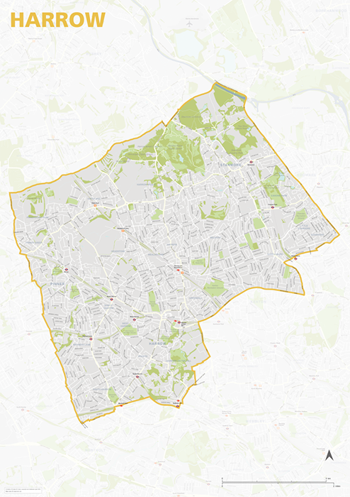
Harrow – London borough map
£40.00Map of the London Borough of Harrow, detailing the road and public transport network, as well as parks and other open areas. Designed for A1+ printing or editing for other uses.
PDFSVGLayered AI file -
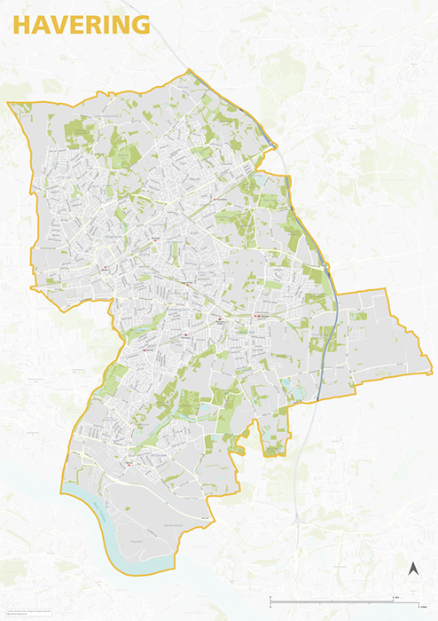
Havering – London borough map
£40.00Map of the London Borough of Havering, detailing the road and public transport network, as well as parks and other open areas. Designed for A1+ printing or editing for other uses.
PDFSVGLayered AI file -
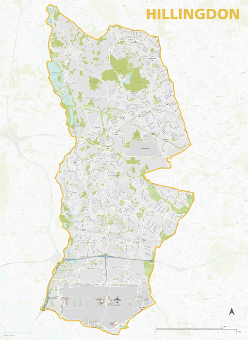
Hillingdon – London borough map
£40.00Map of the London Borough of Hillingdon, detailing the road and public transport network, as well as parks and other open areas. Designed for A1+ printing or editing for other uses.
PDFSVGLayered AI file -
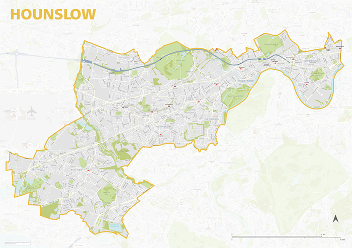
Hounslow – London borough map
£40.00Map of the London Borough of Hounslow, detailing the road and public transport network, as well as parks and other open areas. Designed for A1+ printing or editing for other uses.
PDFSVGLayered AI file -
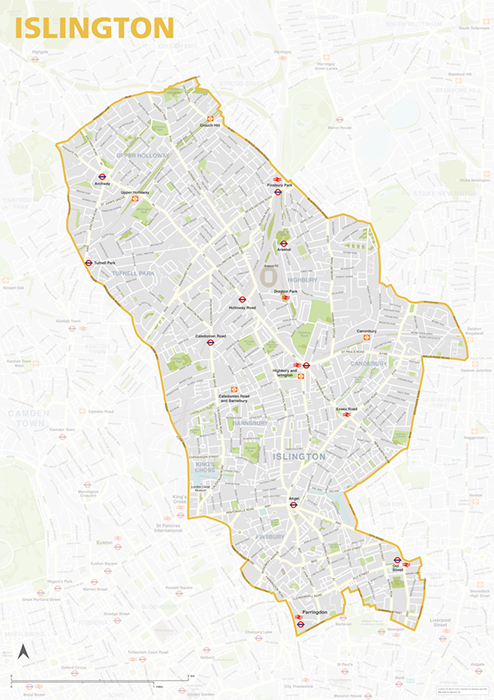
Islington – London borough map
£40.00Map of the London Borough of Islington, detailing the road and public transport network, as well as parks and other open areas. Designed for A1+ printing or editing for other uses.
PDFSVGLayered AI file -
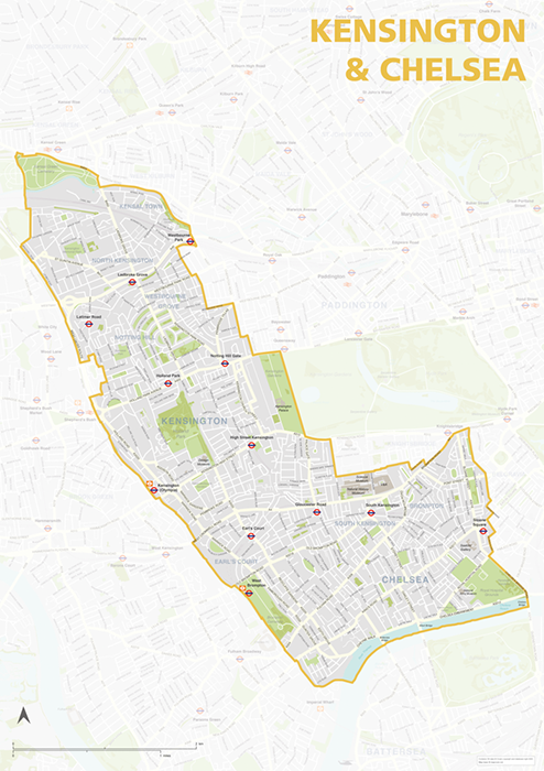
Kensington & Chelsea – London borough map
£40.00Map of the London Borough of Kensington & Chelsea, detailing the road and public transport network, as well as parks and other open areas. Designed for A1+ printing or editing for other uses.
PDFSVGLayered AI file -
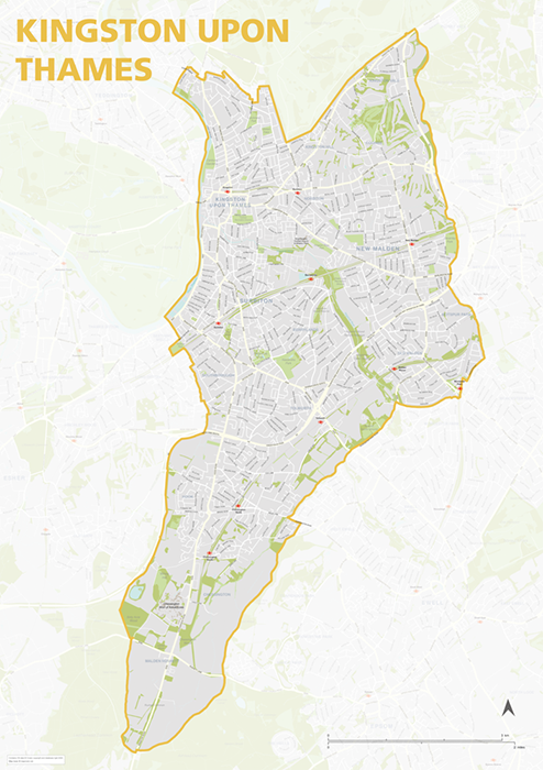
Kingston upon Thames – London borough map
£40.00Map of the London Borough of Kingston upon Thames, detailing the road and public transport network, as well as parks and other open areas. Designed for A1+ printing or editing for other uses.
PDFSVGLayered AI file -
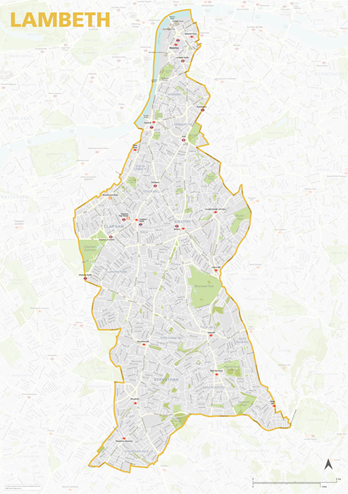
Lambeth – London borough map
£40.00Map of the London Borough of Lambeth, detailing the road and public transport network, as well as parks and other open areas. Designed for A1+ printing or editing for other uses.
PDFSVGLayered AI file -
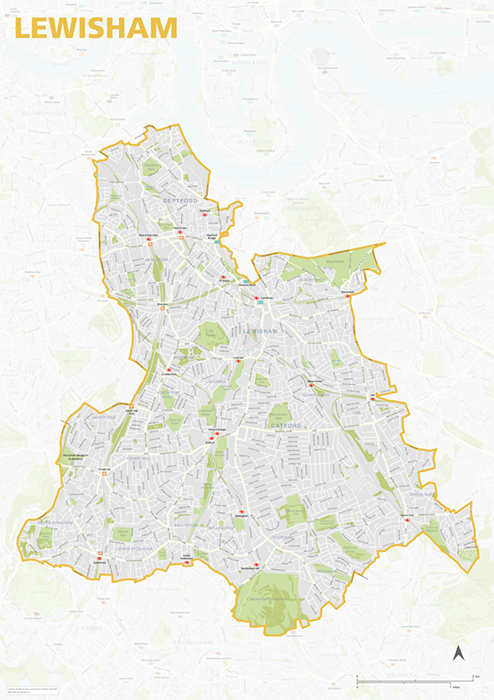
Lewisham – London borough map
£40.00Map of the London Borough of Lewisham, detailing the road and public transport network, as well as parks and other open areas. Designed for A1+ printing or editing for other uses.
PDFSVGLayered AI file -
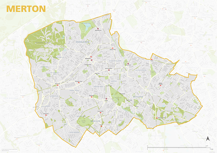
Merton – London borough map
£40.00Map of the London Borough of Merton, detailing the road and public transport network, as well as parks and other open areas. Designed for A1+ printing or editing for other uses.
PDFSVGLayered AI file -
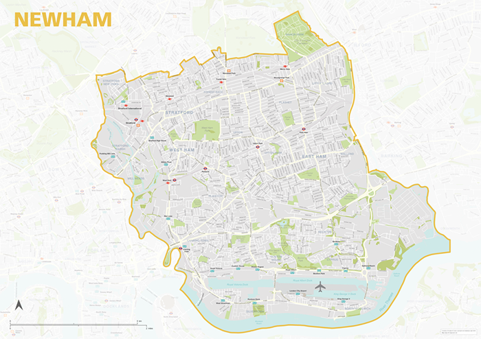
Newham – London borough map
£40.00Map of the London Borough of Newham, detailing the road and public transport network, as well as parks and other open areas. Designed for A1+ printing or editing for other uses.
PDFSVGLayered AI file -
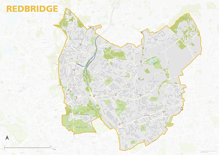
Redbridge – London borough map
£40.00Map of the London Borough of Redbridge, detailing the road and public transport network, as well as parks and other open areas. Designed for A1+ printing or editing for other uses.
PDFSVGLayered AI file -
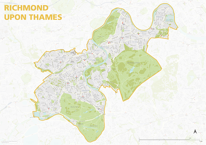
Richmond upon Thames – London borough map
£40.00Map of the London Borough of Richmond upon Thames, detailing the road and public transport network, as well as parks and other open areas. Designed for A1+ printing or editing for other uses.
PDFSVGLayered AI file -
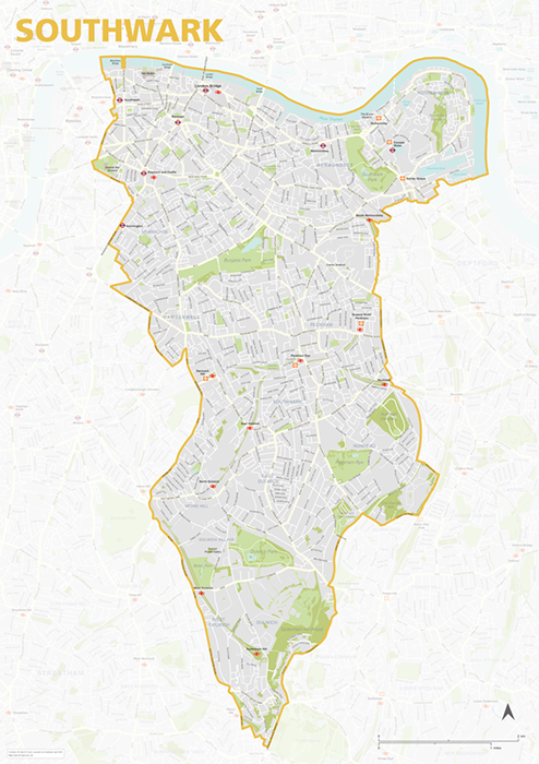
Southwark – London borough map
£40.00Map of the London Borough of Southwark, detailing the road and public transport network, as well as parks and other open areas. Designed for A1+ printing or editing for other uses.
PDFSVGLayered AI file -
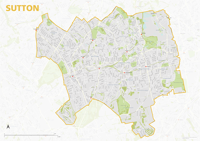
Sutton – London borough map
£40.00Map of the London Borough of Sutton, detailing the road and public transport network, as well as parks and other open areas. Designed for A1+ printing or editing for other uses.
PDFSVGLayered AI file -
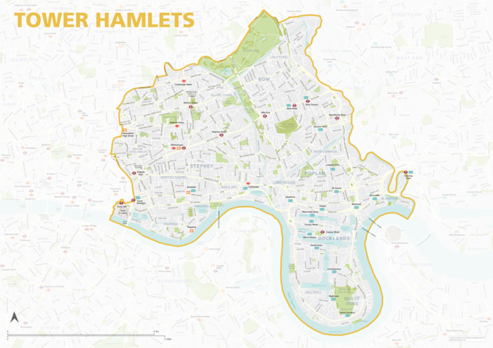
Tower Hamlets – London borough map
£40.00Map of the London Borough of Tower Hamlets, detailing the road and public transport network, as well as parks and other open areas. Designed for A1+ printing or editing for other uses.
PDFSVGLayered AI file -
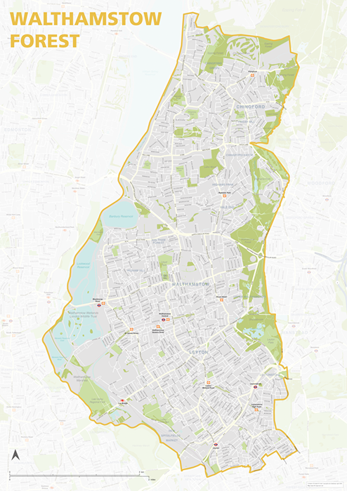
Waltham Forest – London borough map
£40.00Map of the London Borough of Tower Hamlets, detailing the road and public transport network, as well as parks and other open areas. Designed for A1+ printing or editing for other uses.
PDFSVGLayered AI file -
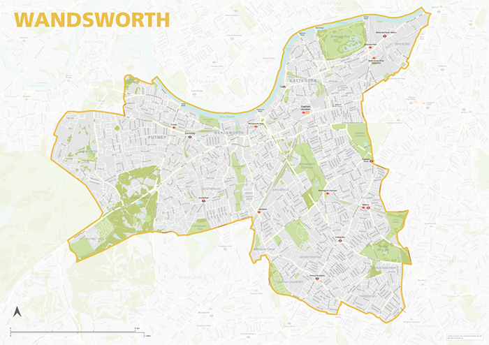
Wandsworth – London borough map
£40.00Map of the London Borough of Wandsworth, detailing the road and public transport network, as well as parks and other open areas. Designed for A1+ printing or editing for other uses.
PDFSVGLayered AI file -
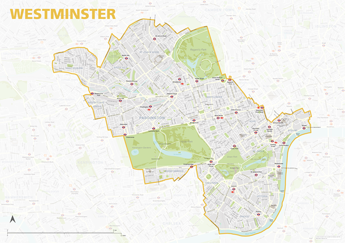
Westminster – London borough map
£40.00Map of the London Borough of Westminster, detailing the road and public transport network, as well as parks and other open areas. Designed for A1+ printing or editing for other uses.
PDFSVGLayered AI file -

Best maps of central London postcode districts – W1, WC, EC – including street names
£25.00See the road names and other street level details of London’s densely packed W1, WC and EC postcode districts overlaid with clear labels, district boundaries and underlying polygons for colour editing.
PDFSVGLayered AI file -
Map of London postcodes – interlocking shapes
£15.00All the London postcode areas including the central sub-districts are included with accurate, interlocking vector shapes.
PDFsSVGLayered AI file -
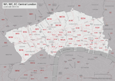
Map of central London postcode districts – W1, WC, EC
£20.00Central London postcode districts – W1, WC, EC – scaled for A4+ printing
PDF -
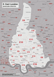
Map of E postcode districts – East London
£15.00The E – East London postcode districts scaled for A4+ printing
PDF -
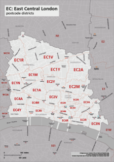
Map of EC postcode districts – East Central London
£15.00The EC – East Central London postcode districts scaled for A4+ printing
PDF -
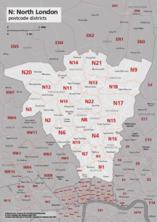
Map of N postcode districts – North London
£15.00The N – North London postcode districts scaled for A4+ printing
PDF -
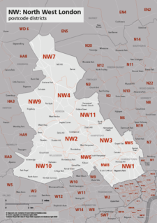
Map of NW postcode districts – North West London
£15.00The NW – North West London postcode districts scaled for A4+ printing
PDF -
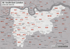
Map of SE postcode districts – South East London
£15.00The SE – South East London postcode districts scaled for A4+ printing
PDF -
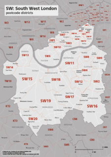
Map of SW postcode districts – South West London
£15.00The SW – South West London postcode districts scaled for A4+ printing
PDF -
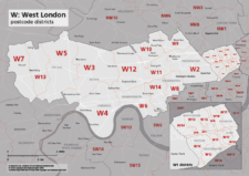
Map of W postcode districts – West London
£15.00The W – West London postcode districts scaled for A4+ printing
PDF -
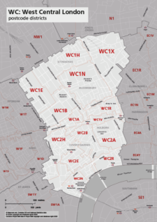
Map of WC postcode districts – West Central London
£15.00The WC – West Central London postcode districts scaled for A4+ printing
PDF -
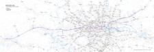
Elizabeth Line map with rail and road networks
£75.00Editable map of the entire length of the Elizabeth Line from Reading in the west to Shenfield in Essex to the east, with southern branch lines to Heathrow and Abbey Wood. The entire Ordnance Survey road network, other railways and Tube, DLR and tram lines are also included on the map for geographical context.
PDFsSVGLayered AI file