Maproom’s dynamic and interactive online postcode maps cover every geographical postcode in the UK. You can zoom deep into these maps to see postcode districts, sectors and unit centroids with the full context of roads, buildings and other geographical features. Search UK addresses and visually see postcode density in relation to local authorities, constituencies, health and police areas, and much more. These maps are invaluable for working out sales territories, marketing and mail drops, freight, fulfilment and delivery zones.
The dynamic postcode maps and online mapping tools are available in our Dynamic Mapping Suite.
Deep-zoom, searchable postcode reference maps with statistics data
We have a unique library of online postcode maps with deep zoom and search capabilities, and juxtaposition with other UK administrative boundaries. See sample data
Quick Select interface for postcode colouring and labelling
Use our Quick Select system to create your own postcode visualisations for planning and marketing. See more info

Bulk postcodes plotting
Plot all your customer postcodes in seconds simply by pasting in your list. See live demo

Postcodes within a radius
See which postcodes fall within a specified radius of your locations. How to plot a radius really easily
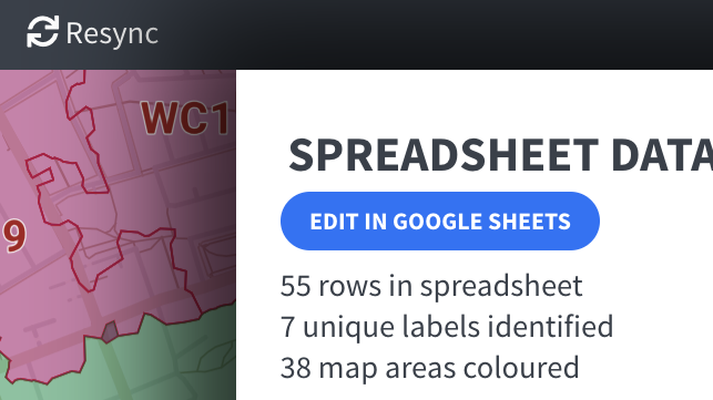
Automated postcodes mapping from spreadsheets
Available for district and sector polygon maps – connect your spreadsheet and experience the pleasure of having your data organised, coloured and feeding to thousands of live polygons. See mapping with spreadsheets
Postcodes in Clean Air and Low Emission Zones, ULEZ etc
Calculate service charge areas and delivery routes. Learn more