Choropleth maps are interlocking boundary shapes that are coloured to show a visualisation of statistics (“heat” density) or other thematic patterns. Our choropleth system is focused on UK administrative boundary map bases into which clients can feed in related data. You can rapidly apply auto-colouring based on numeric or text category values You can import […]
Search Results for: feed
Edit your popups
As you build up your postcode selections and key colours with labels, this data automatically feeds to popups in the Live View. You can add to this popup content. Click Edit Popups on the top bar of the edit screen. This will open a window showing your existing key items in a table. The population […]
Display options
Points display style You can choose between point markers or circles to display on your map (a global setting). The default is markers. However, for datasets with over 500 points, the map will automatically switch to circles for faster loading and better performance. If you select circles, you also have an option for clustering them, […]
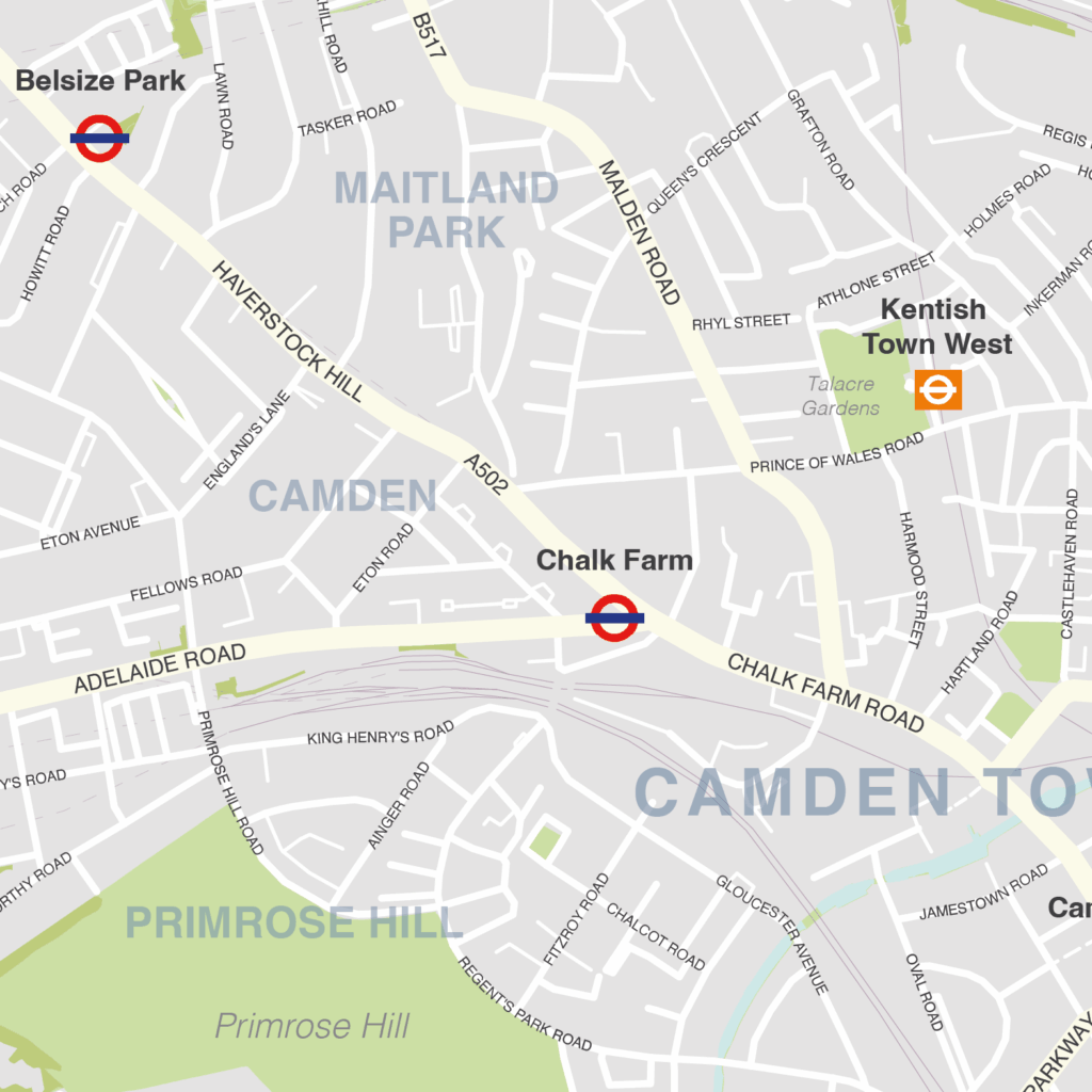
Camden – London borough map
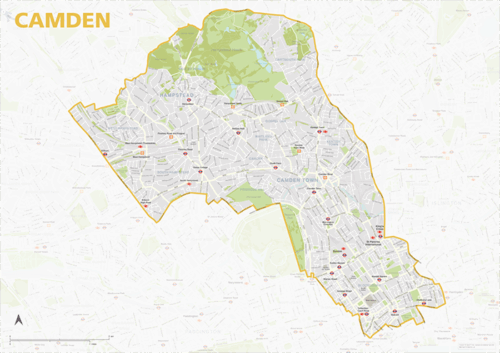
The Camden Borough map focuses on this local authority district in London. It is one of 33 local authority districts in London that make up the full administrative area of Greater London. Our maps of these boroughs can be purchased individually or as an entire set of 33 maps.
The Camden map includes the full road network, the railway lines, and all underground and overground stations. All primary, secondary and minor roads are labelled, as well as the majority of local roads. Prominent open areas, such as parks and woodlands and nature reserves are also shown and labelled, as are significant waterways. The road network, stations and labelling in the neighbouring boroughs is included, but knocked back behind a semi opaque layer to more clearly focus on just Camden. Like any other layer, this can be altered or removed entirely when using the editable versions of the map (see below).
The map is offered in a print-ready format (A1 or larger is recommended), if you are looking for a high-quality print of Camden, and a layered vector file format, suitable for a wide variety of uses in graphic design, marketing, planning and other applications where a bespoke map is required.
The product bundle includes a print-ready high-resolution PDF scaled for A1+ format printing, with the smallest labels legible when printed at A1 or bigger.
Also in the bundle are Adobe Illustrator, SVG and layered PDF file formats suitable for editing in standard vector art software such as Illustrator (see how to edit).
Furthermore, this great value bundle comes with a Limited Free Pass for Maproom’s Dynamic Mapping Suite, which contains online maps and mapping tools. This is a separate system in which you can plot your own locations of interest and feed data dynamically to the Borough of Camden, plus other boroughs, local government and postcode boundary maps.
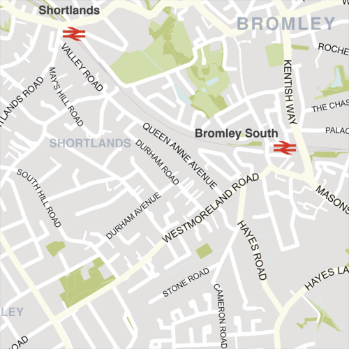
Bromley – London borough map
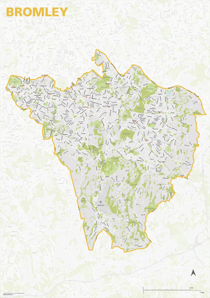
The Bromley Borough map focuses on this local authority district in London. It is one of 33 local authority districts in London that make up the full administrative area of Greater London. Our maps of these boroughs can be purchased individually or as an entire set of 33 maps.
The Bromley map includes the full road network, the railway lines, and all underground and overground stations. All primary, secondary and minor roads are labelled, as well as the majority of local roads. Prominent open areas, such as parks and woodlands and nature reserves are also shown and labelled, as are significant waterways. The road network, stations and labelling in the neighbouring boroughs is included, but knocked back behind a semi opaque layer to more clearly focus on just Bromley. Like any other layer, this can be altered or removed entirely when using the editable versions of the map (see below).
The map is offered in a print-ready format (A1 or larger is recommended), if you are looking for a high-quality print of Bromley, and a layered vector file format, suitable for a wide variety of uses in graphic design, marketing, planning and other applications where a bespoke map is required.
The product bundle includes a print-ready high-resolution PDF scaled for A1+ format printing, with the smallest labels legible when printed at A1 or bigger.
Also in the bundle are Adobe Illustrator, SVG and layered PDF file formats suitable for editing in standard vector art software such as Illustrator (see how to edit).
Furthermore, this great value bundle comes with a Limited Free Pass for Maproom’s Dynamic Mapping Suite, which contains online maps and mapping tools. This is a separate system in which you can plot your own locations of interest and feed data dynamically to the Borough of Bromley, plus other boroughs, local government and postcode boundary maps.
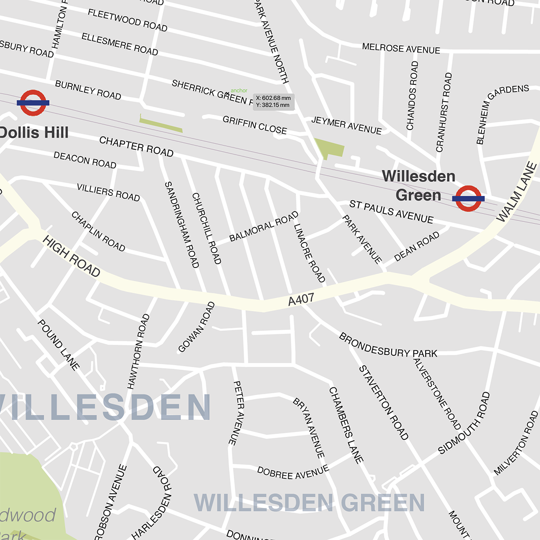
Brent – London borough map

The Brent Borough map focuses on this local authority district in London. It is one of 33 local authority districts in London that make up the full administrative area of Greater London. Our maps of these boroughs can be purchased individually or as an entire set of 33 maps.
The Brent map includes the full road network, the railway lines, and all underground and overground stations. All primary, secondary and minor roads are labelled, as well as the majority of local roads. Prominent open areas, such as parks and woodlands and nature reserves are also shown and labelled, as are significant waterways. The road network, stations and labelling in the neighbouring boroughs is included, but knocked back behind a semi opaque layer to more clearly focus on just Brent. Like any other layer, this can be altered or removed entirely when using the editable versions of the map (see below).
The map is offered in a print-ready format (A1 or larger is recommended), if you are looking for a high-quality print of Brent, and a layered vector file format, suitable for a wide variety of uses in graphic design, marketing, planning and other applications where a bespoke map is required.
The product bundle includes a print-ready high-resolution PDF scaled for A1+ format printing, with the smallest labels legible when printed at A1 or bigger.
Also in the bundle are Adobe Illustrator, SVG and layered PDF file formats suitable for editing in standard vector art software such as Illustrator (see how to edit).
Furthermore, this great value bundle comes with a Limited Free Pass for Maproom’s Dynamic Mapping Suite, which contains online maps and mapping tools. This is a separate system in which you can plot your own locations of interest and feed data dynamically to the Borough of Brent, plus other boroughs, local government and postcode boundary maps.
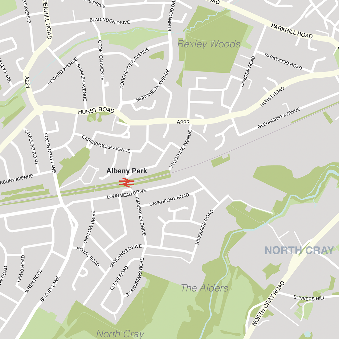
Bexley – London borough map
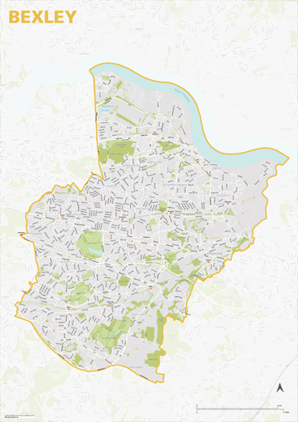
The Bexley Borough map focuses on this local authority district in London. It is one of 33 local authority districts in London that make up the full administrative area of Greater London. Our maps of these boroughs can be purchased individually or as an entire set of 33 maps.
The Bexley map includes the full road network, the railway lines, and all underground and overground stations. All primary, secondary and minor roads are labelled, as well as the majority of local roads. Prominent open areas, such as parks and woodlands and nature reserves are also shown and labelled, as are significant waterways. The road network, stations and labelling in the neighbouring boroughs is included, but knocked back behind a semi opaque layer to more clearly focus on just Bexley. Like any other layer, this can be altered or removed entirely when using the editable versions of the map (see below).
The map is offered in a print-ready format (A1 or larger is recommended), if you are looking for a high-quality print of Bexley, and a layered vector file format, suitable for a wide variety of uses in graphic design, marketing, planning and other applications where a bespoke map is required.
The product bundle includes a print-ready high-resolution PDF scaled for A1+ format printing, with the smallest labels legible when printed at A1 or bigger.
Also in the bundle are Adobe Illustrator, SVG and layered PDF file formats suitable for editing in standard vector art software such as Illustrator (see how to edit).
Furthermore, this great value bundle comes with a Limited Free Pass for Maproom’s Dynamic Mapping Suite, which contains online maps and mapping tools. This is a separate system in which you can plot your own locations of interest and feed data dynamically to the Borough of Bexley, plus other boroughs, local government and postcode boundary maps.
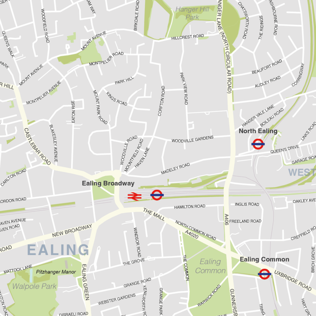
Ealing – London borough map
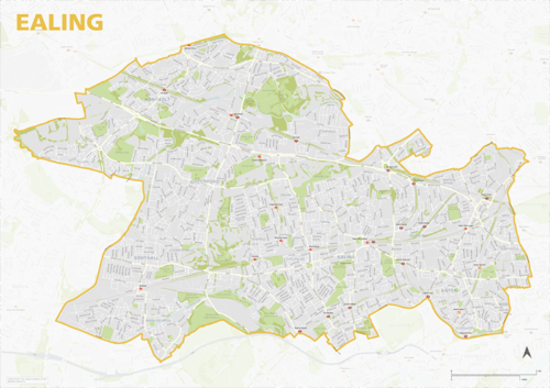
The Ealing Borough map focuses on this local authority district in London. It is one of 33 local authority districts in London that make up the full administrative area of Greater London. Our maps of these boroughs can be purchased individually or as an entire set of 33 maps.
The Ealing map includes the full road network, the railway lines, and all underground and overground stations. All primary, secondary and minor roads are labelled, as well as the majority of local roads. Prominent open areas, such as parks and woodlands and nature reserves are also shown and labelled, as are significant waterways. The road network, stations and labelling in the neighbouring boroughs is included, but knocked back behind a semi opaque layer to more clearly focus on just Ealing. Like any other layer, this can be altered or removed entirely when using the editable versions of the map (see below).
The map is offered in a print-ready format (A1 or larger is recommended), if you are looking for a high-quality print of Ealing, and a layered vector file format, suitable for a wide variety of uses in graphic design, marketing, planning and other applications where a bespoke map is required.
The product bundle includes a print-ready high-resolution PDF scaled for A1+ format printing, with the smallest labels legible when printed at A1 or bigger.
Also in the bundle are Adobe Illustrator, SVG and layered PDF file formats suitable for editing in standard vector art software such as Illustrator (see how to edit).
Furthermore, this great value bundle comes with a Limited Free Pass for Maproom’s Dynamic Mapping Suite, which contains online maps and mapping tools. This is a separate system in which you can plot your own locations of interest and feed data dynamically to the Borough of Ealing, plus other boroughs, local government and postcode boundary maps.
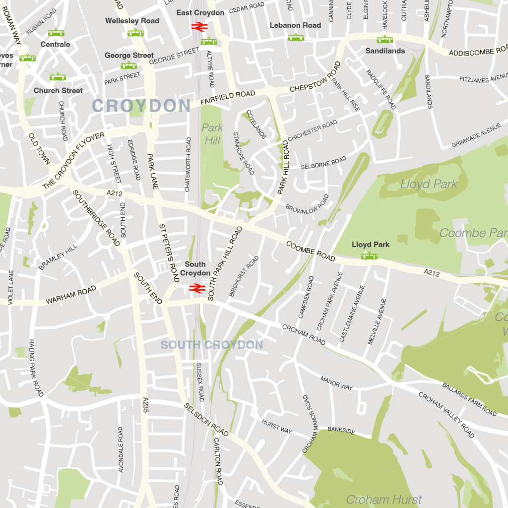
Croydon – London borough map
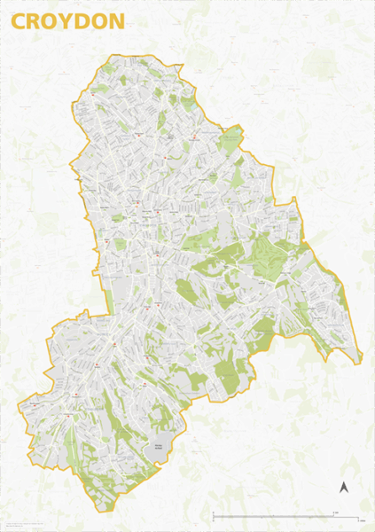
The Croydon Borough map focuses on this local authority district in London. It is one of 33 local authority districts in London that make up the full administrative area of Greater London. Our maps of these boroughs can be purchased individually or as an entire set of 33 maps.
The Croydon map includes the full road network, the railway lines, and all underground and overground stations. All primary, secondary and minor roads are labelled, as well as the majority of local roads. Prominent open areas, such as parks and woodlands and nature reserves are also shown and labelled, as are significant waterways. The road network, stations and labelling in the neighbouring boroughs is included, but knocked back behind a semi opaque layer to more clearly focus on just Croydon. Like any other layer, this can be altered or removed entirely when using the editable versions of the map (see below).
The map is offered in a print-ready format (A1 or larger is recommended), if you are looking for a high-quality print of Croydon, and a layered vector file format, suitable for a wide variety of uses in graphic design, marketing, planning and other applications where a bespoke map is required.
The product bundle includes a print-ready high-resolution PDF scaled for A1+ format printing, with the smallest labels legible when printed at A1 or bigger.
Also in the bundle are Adobe Illustrator, SVG and layered PDF file formats suitable for editing in standard vector art software such as Illustrator (see how to edit).
Furthermore, this great value bundle comes with a Limited Free Pass for Maproom’s Dynamic Mapping Suite, which contains online maps and mapping tools. This is a separate system in which you can plot your own locations of interest and feed data dynamically to the Borough of Croydon, plus other boroughs, local government and postcode boundary maps.
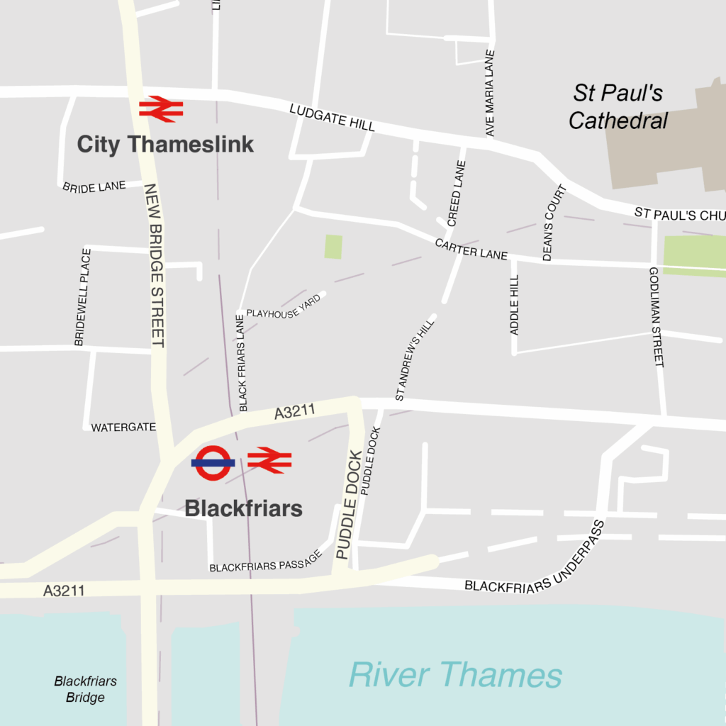
City of London – borough style map
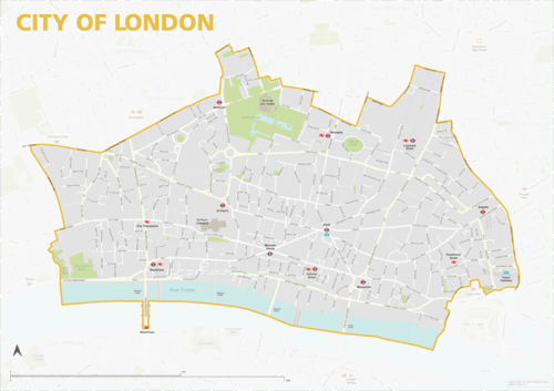
The City of London map focuses on this local authority district in London. It is one of 33 local authority districts in London that make up the full administrative area of Greater London. Our maps of these boroughs can be purchased individually or as an entire set of 33 maps.
The City of London map includes the full road network, the railway lines, and all underground and overground stations. All primary, secondary and minor roads are labelled, as well as the majority of local roads. Prominent open areas, such as park squares and gardens, are also shown and labelled, as is the Thames river. The road network, stations and labelling in the neighbouring boroughs is included, but knocked back behind a semi opaque layer to more clearly focus on just the City of London. Like any other layer, this can be altered or removed entirely when using the editable versions of the map (see below).
The map is offered in a print-ready format (A1 or larger is recommended), if you are looking for a high-quality print of the City of London, and a layered vector file format, suitable for a wide variety of uses in graphic design, marketing, planning and other applications where a bespoke map is required.
The product bundle includes a print-ready high-resolution PDF scaled for A1+ format printing, with the smallest labels legible when printed at A1 or bigger.
Also in the bundle are Adobe Illustrator, SVG and layered PDF file formats suitable for editing in standard vector art software such as Illustrator (see how to edit).
Furthermore, this great value bundle comes with a Limited Free Pass for Maproom’s Dynamic Mapping Suite, which contains online maps and mapping tools. This is a separate system in which you can plot your own locations of interest and feed data dynamically to the City of London, plus other boroughs, local government and postcode boundary maps.
Enfield – London borough map
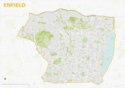
The Enfield Borough map focuses on this local authority district in London. It is one of 33 local authority districts in London that make up the full administrative area of Greater London. Our maps of these boroughs can be purchased individually or as an entire set of 33 maps.
The Enfield map includes the full road network, the railway lines, and all underground and overground stations. All primary, secondary and minor roads are labelled, as well as the majority of local roads. Prominent open areas, such as parks and woodlands and nature reserves are also shown and labelled, as are significant waterways. The road network, stations and labelling in the neighbouring boroughs is included, but knocked back behind a semi opaque layer to more clearly focus on just Enfield. Like any other layer, this can be altered or removed entirely when using the editable versions of the map (see below).
The map is offered in a print-ready format (A1 or larger is recommended), if you are looking for a high-quality print of Enfield, and a layered vector file format, suitable for a wide variety of uses in graphic design, marketing, planning and other applications where a bespoke map is required.
The product bundle includes a print-ready high-resolution PDF scaled for A1+ format printing, with the smallest labels legible when printed at A1 or bigger.
Also in the bundle are Adobe Illustrator, SVG and layered PDF file formats suitable for editing in standard vector art software such as Illustrator (see how to edit).
Furthermore, this great value bundle comes with a Limited Free Pass for Maproom’s Dynamic Mapping Suite, which contains online maps and mapping tools. This is a separate system in which you can plot your own locations of interest and feed data dynamically to the Borough of Enfield, plus other boroughs, local government and postcode boundary maps.

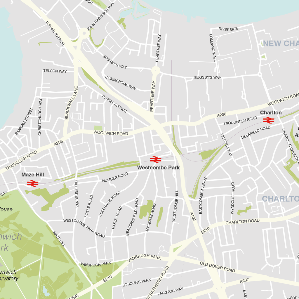
Greenwich – London borough map
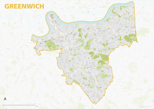
The Greenwich Borough map focuses on this local authority district in London. It is one of 33 local authority districts in London that make up the full administrative area of Greater London. Our maps of these boroughs can be purchased individually or as an entire set of 33 maps.
The Greenwich map includes the full road network, the railway lines, and all underground and overground stations. All primary, secondary and minor roads are labelled, as well as the majority of local roads. Prominent open areas, such as parks and woodlands and nature reserves are also shown and labelled, as are significant waterways. The road network, stations and labelling in the neighbouring boroughs is included, but knocked back behind a semi opaque layer to more clearly focus on just Greenwich. Like any other layer, this can be altered or removed entirely when using the editable versions of the map (see below).
The map is offered in a print-ready format (A1 or larger is recommended), if you are looking for a high-quality print of Greenwich, and a layered vector file format, suitable for a wide variety of uses in graphic design, marketing, planning and other applications where a bespoke map is required.
The product bundle includes a print-ready high-resolution PDF scaled for A1+ format printing, with the smallest labels legible when printed at A1 or bigger.
Also in the bundle are Adobe Illustrator, SVG and layered PDF file formats suitable for editing in standard vector art software such as Illustrator (see how to edit).
Furthermore, this great value bundle comes with a Limited Free Pass for Maproom’s Dynamic Mapping Suite, which contains online maps and mapping tools. This is a separate system in which you can plot your own locations of interest and feed data dynamically to the Borough of Greenwich, plus other boroughs, local government and postcode boundary maps.
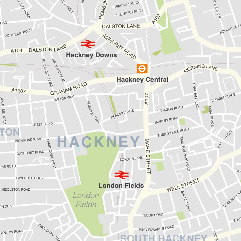
Hackney – London borough map
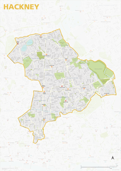
The Hackney Borough map focuses on this local authority district in London. It is one of 33 local authority districts in London that make up the full administrative area of Greater London. Our maps of these boroughs can be purchased individually or as an entire set of 33 maps.
The Hackney map includes the full road network, the railway lines, and all underground and overground stations. All primary, secondary and minor roads are labelled, as well as the majority of local roads. Prominent open areas, such as parks and woodlands and nature reserves are also shown and labelled, as are significant waterways. The road network, stations and labelling in the neighbouring boroughs is included, but knocked back behind a semi opaque layer to more clearly focus on just Hackney. Like any other layer, this can be altered or removed entirely when using the editable versions of the map (see below).
The map is offered in a print-ready format (A1 or larger is recommended), if you are looking for a high-quality print of Hackney, and a layered vector file format, suitable for a wide variety of uses in graphic design, marketing, planning and other applications where a bespoke map is required.
The product bundle includes a print-ready high-resolution PDF scaled for A1+ format printing, with the smallest labels legible when printed at A1 or bigger.
Also in the bundle are Adobe Illustrator, SVG and layered PDF file formats suitable for editing in standard vector art software such as Illustrator (see how to edit).
Furthermore, this great value bundle comes with a Limited Free Pass for Maproom’s Dynamic Mapping Suite, which contains online maps and mapping tools. This is a separate system in which you can plot your own locations of interest and feed data dynamically to the Borough of Hackney, plus other boroughs, local government and postcode boundary maps.
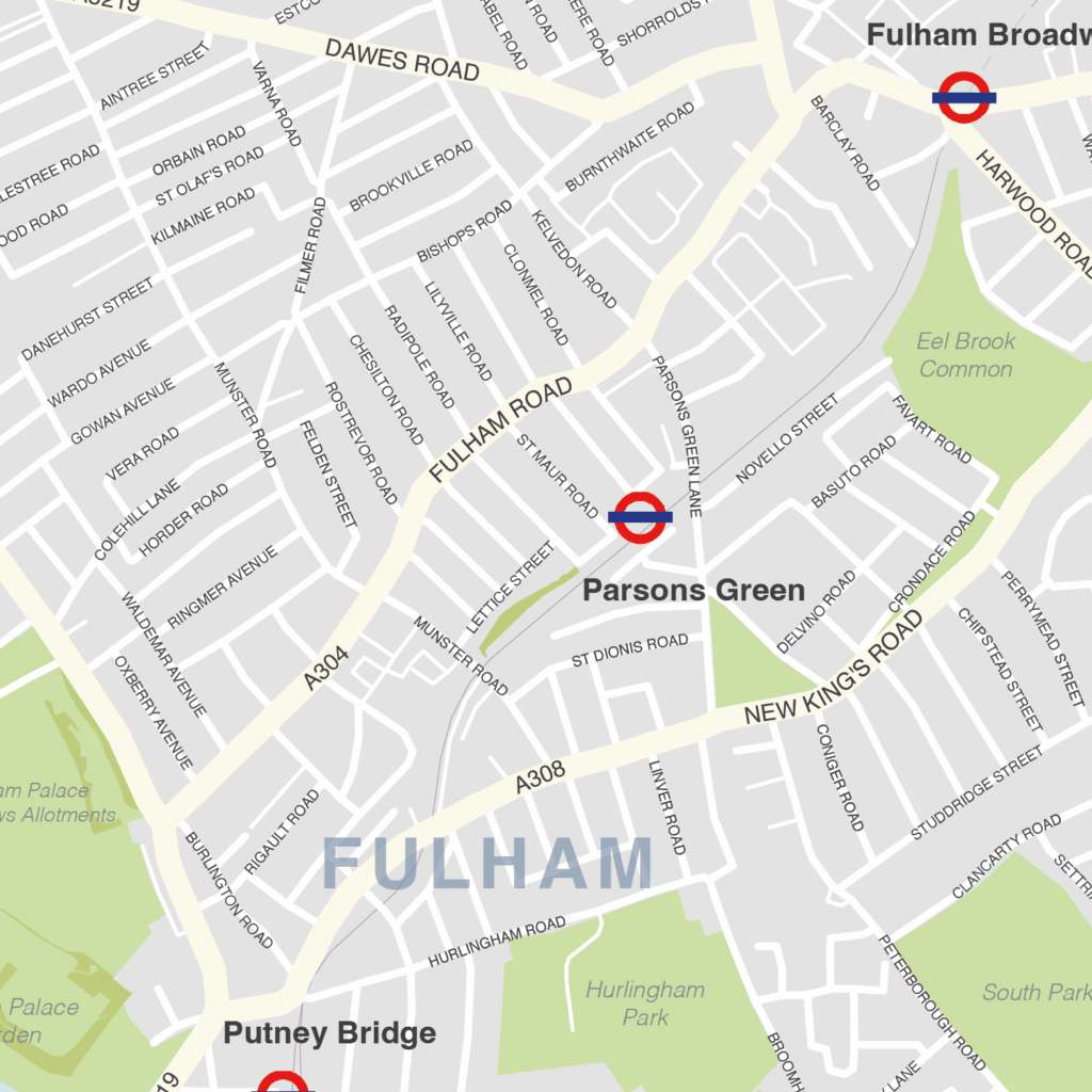
Hammersmith & Fulham – London borough map
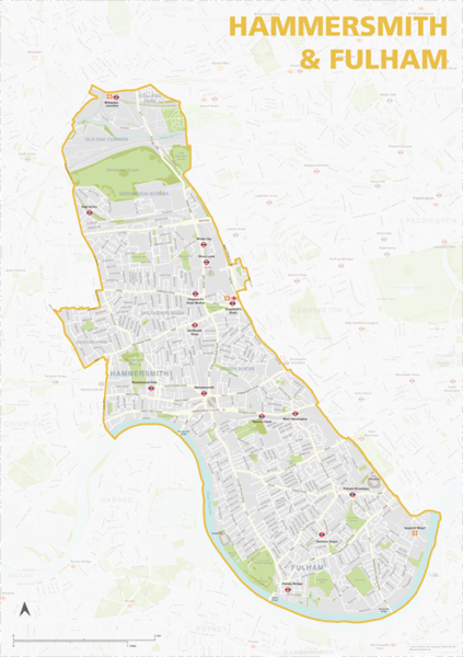
The Hammersmith & Fulham Borough map focuses on this local authority district in London. It is one of 33 local authority districts in London that make up the full administrative area of Greater London. Our maps of these boroughs can be purchased individually or as an entire set of 33 maps.
The Hammersmith & Fulham map includes the full road network, the railway lines, and all underground and overground stations. All primary, secondary and minor roads are labelled, as well as the majority of local roads. Prominent open areas, such as parks and woodlands and nature reserves are also shown and labelled, as are significant waterways. The road network, stations and labelling in the neighbouring boroughs is included, but knocked back behind a semi opaque layer to more clearly focus on just Hammersmith & Fulham. Like any other layer, this can be altered or removed entirely when using the editable versions of the map (see below).
The map is offered in a print-ready format (A1 or larger is recommended), if you are looking for a high-quality print of Hammersmith & Fulham, and a layered vector file format, suitable for a wide variety of uses in graphic design, marketing, planning and other applications where a bespoke map is required.
The product bundle includes a print-ready high-resolution PDF scaled for A1+ format printing, with the smallest labels legible when printed at A1 or bigger.
Also in the bundle are Adobe Illustrator, SVG and layered PDF file formats suitable for editing in standard vector art software such as Illustrator (see how to edit).
Furthermore, this great value bundle comes with a Limited Free Pass for Maproom’s Dynamic Mapping Suite, which contains online maps and mapping tools. This is a separate system in which you can plot your own locations of interest and feed data dynamically to the Borough of Hammersmith & Fulham, plus other boroughs, local government and postcode boundary maps.
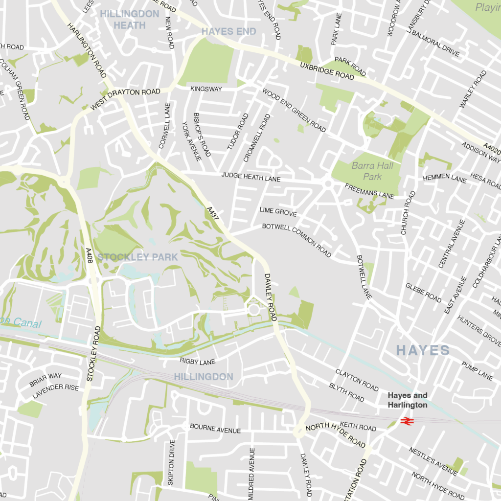
Hillingdon – London borough map
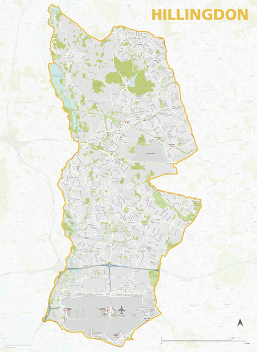
The Hillingdon Borough map focuses on this local authority district in London. It is one of 33 local authority districts in London that make up the full administrative area of Greater London. Our maps of these boroughs can be purchased individually or as an entire set of 33 maps.
The Hillingdon map includes the full road network, the railway lines, and all underground and overground stations. All primary, secondary and minor roads are labelled, as well as the majority of local roads. Prominent open areas, such as parks and woodlands and nature reserves are also shown and labelled, as are significant waterways. The road network, stations and labelling in the neighbouring boroughs is included, but knocked back behind a semi opaque layer to more clearly focus on just Hillingdon. Like any other layer, this can be altered or removed entirely when using the editable versions of the map (see below).
The map is offered in a print-ready format (A1 or larger is recommended), if you are looking for a high-quality print of Hillingdon, and a layered vector file format, suitable for a wide variety of uses in graphic design, marketing, planning and other applications where a bespoke map is required.
The product bundle includes a print-ready high-resolution PDF scaled for A1+ format printing, with the smallest labels legible when printed at A1 or bigger.
Also in the bundle are Adobe Illustrator, SVG and layered PDF file formats suitable for editing in standard vector art software such as Illustrator (see how to edit).
Furthermore, this great value bundle comes with a Limited Free Pass for Maproom’s Dynamic Mapping Suite, which contains online maps and mapping tools. This is a separate system in which you can plot your own locations of interest and feed data dynamically to the Borough of Hillingdon, plus other boroughs, local government and postcode boundary maps.
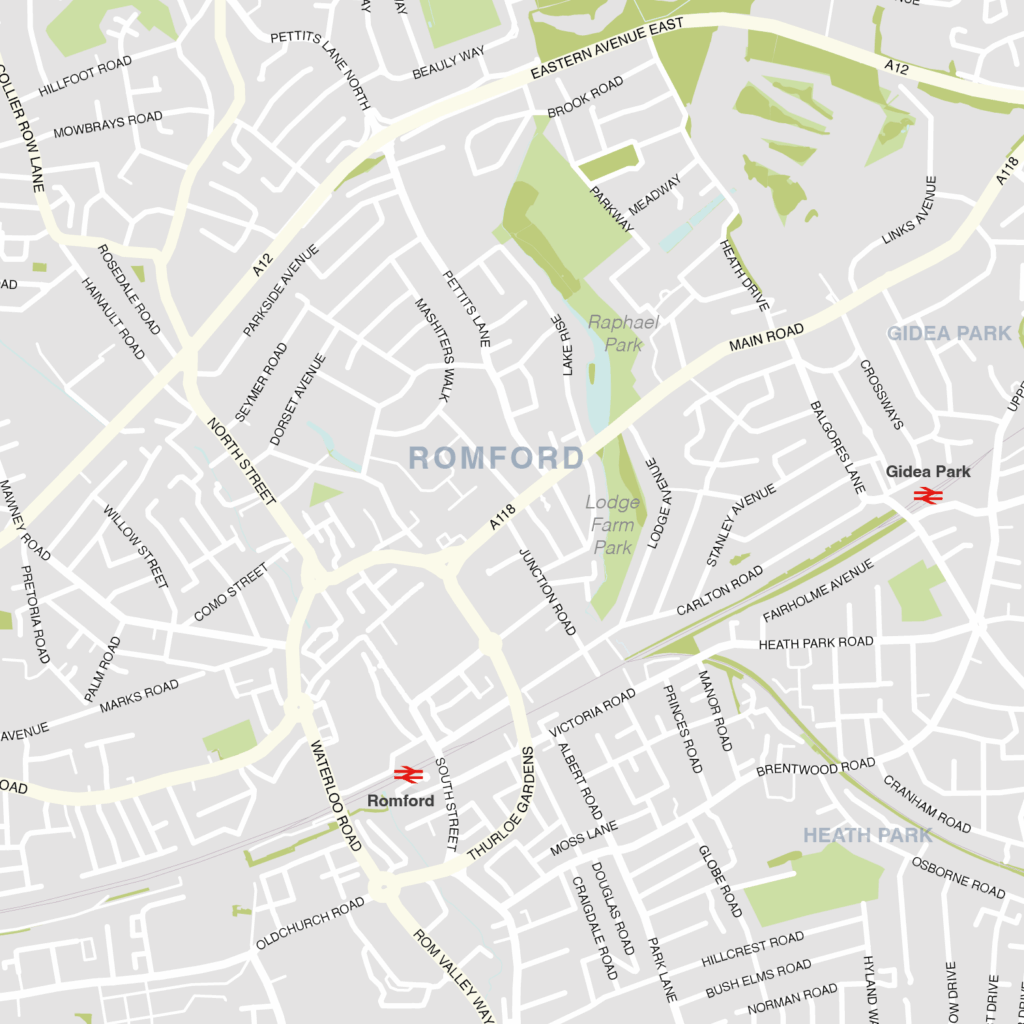
Havering – London borough map
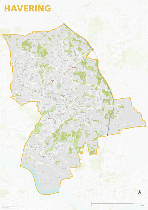
The Havering Borough map focuses on this local authority district in London. It is one of 33 local authority districts in London that make up the full administrative area of Greater London. Our maps of these boroughs can be purchased individually or as an entire set of 33 maps.
The Havering map includes the full road network, the railway lines, and all underground and overground stations. All primary, secondary and minor roads are labelled, as well as the majority of local roads. Prominent open areas, such as parks and woodlands and nature reserves are also shown and labelled, as are significant waterways. The road network, stations and labelling in the neighbouring boroughs is included, but knocked back behind a semi opaque layer to more clearly focus on just Havering. Like any other layer, this can be altered or removed entirely when using the editable versions of the map (see below).
The map is offered in a print-ready format (A1 or larger is recommended), if you are looking for a high-quality print of Havering, and a layered vector file format, suitable for a wide variety of uses in graphic design, marketing, planning and other applications where a bespoke map is required.
The product bundle includes a print-ready high-resolution PDF scaled for A1+ format printing, with the smallest labels legible when printed at A1 or bigger.
Also in the bundle are Adobe Illustrator, SVG and layered PDF file formats suitable for editing in standard vector art software such as Illustrator (see how to edit).
Furthermore, this great value bundle comes with a Limited Free Pass for Maproom’s Dynamic Mapping Suite, which contains online maps and mapping tools. This is a separate system in which you can plot your own locations of interest and feed data dynamically to the Borough of Havering, plus other boroughs, local government and postcode boundary maps.
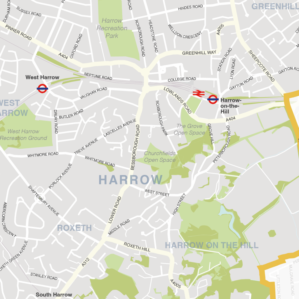
Harrow – London borough map
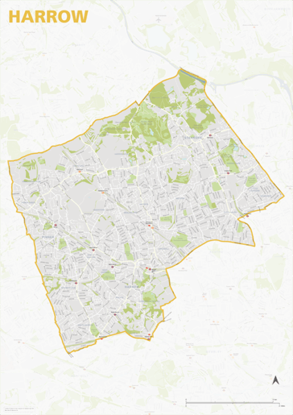
The Harrow Borough map focuses on this local authority district in London. It is one of 33 local authority districts in London that make up the full administrative area of Greater London. Our maps of these boroughs can be purchased individually or as an entire set of 33 maps.
The Harrow map includes the full road network, the railway lines, and all underground and overground stations. All primary, secondary and minor roads are labelled, as well as the majority of local roads. Prominent open areas, such as parks and woodlands and nature reserves are also shown and labelled, as are significant waterways. The road network, stations and labelling in the neighbouring boroughs is included, but knocked back behind a semi opaque layer to more clearly focus on just Harrow. Like any other layer, this can be altered or removed entirely when using the editable versions of the map (see below).
The map is offered in a print-ready format (A1 or larger is recommended), if you are looking for a high-quality print of Harrow, and a layered vector file format, suitable for a wide variety of uses in graphic design, marketing, planning and other applications where a bespoke map is required.
The product bundle includes a print-ready high-resolution PDF scaled for A1+ format printing, with the smallest labels legible when printed at A1 or bigger.
Also in the bundle are Adobe Illustrator, SVG and layered PDF file formats suitable for editing in standard vector art software such as Illustrator (see how to edit).
Furthermore, this great value bundle comes with a Limited Free Pass for Maproom’s Dynamic Mapping Suite, which contains online maps and mapping tools. This is a separate system in which you can plot your own locations of interest and feed data dynamically to the Borough of Harrow, plus other boroughs, local government and postcode boundary maps.
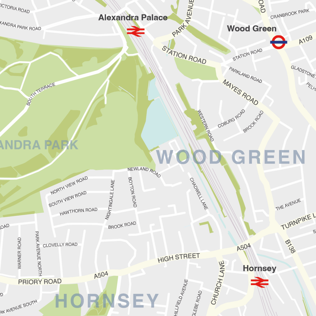
Haringey – London borough map
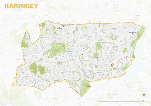
The Haringey Borough map focuses on this local authority district in London. It is one of 33 local authority districts in London that make up the full administrative area of Greater London. Our maps of these boroughs can be purchased individually or as an entire set of 33 maps.
The Haringey map includes the full road network, the railway lines, and all underground and overground stations. All primary, secondary and minor roads are labelled, as well as the majority of local roads. Prominent open areas, such as parks and woodlands and nature reserves are also shown and labelled, as are significant waterways. The road network, stations and labelling in the neighbouring boroughs is included, but knocked back behind a semi opaque layer to more clearly focus on just Haringey. Like any other layer, this can be altered or removed entirely when using the editable versions of the map (see below).
The map is offered in a print-ready format (A1 or larger is recommended), if you are looking for a high-quality print of Haringey, and a layered vector file format, suitable for a wide variety of uses in graphic design, marketing, planning and other applications where a bespoke map is required.
The product bundle includes a print-ready high-resolution PDF scaled for A1+ format printing, with the smallest labels legible when printed at A1 or bigger.
Also in the bundle are Adobe Illustrator, SVG and layered PDF file formats suitable for editing in standard vector art software such as Illustrator (see how to edit).
Furthermore, this great value bundle comes with a Limited Free Pass for Maproom’s Dynamic Mapping Suite, which contains online maps and mapping tools. This is a separate system in which you can plot your own locations of interest and feed data dynamically to the Borough of Haringey, plus other boroughs, local government and postcode boundary maps.
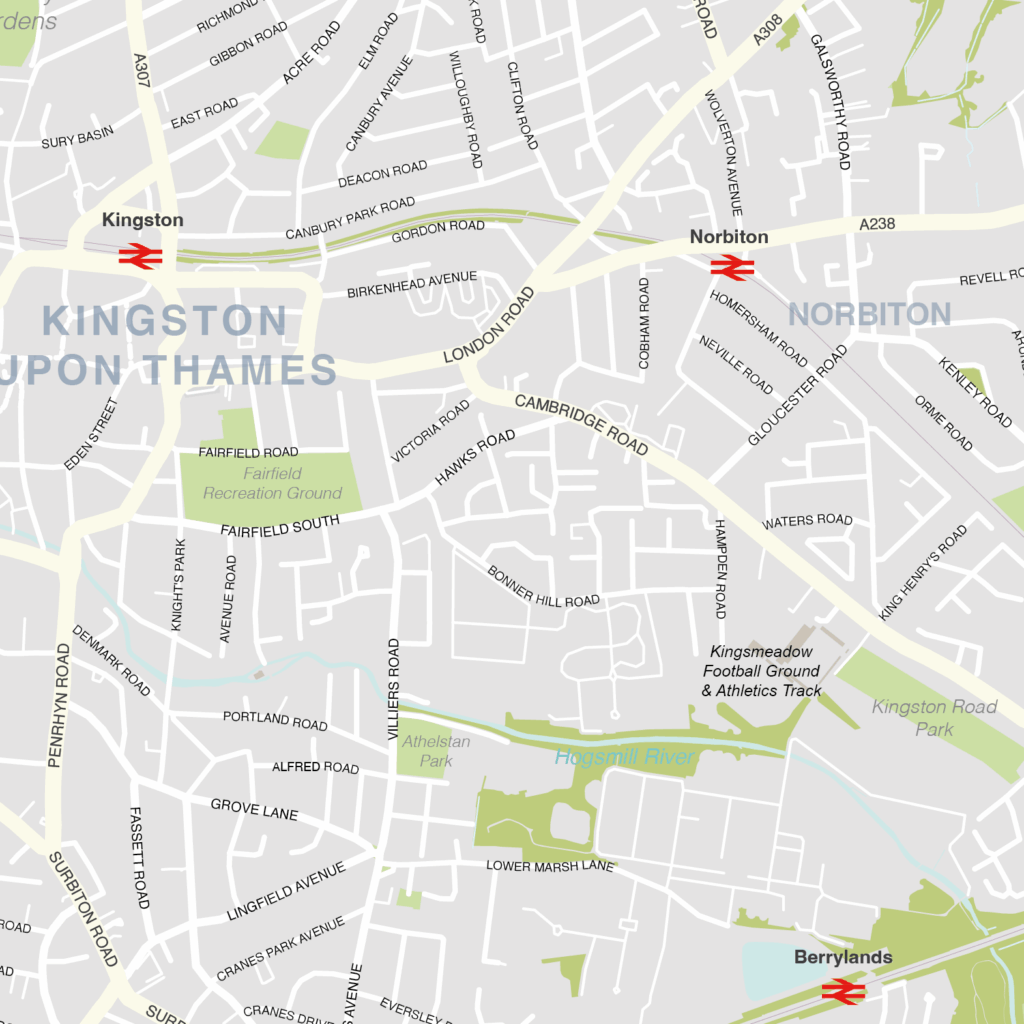
Kingston upon Thames – London borough map
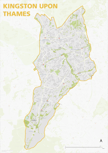
The Kingston upon Thames Borough map focuses on this local authority district in London. It is one of 33 local authority districts in London that make up the full administrative area of Greater London. Our maps of these boroughs can be purchased individually or as an entire set of 33 maps.
The Kingston upon Thames map includes the full road network, the railway lines, and all underground and overground stations. All primary, secondary and minor roads are labelled, as well as the majority of local roads. Prominent open areas, such as parks and woodlands and nature reserves are also shown and labelled, as are significant waterways. The road network, stations and labelling in the neighbouring boroughs is included, but knocked back behind a semi opaque layer to more clearly focus on just Kingston upon Thames. Like any other layer, this can be altered or removed entirely when using the editable versions of the map (see below).
The map is offered in a print-ready format (A1 or larger is recommended), if you are looking for a high-quality print of Kingston upon Thames, and a layered vector file format, suitable for a wide variety of uses in graphic design, marketing, planning and other applications where a bespoke map is required.
The product bundle includes a print-ready high-resolution PDF scaled for A1+ format printing, with the smallest labels legible when printed at A1 or bigger.
Also in the bundle are Adobe Illustrator, SVG and layered PDF file formats suitable for editing in standard vector art software such as Illustrator (see how to edit).
Furthermore, this great value bundle comes with a Limited Free Pass for Maproom’s Dynamic Mapping Suite, which contains online maps and mapping tools. This is a separate system in which you can plot your own locations of interest and feed data dynamically to the Borough of Kingston upon Thames, plus other boroughs, local government and postcode boundary maps.
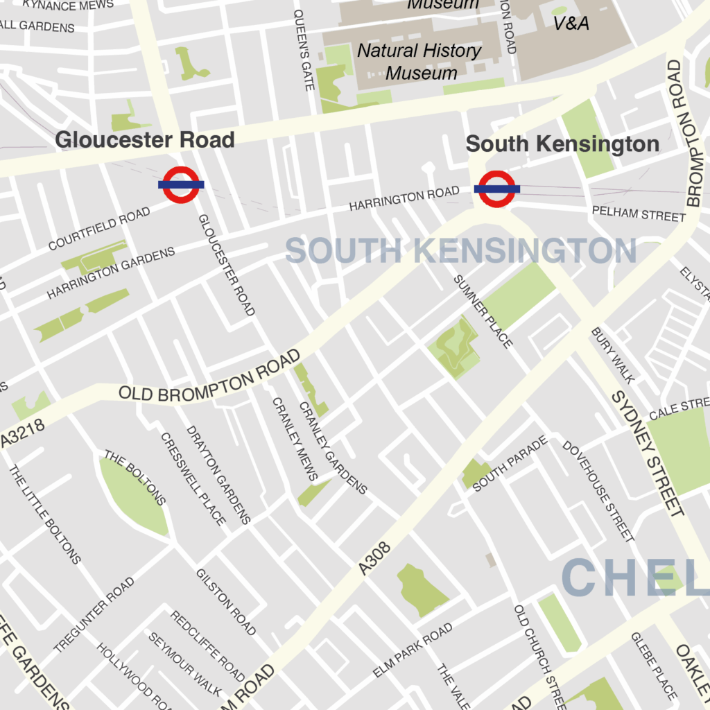
Kensington & Chelsea – London borough map
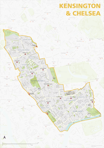
The Kensington & Chelsea Borough map focuses on this local authority district in London. It is one of 33 local authority districts in London that make up the full administrative area of Greater London. Our maps of these boroughs can be purchased individually or as an entire set of 33 maps.
The Kensington & Chelsea map includes the full road network, the railway lines, and all underground and overground stations. All primary, secondary and minor roads are labelled, as well as the majority of local roads. Prominent open areas, such as parks and woodlands and nature reserves are also shown and labelled, as are significant waterways. The road network, stations and labelling in the neighbouring boroughs is included, but knocked back behind a semi opaque layer to more clearly focus on just Kensington & Chelsea. Like any other layer, this can be altered or removed entirely when using the editable versions of the map (see below).
The map is offered in a print-ready format (A1 or larger is recommended), if you are looking for a high-quality print of Kensington & Chelsea, and a layered vector file format, suitable for a wide variety of uses in graphic design, marketing, planning and other applications where a bespoke map is required.
The product bundle includes a print-ready high-resolution PDF scaled for A1+ format printing, with the smallest labels legible when printed at A1 or bigger.
Also in the bundle are Adobe Illustrator, SVG and layered PDF file formats suitable for editing in standard vector art software such as Illustrator (see how to edit).
Furthermore, this great value bundle comes with a Limited Free Pass for Maproom’s Dynamic Mapping Suite, which contains online maps and mapping tools. This is a separate system in which you can plot your own locations of interest and feed data dynamically to the Borough of Kensington & Chelsea, plus other boroughs, local government and postcode boundary maps.
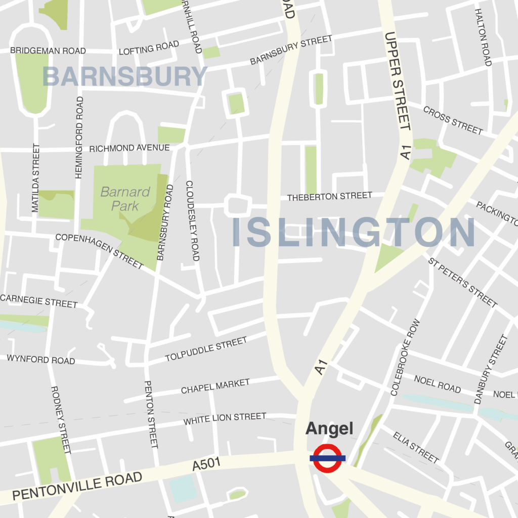
Islington – London borough map
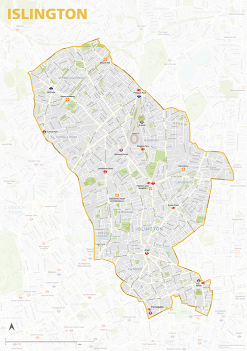
The Islington Borough map focuses on this local authority district in London. It is one of 33 local authority districts in London that make up the full administrative area of Greater London. Our maps of these boroughs can be purchased individually or as an entire set of 33 maps.
The Islington map includes the full road network, the railway lines, and all underground and overground stations. All primary, secondary and minor roads are labelled, as well as the majority of local roads. Prominent open areas, such as parks and woodlands and nature reserves are also shown and labelled, as are significant waterways. The road network, stations and labelling in the neighbouring boroughs is included, but knocked back behind a semi opaque layer to more clearly focus on just Islington. Like any other layer, this can be altered or removed entirely when using the editable versions of the map (see below).
The map is offered in a print-ready format (A1 or larger is recommended), if you are looking for a high-quality print of Islington, and a layered vector file format, suitable for a wide variety of uses in graphic design, marketing, planning and other applications where a bespoke map is required.
The product bundle includes a print-ready high-resolution PDF scaled for A1+ format printing, with the smallest labels legible when printed at A1 or bigger.
Also in the bundle are Adobe Illustrator, SVG and layered PDF file formats suitable for editing in standard vector art software such as Illustrator (see how to edit).
Furthermore, this great value bundle comes with a Limited Free Pass for Maproom’s Dynamic Mapping Suite, which contains online maps and mapping tools. This is a separate system in which you can plot your own locations of interest and feed data dynamically to the Borough of Islington, plus other boroughs, local government and postcode boundary maps.
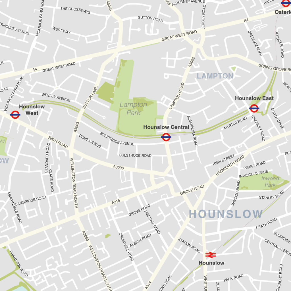
Hounslow – London borough map
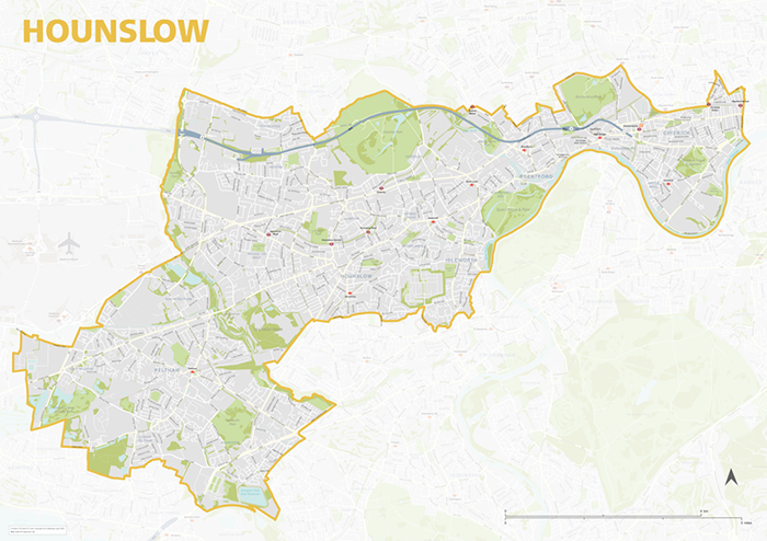
The Hounslow Borough map focuses on this local authority district in London. It is one of 33 local authority districts in London that make up the full administrative area of Greater London. Our maps of these boroughs can be purchased individually or as an entire set of 33 maps.
The Hounslow map includes the full road network, the railway lines, and all underground and overground stations. All primary, secondary and minor roads are labelled, as well as the majority of local roads. Prominent open areas, such as parks and woodlands and nature reserves are also shown and labelled, as are significant waterways. The road network, stations and labelling in the neighbouring boroughs is included, but knocked back behind a semi opaque layer to more clearly focus on just Hounslow. Like any other layer, this can be altered or removed entirely when using the editable versions of the map (see below).
The map is offered in a print-ready format (A1 or larger is recommended), if you are looking for a high-quality print of Hounslow, and a layered vector file format, suitable for a wide variety of uses in graphic design, marketing, planning and other applications where a bespoke map is required.
The product bundle includes a print-ready high-resolution PDF scaled for A1+ format printing, with the smallest labels legible when printed at A1 or bigger.
Also in the bundle are Adobe Illustrator, SVG and layered PDF file formats suitable for editing in standard vector art software such as Illustrator (see how to edit).
Furthermore, this great value bundle comes with a Limited Free Pass for Maproom’s Dynamic Mapping Suite, which contains online maps and mapping tools. This is a separate system in which you can plot your own locations of interest and feed data dynamically to the Borough of Hounslow, plus other boroughs, local government and postcode boundary maps.
Newham – London borough map
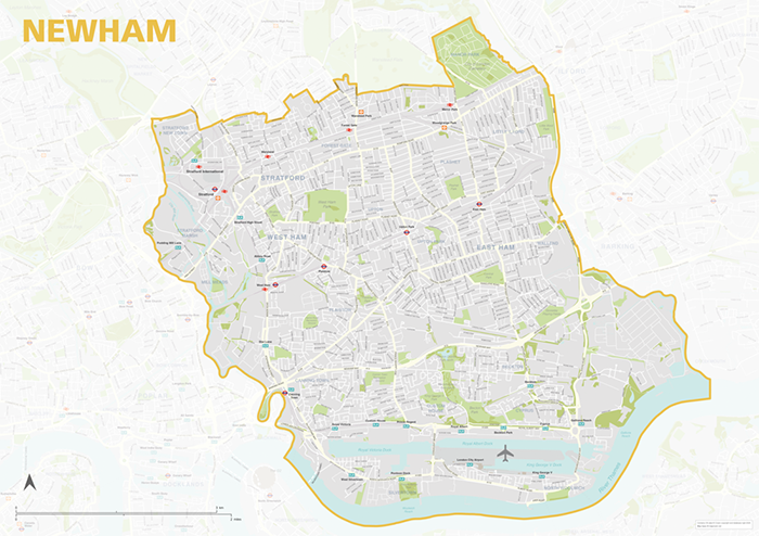
The Newham Borough map focuses on this local authority district in London. It is one of 33 local authority districts in London that make up the full administrative area of Greater London. Our maps of these boroughs can be purchased individually or as an entire set of 33 maps.
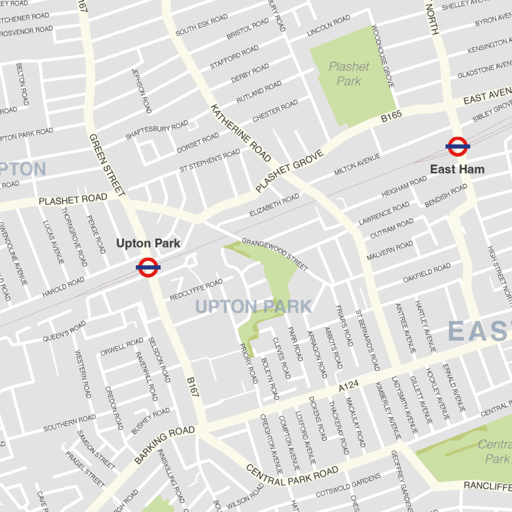
The Newham map includes the full road network, the railway lines, and all underground and overground stations. All primary, secondary and minor roads are labelled, as well as the majority of local roads. Prominent open areas, such as parks and woodlands and nature reserves are also shown and labelled, as are significant waterways. The road network, stations and labelling in the neighbouring boroughs is included, but knocked back behind a semi opaque layer to more clearly focus on just Newham. Like any other layer, this can be altered or removed entirely when using the editable versions of the map (see below).
The map is offered in a print-ready format (A1 or larger is recommended), if you are looking for a high-quality print of Newham, and a layered vector file format, suitable for a wide variety of uses in graphic design, marketing, planning and other applications where a bespoke map is required.
The product bundle includes a print-ready high-resolution PDF scaled for A1+ format printing, with the smallest labels legible when printed at A1 or bigger.
Also in the bundle are Adobe Illustrator, SVG and layered PDF file formats suitable for editing in standard vector art software such as Illustrator (see how to edit).
Furthermore, this great value bundle comes with a Limited Free Pass for Maproom’s Dynamic Mapping Suite, which contains online maps and mapping tools. This is a separate system in which you can plot your own locations of interest and feed data dynamically to the Borough of Newham, plus other boroughs, local government and postcode boundary maps.
Merton – London borough map
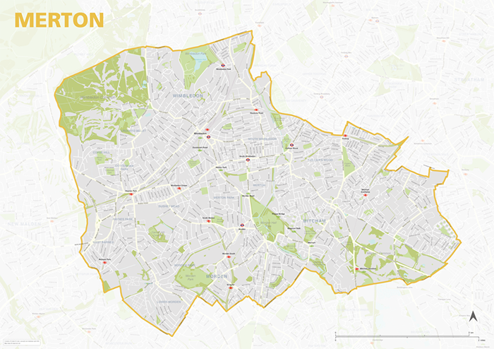
The Merton Borough map focuses on this local authority district in London. It is one of 33 local authority districts in London that make up the full administrative area of Greater London. Our maps of these boroughs can be purchased individually or as an entire set of 33 maps.
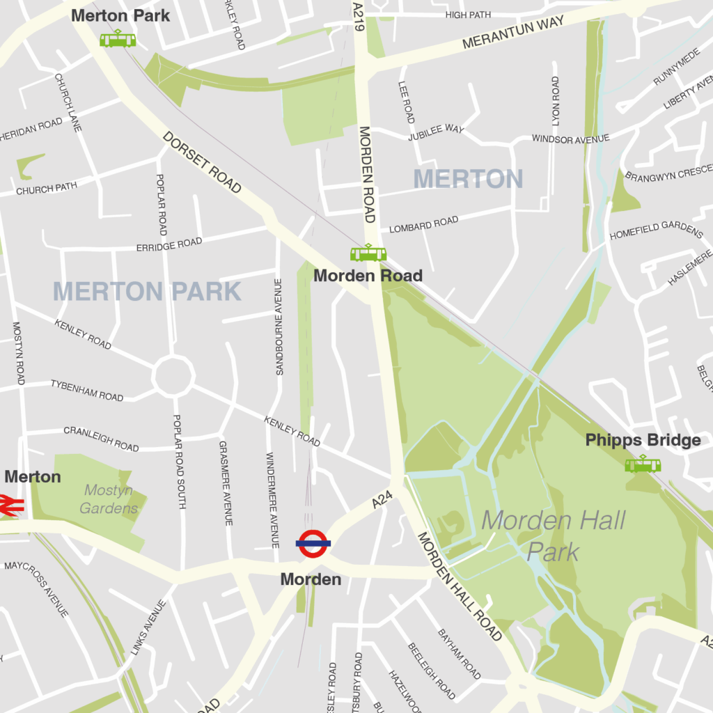
The Merton map includes the full road network, the railway lines, and all underground and overground stations. All primary, secondary and minor roads are labelled, as well as the majority of local roads. Prominent open areas, such as parks and woodlands and nature reserves are also shown and labelled, as are significant waterways. The road network, stations and labelling in the neighbouring boroughs is included, but knocked back behind a semi opaque layer to more clearly focus on just Merton. Like any other layer, this can be altered or removed entirely when using the editable versions of the map (see below).
The map is offered in a print-ready format (A1 or larger is recommended), if you are looking for a high-quality print of Merton, and a layered vector file format, suitable for a wide variety of uses in graphic design, marketing, planning and other applications where a bespoke map is required.
The product bundle includes a print-ready high-resolution PDF scaled for A1+ format printing, with the smallest labels legible when printed at A1 or bigger.
Also in the bundle are Adobe Illustrator, SVG and layered PDF file formats suitable for editing in standard vector art software such as Illustrator (see how to edit).
Furthermore, this great value bundle comes with a Limited Free Pass for Maproom’s Dynamic Mapping Suite, which contains online maps and mapping tools. This is a separate system in which you can plot your own locations of interest and feed data dynamically to the Borough of Merton, plus other boroughs, local government and postcode boundary maps.
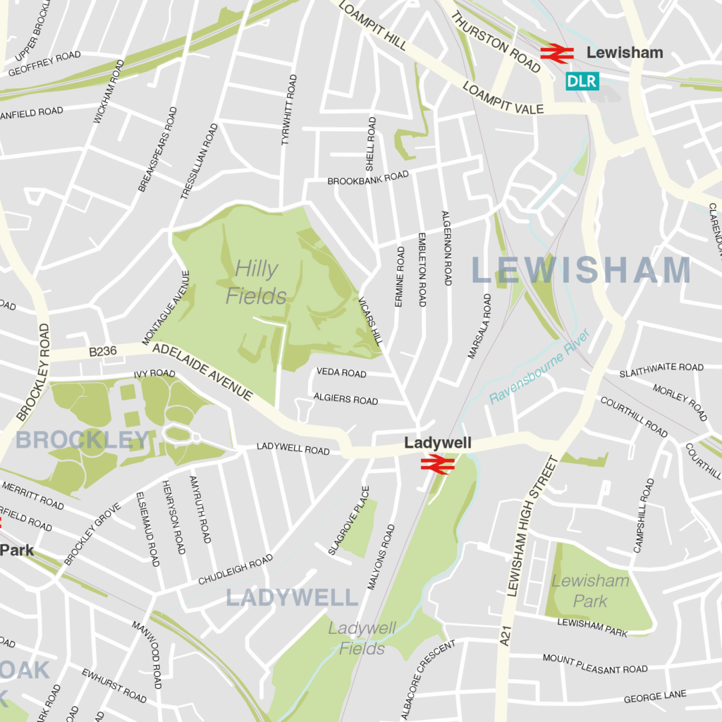
Lewisham – London borough map
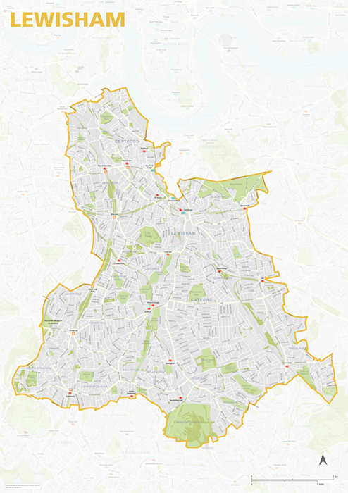
The Lewisham Borough map focuses on this local authority district in London. It is one of 33 local authority districts in London that make up the full administrative area of Greater London. Our maps of these boroughs can be purchased individually or as an entire set of 33 maps.
The Lewisham map includes the full road network, the railway lines, and all underground and overground stations. All primary, secondary and minor roads are labelled, as well as the majority of local roads. Prominent open areas, such as parks and woodlands and nature reserves are also shown and labelled, as are significant waterways. The road network, stations and labelling in the neighbouring boroughs is included, but knocked back behind a semi opaque layer to more clearly focus on just Lewisham. Like any other layer, this can be altered or removed entirely when using the editable versions of the map (see below).
The map is offered in a print-ready format (A1 or larger is recommended), if you are looking for a high-quality print of Lewisham, and a layered vector file format, suitable for a wide variety of uses in graphic design, marketing, planning and other applications where a bespoke map is required.
The product bundle includes a print-ready high-resolution PDF scaled for A1+ format printing, with the smallest labels legible when printed at A1 or bigger.
Also in the bundle are Adobe Illustrator, SVG and layered PDF file formats suitable for editing in standard vector art software such as Illustrator (see how to edit).
Furthermore, this great value bundle comes with a Limited Free Pass for Maproom’s Dynamic Mapping Suite, which contains online maps and mapping tools. This is a separate system in which you can plot your own locations of interest and feed data dynamically to the Borough of Lewisham, plus other boroughs, local government and postcode boundary maps.
Lambeth – London borough map
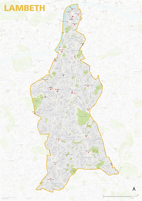
The Lambeth Borough map focuses on this local authority district in London. It is one of 33 local authority districts in London that make up the full administrative area of Greater London. Our maps of these boroughs can be purchased individually or as an entire set of 33 maps.
The Lambeth map includes the full road network, the railway lines, and all underground and overground stations. All primary, secondary and minor roads are labelled, as well as the majority of local roads. Prominent open areas, such as parks and woodlands and nature reserves are also shown and labelled, as are significant waterways. The road network, stations and labelling in the neighbouring boroughs is included, but knocked back behind a semi opaque layer to more clearly focus on just Lambeth. Like any other layer, this can be altered or removed entirely when using the editable versions of the map (see below).
The map is offered in a print-ready format (A1 or larger is recommended), if you are looking for a high-quality print of Lambeth, and a layered vector file format, suitable for a wide variety of uses in graphic design, marketing, planning and other applications where a bespoke map is required.
The product bundle includes a print-ready high-resolution PDF scaled for A1+ format printing, with the smallest labels legible when printed at A1 or bigger.
Also in the bundle are Adobe Illustrator, SVG and layered PDF file formats suitable for editing in standard vector art software such as Illustrator (see how to edit).
Furthermore, this great value bundle comes with a Limited Free Pass for Maproom’s Dynamic Mapping Suite, which contains online maps and mapping tools. This is a separate system in which you can plot your own locations of interest and feed data dynamically to the Borough of Lambeth, plus other boroughs, local government and postcode boundary maps.

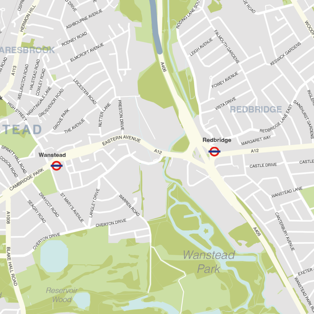
Redbridge – London borough map
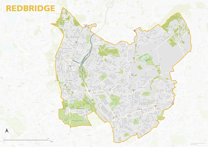
The Redbridge Borough map focuses on this local authority district in London. It is one of 33 local authority districts in London that make up the full administrative area of Greater London. Our maps of these boroughs can be purchased individually or as an entire set of 33 maps.
The Redbridge map includes the full road network, the railway lines, and all underground and overground stations. All primary, secondary and minor roads are labelled, as well as the majority of local roads. Prominent open areas, such as parks and woodlands and nature reserves are also shown and labelled, as are significant waterways. The road network, stations and labelling in the neighbouring boroughs is included, but knocked back behind a semi opaque layer to more clearly focus on just Redbridge. Like any other layer, this can be altered or removed entirely when using the editable versions of the map (see below).
The map is offered in a print-ready format (A1 or larger is recommended), if you are looking for a high-quality print of Redbridge, and a layered vector file format, suitable for a wide variety of uses in graphic design, marketing, planning and other applications where a bespoke map is required.
The product bundle includes a print-ready high-resolution PDF scaled for A1+ format printing, with the smallest labels legible when printed at A1 or bigger.
Also in the bundle are Adobe Illustrator, SVG and layered PDF file formats suitable for editing in standard vector art software such as Illustrator (see how to edit).
Furthermore, this great value bundle comes with a Limited Free Pass for Maproom’s Dynamic Mapping Suite, which contains online maps and mapping tools. This is a separate system in which you can plot your own locations of interest and feed data dynamically to the Borough of Redbridge, plus other boroughs, local government and postcode boundary maps.
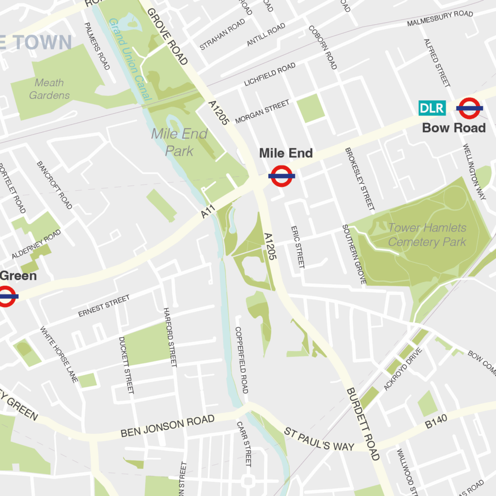
Tower Hamlets – London borough map
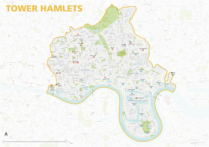
The Tower Hamlets Borough map focuses on this local authority district in London. It is one of 33 local authority districts in London that make up the full administrative area of Greater London. Our maps of these boroughs can be purchased individually or as an entire set of 33 maps.
The Tower Hamlets map includes the full road network, the railway lines, and all underground and overground stations. All primary, secondary and minor roads are labelled, as well as the majority of local roads. Prominent open areas, such as parks and woodlands and nature reserves are also shown and labelled, as are significant waterways. The road network, stations and labelling in the neighbouring boroughs is included, but knocked back behind a semi opaque layer to more clearly focus on just Tower Hamlets. Like any other layer, this can be altered or removed entirely when using the editable versions of the map (see below).
The map is offered in a print-ready format (A1 or larger is recommended), if you are looking for a high-quality print of Tower Hamlets, and a layered vector file format, suitable for a wide variety of uses in graphic design, marketing, planning and other applications where a bespoke map is required.
The product bundle includes a print-ready high-resolution PDF scaled for A1+ format printing, with the smallest labels legible when printed at A1 or bigger.
Also in the bundle are Adobe Illustrator, SVG and layered PDF file formats suitable for editing in standard vector art software such as Illustrator (see how to edit).
Furthermore, this great value bundle comes with a Limited Free Pass for Maproom’s Dynamic Mapping Suite, which contains online maps and mapping tools. This is a separate system in which you can plot your own locations of interest and feed data dynamically to the Borough of Tower Hamlets, plus other boroughs, local government and postcode boundary maps.
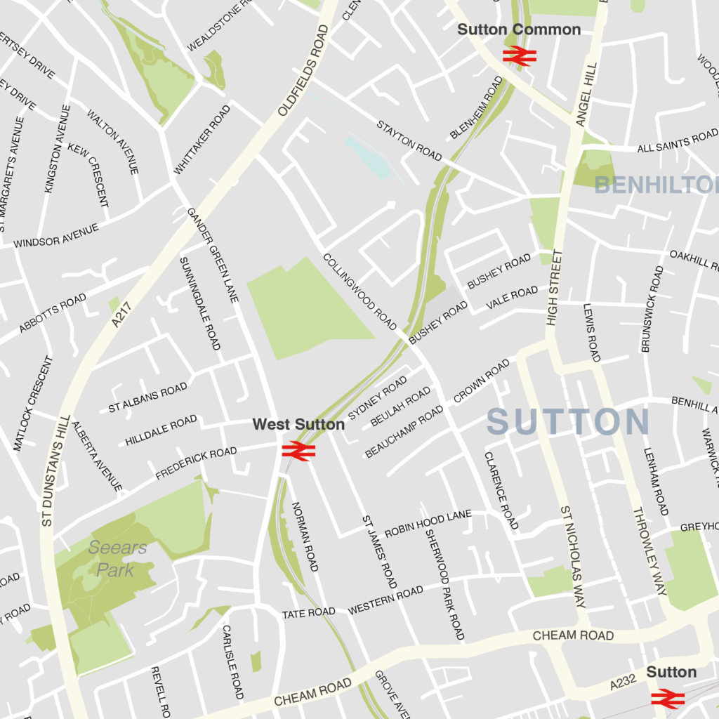
Sutton – London borough map
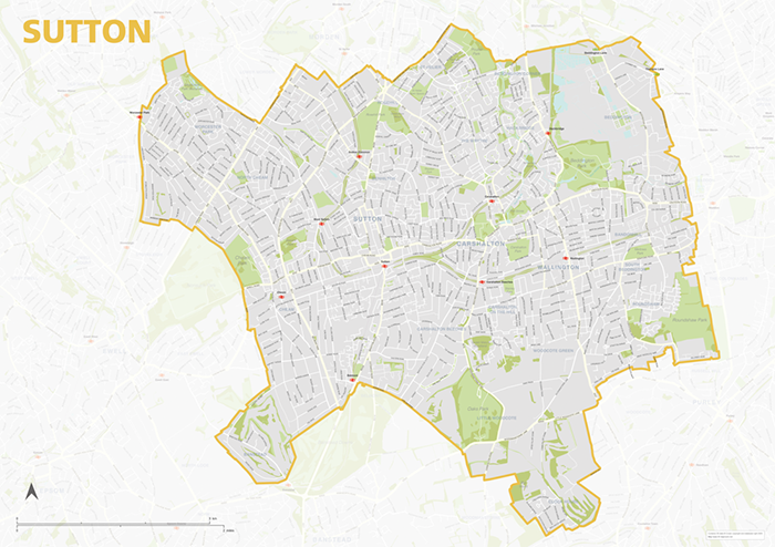
The Sutton Borough map focuses on this local authority district in London. It is one of 33 local authority districts in London that make up the full administrative area of Greater London. Our maps of these boroughs can be purchased individually or as an entire set of 33 maps.
The Sutton map includes the full road network, the railway lines, and all underground and overground stations. All primary, secondary and minor roads are labelled, as well as the majority of local roads. Prominent open areas, such as parks and woodlands and nature reserves are also shown and labelled, as are significant waterways. The road network, stations and labelling in the neighbouring boroughs is included, but knocked back behind a semi opaque layer to more clearly focus on just Sutton. Like any other layer, this can be altered or removed entirely when using the editable versions of the map (see below).
The map is offered in a print-ready format (A1 or larger is recommended), if you are looking for a high-quality print of Sutton, and a layered vector file format, suitable for a wide variety of uses in graphic design, marketing, planning and other applications where a bespoke map is required.
The product bundle includes a print-ready high-resolution PDF scaled for A1+ format printing, with the smallest labels legible when printed at A1 or bigger.
Also in the bundle are Adobe Illustrator, SVG and layered PDF file formats suitable for editing in standard vector art software such as Illustrator (see how to edit).
Furthermore, this great value bundle comes with a Limited Free Pass for Maproom’s Dynamic Mapping Suite, which contains online maps and mapping tools. This is a separate system in which you can plot your own locations of interest and feed data dynamically to the Borough of Sutton, plus other boroughs, local government and postcode boundary maps.
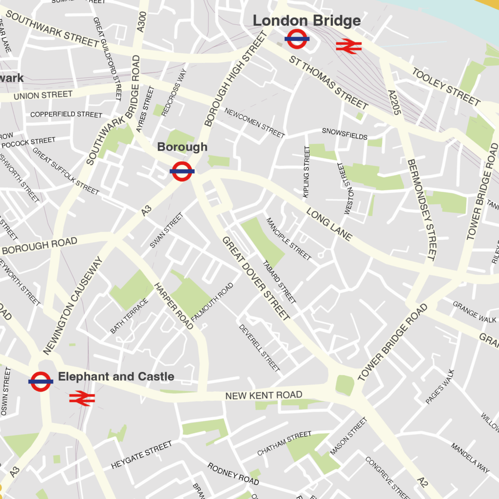
Southwark – London borough map
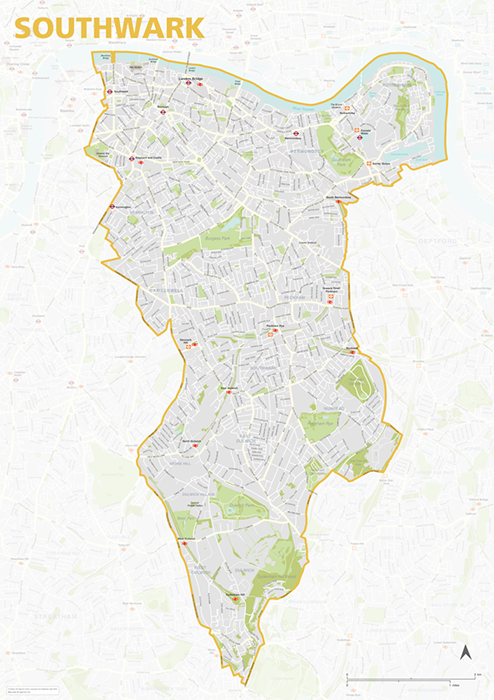
The Southwark Borough map focuses on this local authority district in London. It is one of 33 local authority districts in London that make up the full administrative area of Greater London. Our maps of these boroughs can be purchased individually or as an entire set of 33 maps.
The Southwark map includes the full road network, the railway lines, and all underground and overground stations. All primary, secondary and minor roads are labelled, as well as the majority of local roads. Prominent open areas, such as parks and woodlands and nature reserves are also shown and labelled, as are significant waterways. The road network, stations and labelling in the neighbouring boroughs is included, but knocked back behind a semi opaque layer to more clearly focus on just Southwark. Like any other layer, this can be altered or removed entirely when using the editable versions of the map (see below).
The map is offered in a print-ready format (A1 or larger is recommended), if you are looking for a high-quality print of Southwark, and a layered vector file format, suitable for a wide variety of uses in graphic design, marketing, planning and other applications where a bespoke map is required.
The product bundle includes a print-ready high-resolution PDF scaled for A1+ format printing, with the smallest labels legible when printed at A1 or bigger.
Also in the bundle are Adobe Illustrator, SVG and layered PDF file formats suitable for editing in standard vector art software such as Illustrator (see how to edit).
Furthermore, this great value bundle comes with a Limited Free Pass for Maproom’s Dynamic Mapping Suite, which contains online maps and mapping tools. This is a separate system in which you can plot your own locations of interest and feed data dynamically to the Borough of Southwark, plus other boroughs, local government and postcode boundary maps.
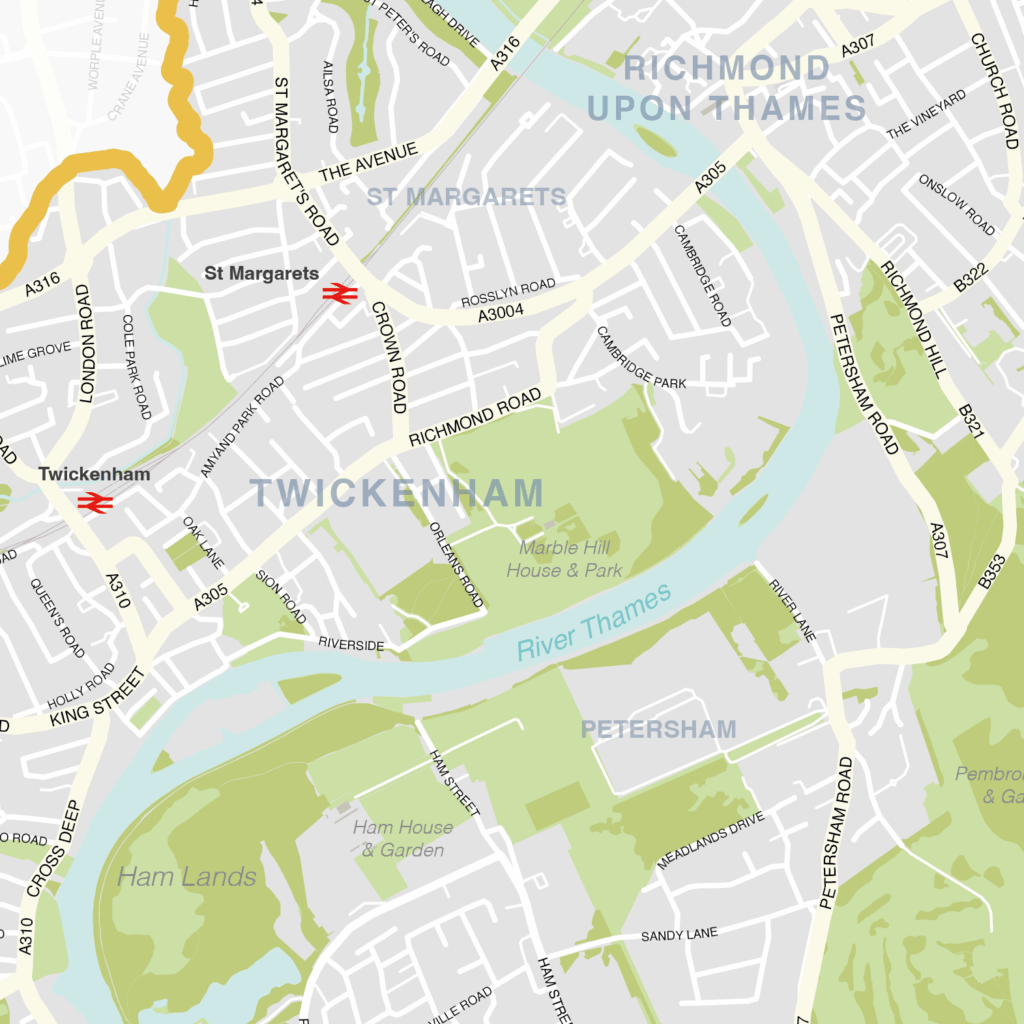
Richmond upon Thames – London borough map
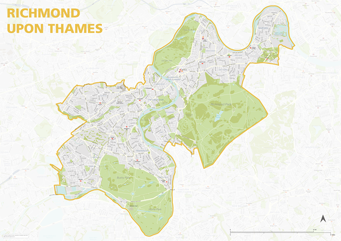
The Richmond upon Thames Borough map focuses on this local authority district in London. It is one of 33 local authority districts in London that make up the full administrative area of Greater London. Our maps of these boroughs can be purchased individually or as an entire set of 33 maps.
The Richmond upon Thames map includes the full road network, the railway lines, and all underground and overground stations. All primary, secondary and minor roads are labelled, as well as the majority of local roads. Prominent open areas, such as parks and woodlands and nature reserves are also shown and labelled, as are significant waterways. The road network, stations and labelling in the neighbouring boroughs is included, but knocked back behind a semi opaque layer to more clearly focus on just Richmond upon Thames. Like any other layer, this can be altered or removed entirely when using the editable versions of the map (see below).
The map is offered in a print-ready format (A1 or larger is recommended), if you are looking for a high-quality print of Richmond upon Thames, and a layered vector file format, suitable for a wide variety of uses in graphic design, marketing, planning and other applications where a bespoke map is required.
The product bundle includes a print-ready high-resolution PDF scaled for A1+ format printing, with the smallest labels legible when printed at A1 or bigger.
Also in the bundle are Adobe Illustrator, SVG and layered PDF file formats suitable for editing in standard vector art software such as Illustrator (see how to edit).
Furthermore, this great value bundle comes with a Limited Free Pass for Maproom’s Dynamic Mapping Suite, which contains online maps and mapping tools. This is a separate system in which you can plot your own locations of interest and feed data dynamically to the Borough of Richmond upon Thames, plus other boroughs, local government and postcode boundary maps.
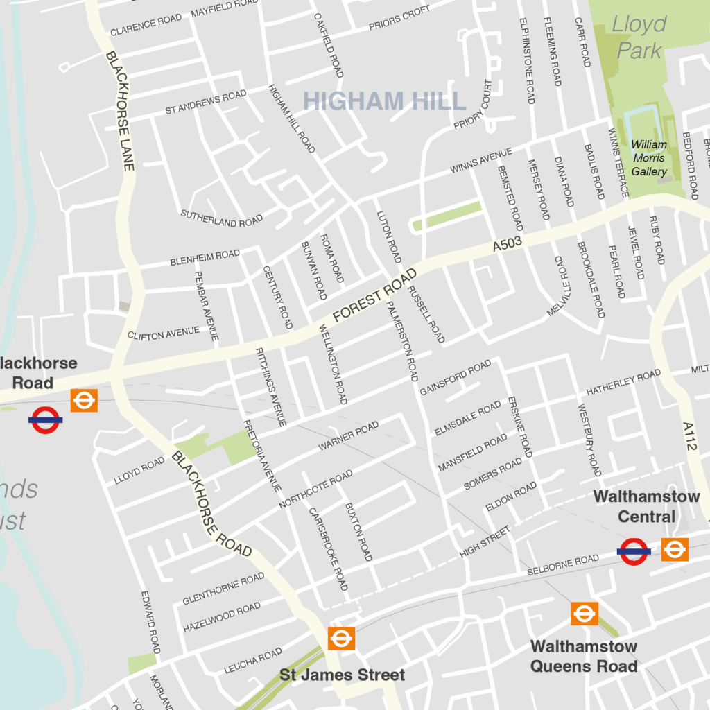
Waltham Forest – London borough map
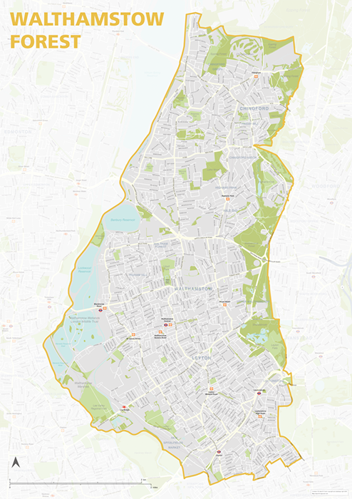
The Waltham Forest Borough map focuses on this local authority district in London. It is one of 33 local authority districts in London that make up the full administrative area of Greater London. Our maps of these boroughs can be purchased individually or as an entire set of 33 maps.
The Waltham Forest map includes the full road network, the railway lines, and all underground and overground stations. All primary, secondary and minor roads are labelled, as well as the majority of local roads. Prominent open areas, such as parks and woodlands and nature reserves are also shown and labelled, as are significant waterways. The road network, stations and labelling in the neighbouring boroughs is included, but knocked back behind a semi opaque layer to more clearly focus on just Waltham Forest. Like any other layer, this can be altered or removed entirely when using the editable versions of the map (see below).
The map is offered in a print-ready format (A1 or larger is recommended), if you are looking for a high-quality print of Waltham Forest, and a layered vector file format, suitable for a wide variety of uses in graphic design, marketing, planning and other applications where a bespoke map is required.
The product bundle includes a print-ready high-resolution PDF scaled for A1+ format printing, with the smallest labels legible when printed at A1 or bigger.
Also in the bundle are Adobe Illustrator, SVG and layered PDF file formats suitable for editing in standard vector art software such as Illustrator (see how to edit).
Furthermore, this great value bundle comes with a Limited Free Pass for Maproom’s Dynamic Mapping Suite, which contains online maps and mapping tools. This is a separate system in which you can plot your own locations of interest and feed data dynamically to the Borough of Waltham Forest, plus other boroughs, local government and postcode boundary maps.
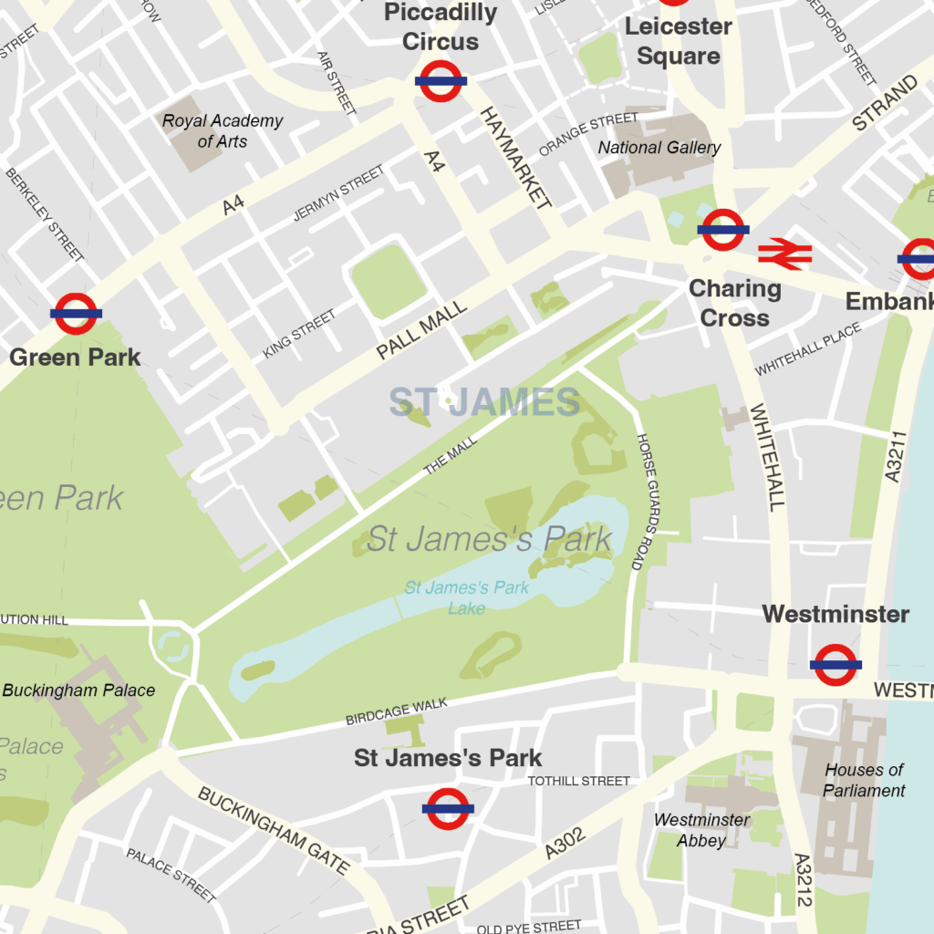
Westminster – London borough map
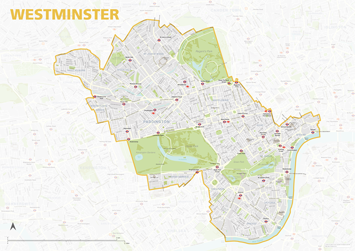
The Westminster Borough map focuses on this local authority district in London. It is one of 33 local authority districts in London that make up the full administrative area of Greater London. Our maps of these boroughs can be purchased individually or as an entire set of 33 maps.
The Westminster map includes the full road network, the railway lines, and all underground and overground stations. All primary, secondary and minor roads are labelled, as well as the majority of local roads. Prominent open areas, such as parks and gardens are also shown and labelled, as are significant bodies of water. The road network, stations and labelling in the neighbouring boroughs is included, but knocked back behind a semi opaque layer to more clearly focus on just Westminster. Like any other layer, this can be altered or removed entirely when using the editable versions of the map (see below).
The map is offered in a print-ready format (A1 or larger is recommended), if you are looking for a high-quality print of Westminster, and a layered vector file format, suitable for a wide variety of uses in graphic design, marketing, planning and other applications where a bespoke map is required.
The product bundle includes a print-ready high-resolution PDF scaled for A1+ format printing, with the smallest labels legible when printed at A1 or bigger.
Also in the bundle are Adobe Illustrator, SVG and layered PDF file formats suitable for editing in standard vector art software such as Illustrator (see how to edit).
Furthermore, this great value bundle comes with a Limited Free Pass for Maproom’s Dynamic Mapping Suite, which contains online maps and mapping tools. This is a separate system in which you can plot your own locations of interest and feed data dynamically to the Borough of Westminster, plus other boroughs, local government and postcode boundary maps.
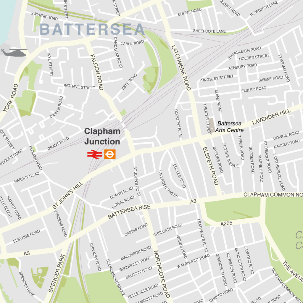
Wandsworth – London borough map
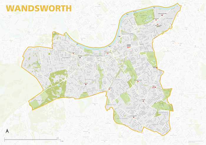
The Wandsworth Borough map focuses on this local authority district in London. It is one of 33 local authority districts in London that make up the full administrative area of Greater London. Our maps of these boroughs can be purchased individually or as an entire set of 33 maps.
The Wandsworth map includes the full road network, the railway lines, and all underground and overground stations. All primary, secondary and minor roads are labelled, as well as the majority of local roads. Prominent open areas, such as parks and woodlands and nature reserves are also shown and labelled, as are significant waterways. The road network, stations and labelling in the neighbouring boroughs is included, but knocked back behind a semi opaque layer to more clearly focus on just Wandsworth. Like any other layer, this can be altered or removed entirely when using the editable versions of the map (see below).
The map is offered in a print-ready format (A1 or larger is recommended), if you are looking for a high-quality print of Wandsworth, and a layered vector file format, suitable for a wide variety of uses in graphic design, marketing, planning and other applications where a bespoke map is required.
The product bundle includes a print-ready high-resolution PDF scaled for A1+ format printing, with the smallest labels legible when printed at A1 or bigger.
Also in the bundle are Adobe Illustrator, SVG and layered PDF file formats suitable for editing in standard vector art software such as Illustrator (see how to edit).
Furthermore, this great value bundle comes with a Limited Free Pass for Maproom’s Dynamic Mapping Suite, which contains online maps and mapping tools. This is a separate system in which you can plot your own locations of interest and feed data dynamically to the Borough of Wandsworth, plus other boroughs, local government and postcode boundary maps.
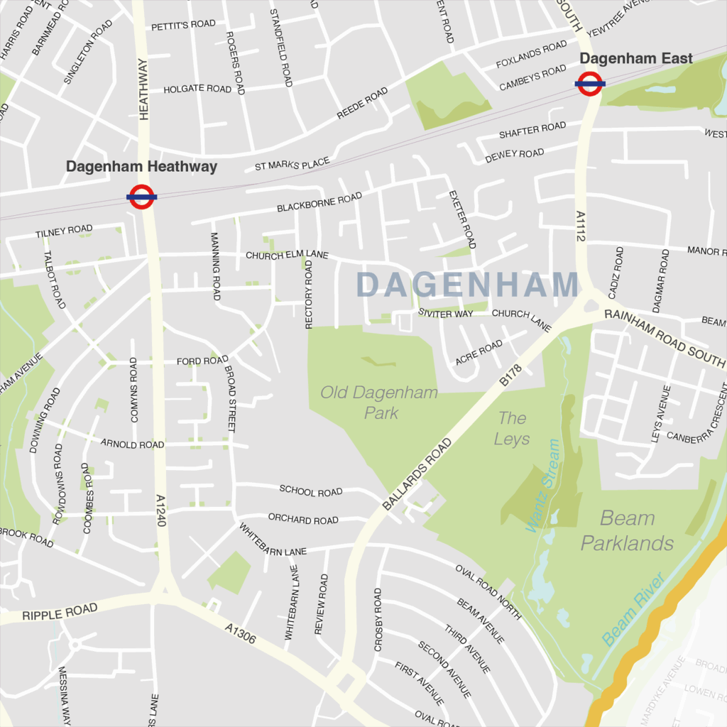
Barking & Dagenham – London borough map
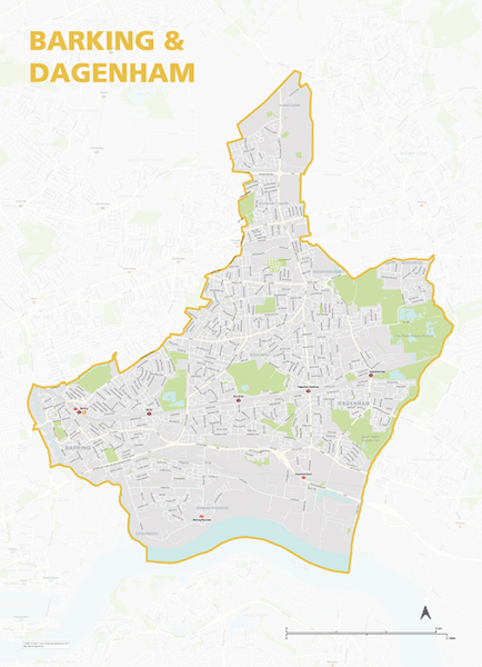
The Barking and Dagenham Borough map focuses on this local authority district in London. It is one of 33 local authority districts in London that make up the full administrative area of Greater London. Our maps of these boroughs can be purchased individually or as an entire set of 33 maps.
The Barking and Dagenham map includes the full road network, the railway lines, and all underground and overground stations. All primary, secondary and minor roads are labelled, as well as the majority of local roads. Prominent open areas, such as parks and woodlands and nature reserves are also shown and labelled, as are significant waterways. The road network, stations and labelling in the neighbouring boroughs is included, but knocked back behind a semi opaque layer to more clearly focus on just Barking & Dagenham. Like any other layer, this can be altered or removed entirely when using the editable versions of the map (see below).
The map is offered in a print-ready format (A1 or larger is recommended), if you are looking for a high-quality print of Barking and Dagenham, and a layered vector file format, suitable for a wide variety of uses in graphic design, marketing, planning and other applications where a bespoke map is required.
The product bundle includes a print-ready high-resolution PDF scaled for A1+ format printing, with the smallest labels legible when printed at A1 or bigger.
Also in the bundle are Adobe Illustrator, SVG and layered PDF file formats suitable for editing in standard vector art software such as Illustrator (see how to edit).
Furthermore, this great value bundle comes with a Limited Free Pass for Maproom’s Dynamic Mapping Suite, which contains online maps and mapping tools. This is a separate system in which you can plot your own locations of interest and feed data dynamically to the Borough of Barking & Dagenham plus other boroughs, local government and postcode boundary maps.
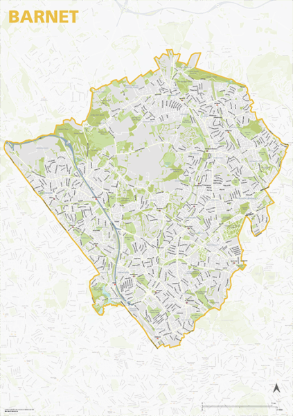
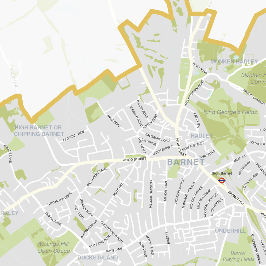
Barnet – London borough map
The Barnet Borough map focuses on this local authority district in London. It is one of 33 local authority districts in London that make up the full administrative area of Greater London. Our maps of these boroughs can be purchased individually or as an entire set of 33 maps.
The Barnet map includes the full road network, the railway lines, and all underground and overground stations. All primary, secondary and minor roads are labelled, as well as the majority of local roads. Prominent open areas, such as parks and woodlands and nature reserves are also shown and labelled, as are significant waterways. The road network, stations and labelling in the neighbouring boroughs is included, but knocked back behind a semi opaque layer to more clearly focus on just Barnet. Like any other layer, this can be altered or removed entirely when using the editable versions of the map (see below).
The map is offered in a print-ready format (A1 or larger is recommended), if you are looking for a high-quality print of Barnet, and a layered vector file format, suitable for a wide variety of uses in graphic design, marketing, planning and other applications where a bespoke map is required.
The product bundle includes a print-ready high-resolution PDF scaled for A1+ format printing, with the smallest labels legible when printed at A1 or bigger.
Also in the bundle are Adobe Illustrator, SVG and layered PDF file formats suitable for editing in standard vector art software such as Illustrator (see how to edit).
Furthermore, this great value bundle comes with a Limited Free Pass for Maproom’s Dynamic Mapping Suite, which contains online maps and mapping tools. This is a separate system in which you can plot your own locations of interest and feed data dynamically to the Borough of Barnet, plus other boroughs, local government and postcode boundary maps.
Demos
Locations Plotter Plot location markers, radii, shapes and lines for anywhere in the world on a choice of base maps. How to use the Locations Plotter World cities with 100-mile radii on 3d base Open Nuclear power plants with filters demo Open Lines demo on monochrome slate base Open Radii with dynamic population, households and […]
About Geocoding
Geocoding is the process of turning standard addresses, such as “10 Downing Street, London”, into precise geographic coordinates that a computer can use for map plotting. Dynamic maps use digital coordinates for latitude and longitude, e.g. 51.5034° N, 0.1276° W for 10 Downing Street. The coordinates are generally expressed as latitude followed by longitude. A […]
Parliamentary Constituencies: compare pre- and post- General Election 2024 boundary changes
The Westminster Parliamentary Constituency boundaries are changing significantly for the next General Election. This map has double active layers as you mouseover or touch scroll, highlighting both the current and future boundaries.
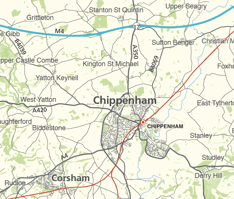
Wiltshire county map
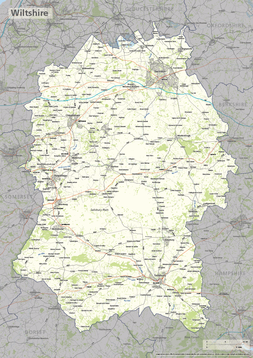
The ceremonial county of Wiltshire is highlighted on this editable vector art map. The towns, villages, roads, railway lines, lakes, rivers, woodland and green spaces of Wiltshire are all included in a default easy-to-read neutral colour scheme suitable for a wide variety of uses in graphic design, marketing, planning and other applications.
The product bundle includes a print-ready high-resolution PDF scaled for A-format printing, with the smallest labels legible when printed at A3 or bigger.
Also in the bundle are Adobe Illustrator, SVG and layered PDF file formats suitable for editing in standard vector art software (see how to edit).
Furthermore, this great value bundle comes with a Limited Free Pass for Maproom’s Dynamic Mapping Suite, which contains online maps and mapping tools. This is a separate system in which you can plot your own locations of interest and feed data dynamically to Wiltshire plus other counties, local government and postcode boundary maps.
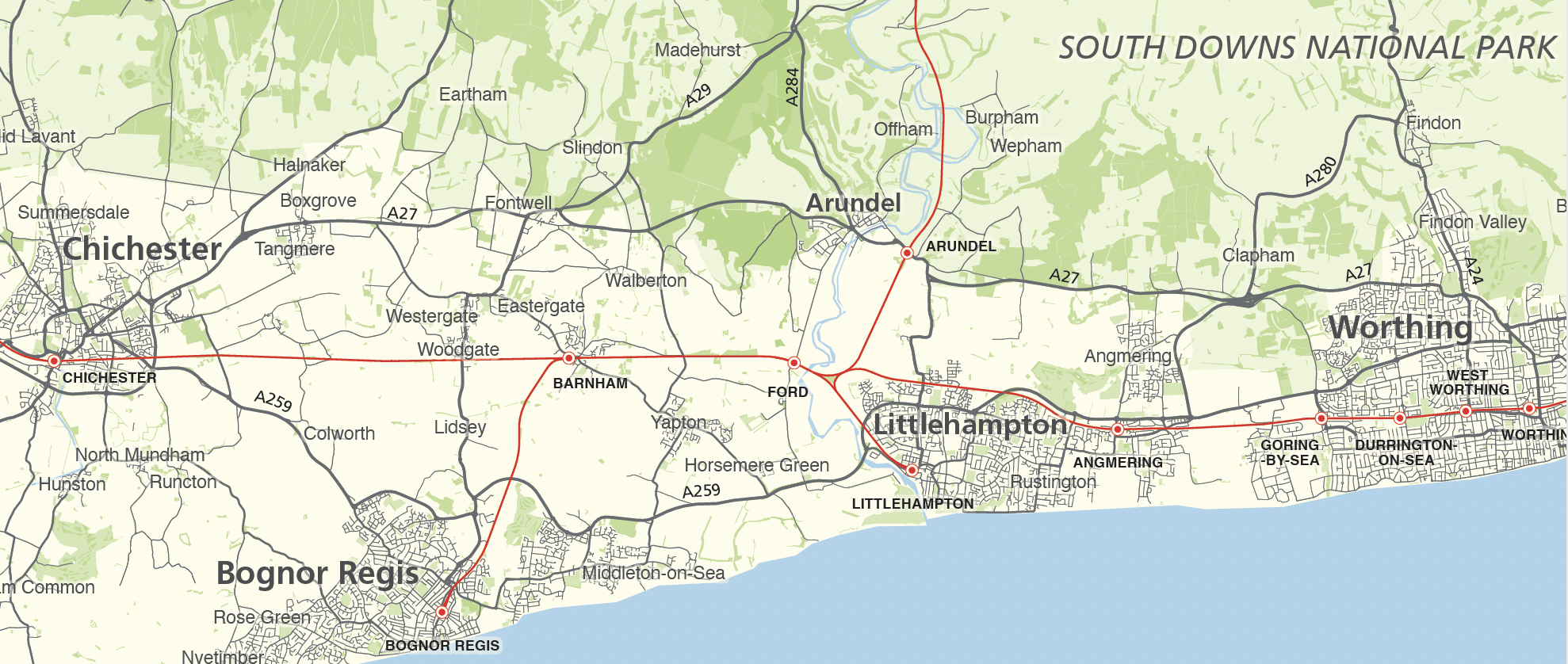
West Sussex county map
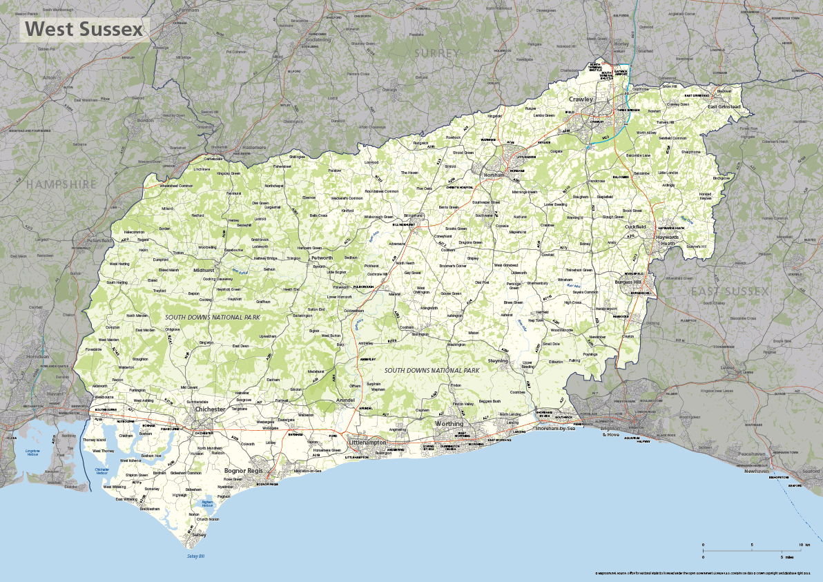
The ceremonial county of West Sussex is highlighted on this editable vector art map. The towns, villages, roads, railway lines, lakes, rivers, woodland and green spaces of West Sussex are all included in a default easy-to-read neutral colour scheme suitable for a wide variety of uses in graphic design, marketing, planning and other applications.
The product bundle includes a print-ready high-resolution PDF scaled for A-format printing, with the smallest labels legible when printed at A3 or bigger.
Also in the bundle are Adobe Illustrator, SVG and layered PDF file formats suitable for editing in standard vector art software (see how to edit).
Furthermore, this great value bundle comes with a Limited Free Pass for Maproom’s Dynamic Mapping Suite, which contains online maps and mapping tools. This is a separate system in which you can plot your own locations of interest and feed data dynamically to West Sussex plus other counties, local government and postcode boundary maps.
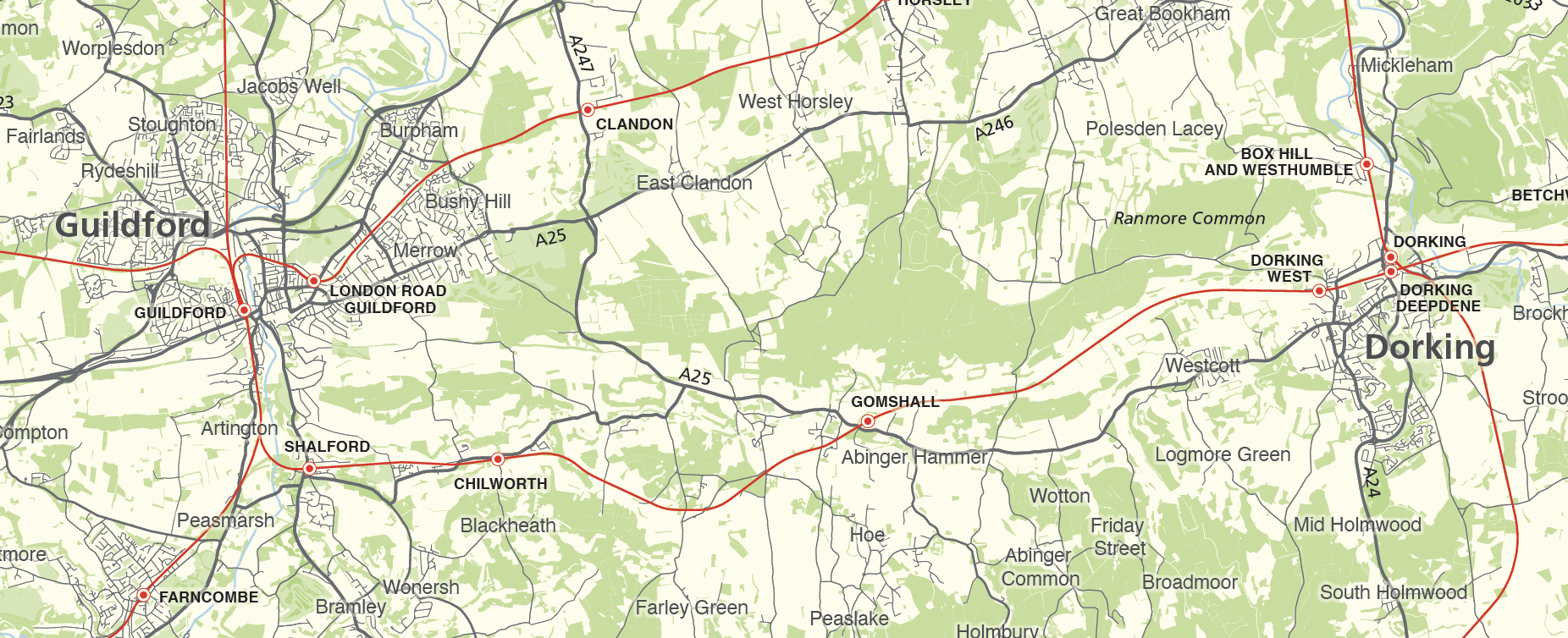
Surrey county map
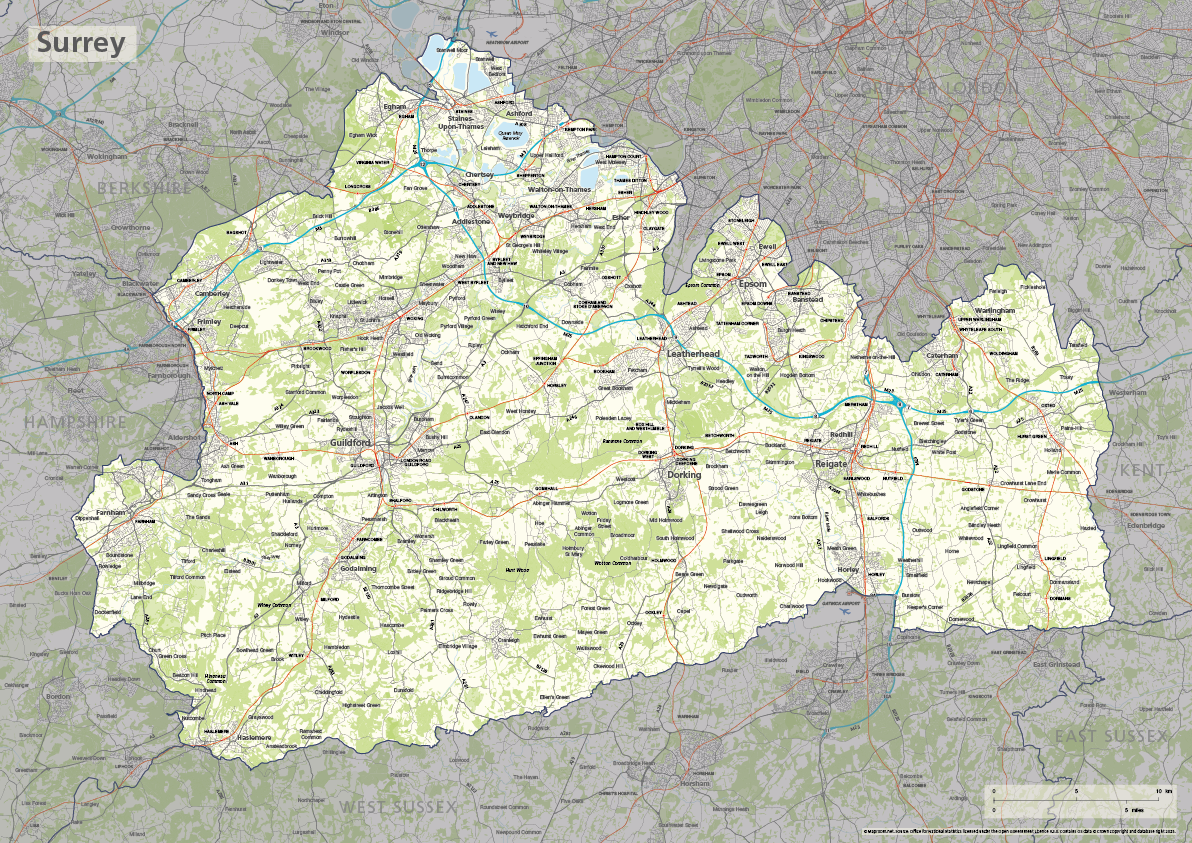
The ceremonial county of Surrey is highlighted on this editable vector art map. The towns, villages, roads, railway lines, lakes, rivers, woodland and green spaces of Surrey are all included in a default easy-to-read neutral colour scheme suitable for a wide variety of uses in graphic design, marketing, planning and other applications.
The product bundle includes a print-ready high-resolution PDF scaled for A-format printing, with the smallest labels legible when printed at A3 or bigger.
Also in the bundle are Adobe Illustrator, SVG and layered PDF file formats suitable for editing in standard vector art software (see how to edit).
Furthermore, this great value bundle comes with a Limited Free Pass for Maproom’s Dynamic Mapping Suite, which contains online maps and mapping tools. This is a separate system in which you can plot your own locations of interest and feed data dynamically to Surrey plus other counties, local government and postcode boundary maps.
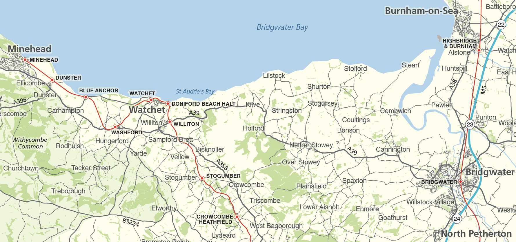
Somerset county map
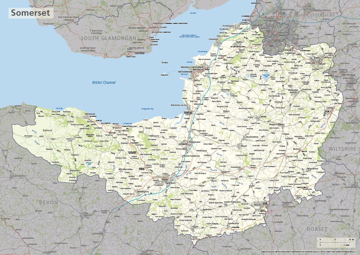
The ceremonial county of Somerset is highlighted on this editable vector art map. The towns, villages, roads, railway lines, lakes, rivers, woodland and green spaces of Somerset are all included in a default easy-to-read neutral colour scheme suitable for a wide variety of uses in graphic design, marketing, planning and other applications.
The product bundle includes a print-ready high-resolution PDF scaled for A-format printing, with the smallest labels legible when printed at A3 or bigger.
Also in the bundle are Adobe Illustrator, SVG and layered PDF file formats suitable for editing in standard vector art software (see how to edit).
Furthermore, this great value bundle comes with a Limited Free Pass for Maproom’s Dynamic Mapping Suite, which contains online maps and mapping tools. This is a separate system in which you can plot your own locations of interest and feed data dynamically to Somerset plus other counties, local government and postcode boundary maps.
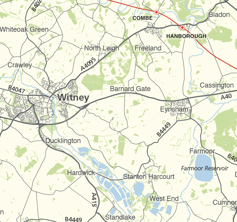
Oxfordshire county map
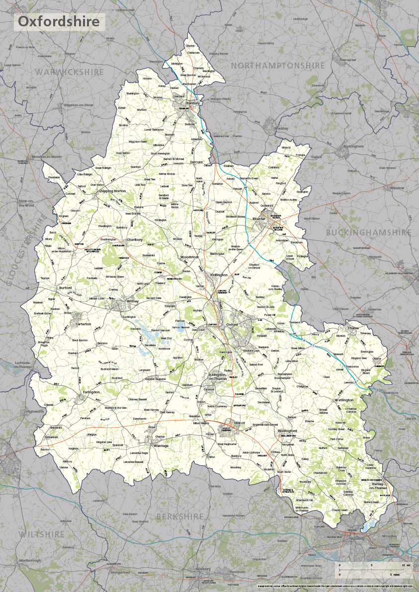
The ceremonial county of Oxfordshire is highlighted on this editable vector art map. The towns, villages, roads, railway lines, lakes, rivers, woodland and green spaces of Oxfordshire are all included in a default easy-to-read neutral colour scheme suitable for a wide variety of uses in graphic design, marketing, planning and other applications.
The product bundle includes a print-ready high-resolution PDF scaled for A-format printing, with the smallest labels legible when printed at A3 or bigger.
Also in the bundle are Adobe Illustrator, SVG and layered PDF file formats suitable for editing in standard vector art software (see how to edit).
Furthermore, this great value bundle comes with a Limited Free Pass for Maproom’s Dynamic Mapping Suite, which contains online maps and mapping tools. This is a separate system in which you can plot your own locations of interest and feed data dynamically to Oxfordshire plus other counties, local government and postcode boundary maps.
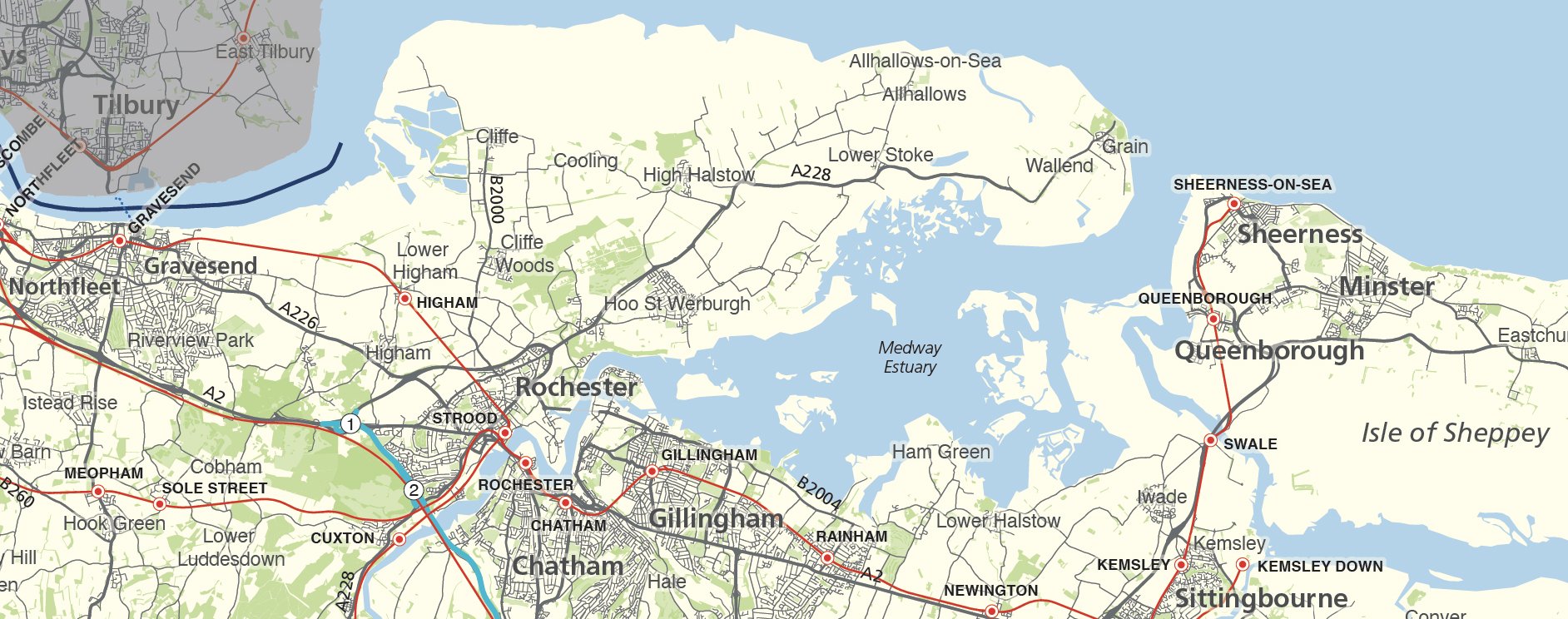
Kent county map

The ceremonial county of Kent is highlighted on this editable vector art map. The towns, villages, roads, railway lines, lakes, rivers, woodland and green spaces of Kent are all included in a default easy-to-read neutral colour scheme suitable for a wide variety of uses in graphic design, marketing, planning and other applications.
The product bundle includes a print-ready high-resolution PDF scaled for A-format printing, with the smallest labels legible when printed at A3 or bigger.
Also in the bundle are Adobe Illustrator, SVG and layered PDF file formats suitable for editing in standard vector art software (see how to edit).
Furthermore, this great value bundle comes with a Limited Free Pass for Maproom’s Dynamic Mapping Suite, which contains online maps and mapping tools. This is a separate system in which you can plot your own locations of interest and feed data dynamically to Kent plus other counties, local government and postcode boundary maps.
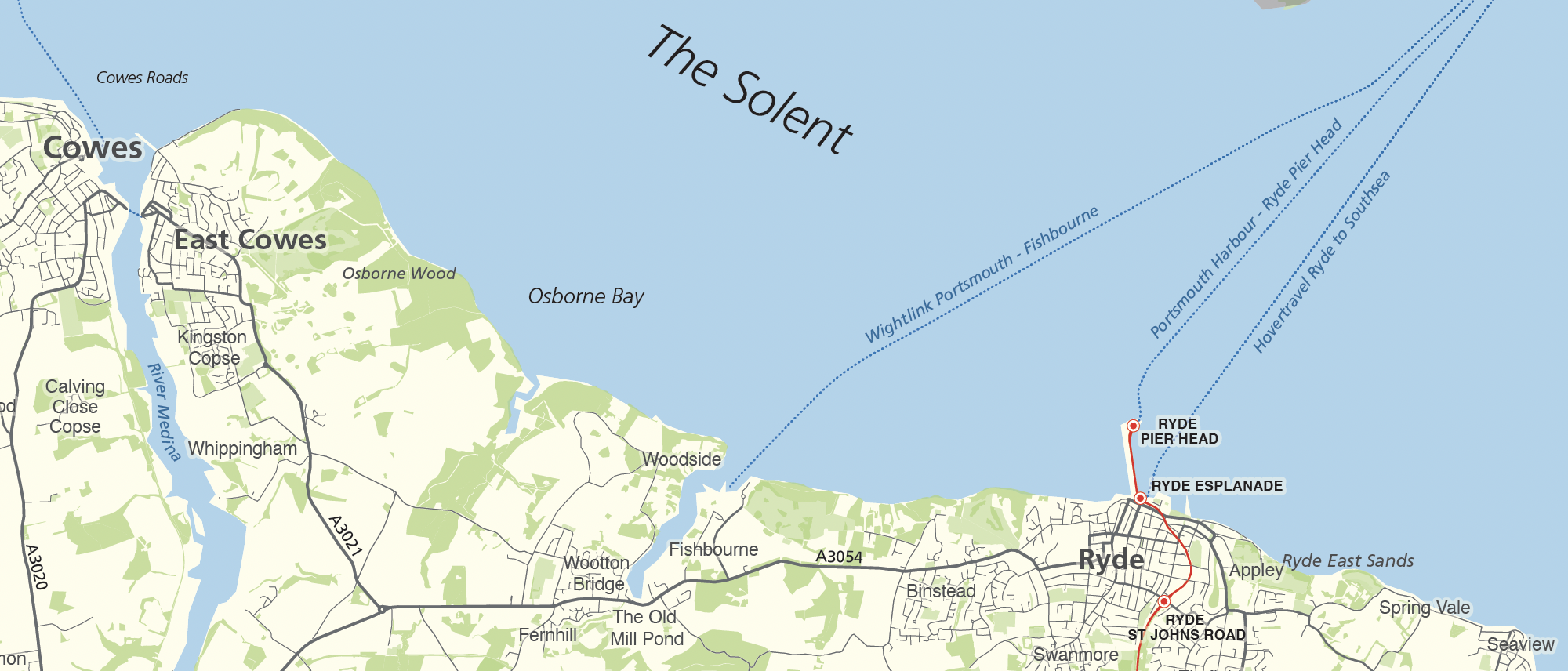
Isle of Wight map
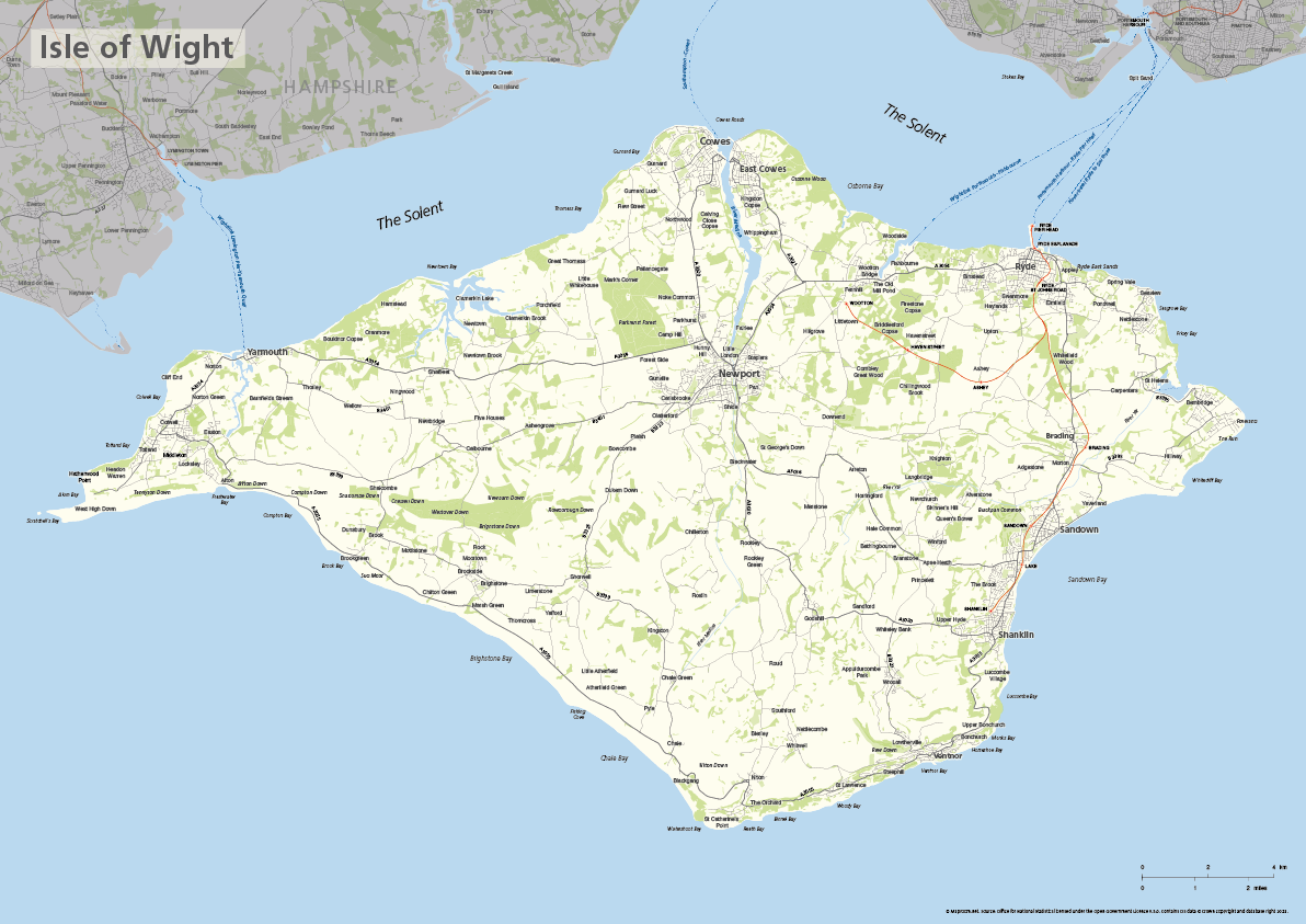
The Isle of Wight is a ceremonial county in its own right (separated from the ceremonial county of Hampshire in 1974) and highlighted on this editable vector art map. The towns, villages, roads, railway lines, lakes, rivers, woodland and green spaces of the Isle of Wight are all included in a default easy-to-read neutral colour scheme suitable for a wide variety of uses in graphic design, marketing, planning and other applications.
The product bundle includes a print-ready high-resolution PDF scaled for A-format printing, with the smallest labels legible when printed at A3 or bigger.
Also in the bundle are Adobe Illustrator, SVG and layered PDF file formats suitable for editing in standard vector art software (see how to edit).
Furthermore, this great value bundle comes with a Limited Free Pass for Maproom’s Dynamic Mapping Suite, which contains online maps and mapping tools. This is a separate system in which you can plot your own locations of interest and feed data dynamically to the Isle of Wight plus other ceremonial counties, local government and postcode boundary maps.
Hertfordshire county map
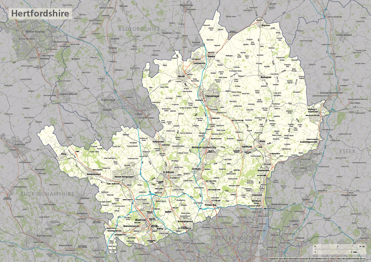
The ceremonial county of Hertfordshire is highlighted on this editable vector art map. The towns, villages, roads, railway lines, lakes, rivers, woodland and green spaces of Hertfordshire are all included in a default easy-to-read neutral colour scheme suitable for a wide variety of uses in graphic design, marketing, planning and other applications.
The product bundle includes a print-ready high-resolution PDF scaled for A-format printing, with the smallest labels legible when printed at A3 or bigger.
Also in the bundle are Adobe Illustrator, SVG and layered PDF file formats suitable for editing in standard vector art software (see how to edit).
Furthermore, this great value bundle comes with a Limited Free Pass for Maproom’s Dynamic Mapping Suite, which contains online maps and mapping tools. This is a separate system in which you can plot your own locations of interest and feed data dynamically to Hertfordshire plus other counties, local government and postcode boundary maps.
Hampshire county map
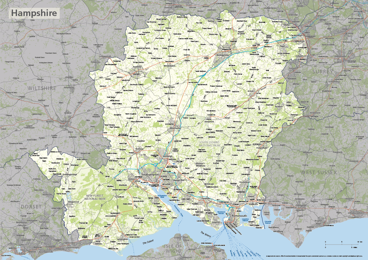
The ceremonial county of Hampshire is highlighted on this editable vector art map. The towns, villages, roads, railway lines, lakes, rivers, woodland and green spaces of Hampshire are all included in a default easy-to-read neutral colour scheme suitable for a wide variety of uses in graphic design, marketing, planning and other applications.
The product bundle includes a print-ready high-resolution PDF scaled for A-format printing, with the smallest labels legible when printed at A3 or bigger.
Also in the bundle are Adobe Illustrator, SVG and layered PDF file formats suitable for editing in standard vector art software (see how to edit).
Furthermore, this great value bundle comes with a Limited Free Pass for Maproom’s Dynamic Mapping Suite, which contains online maps and mapping tools. This is a separate system in which you can plot your own locations of interest and feed data dynamically to Hampshire plus other counties, local government and postcode boundary maps.
See also the Isle of Wight map, which has been a separate ceremonial county from Hampshire since 1974.
Gloucestershire county map
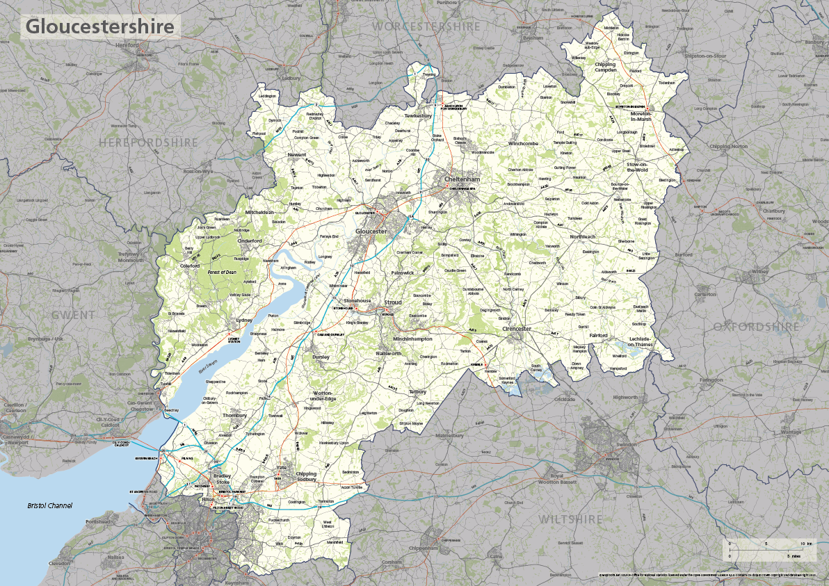
The ceremonial county of Gloucestershire is highlighted on this editable vector art map. The towns, villages, roads, railway lines, lakes, rivers, woodland and green spaces of Gloucestershire are all included in a default easy-to-read neutral colour scheme suitable for a wide variety of uses in graphic design, marketing, planning and other applications.
The product bundle includes a print-ready high-resolution PDF scaled for A-format printing, with the smallest labels legible when printed at A3 or bigger.
Also in the bundle are Adobe Illustrator, SVG and layered PDF file formats suitable for editing in standard vector art software (see how to edit).
Furthermore, this great value bundle comes with a Limited Free Pass for Maproom’s Dynamic Mapping Suite, which contains online maps and mapping tools. This is a separate system in which you can plot your own locations of interest and feed data dynamically to Gloucestershire plus other counties, local government and postcode boundary maps.
Essex county map
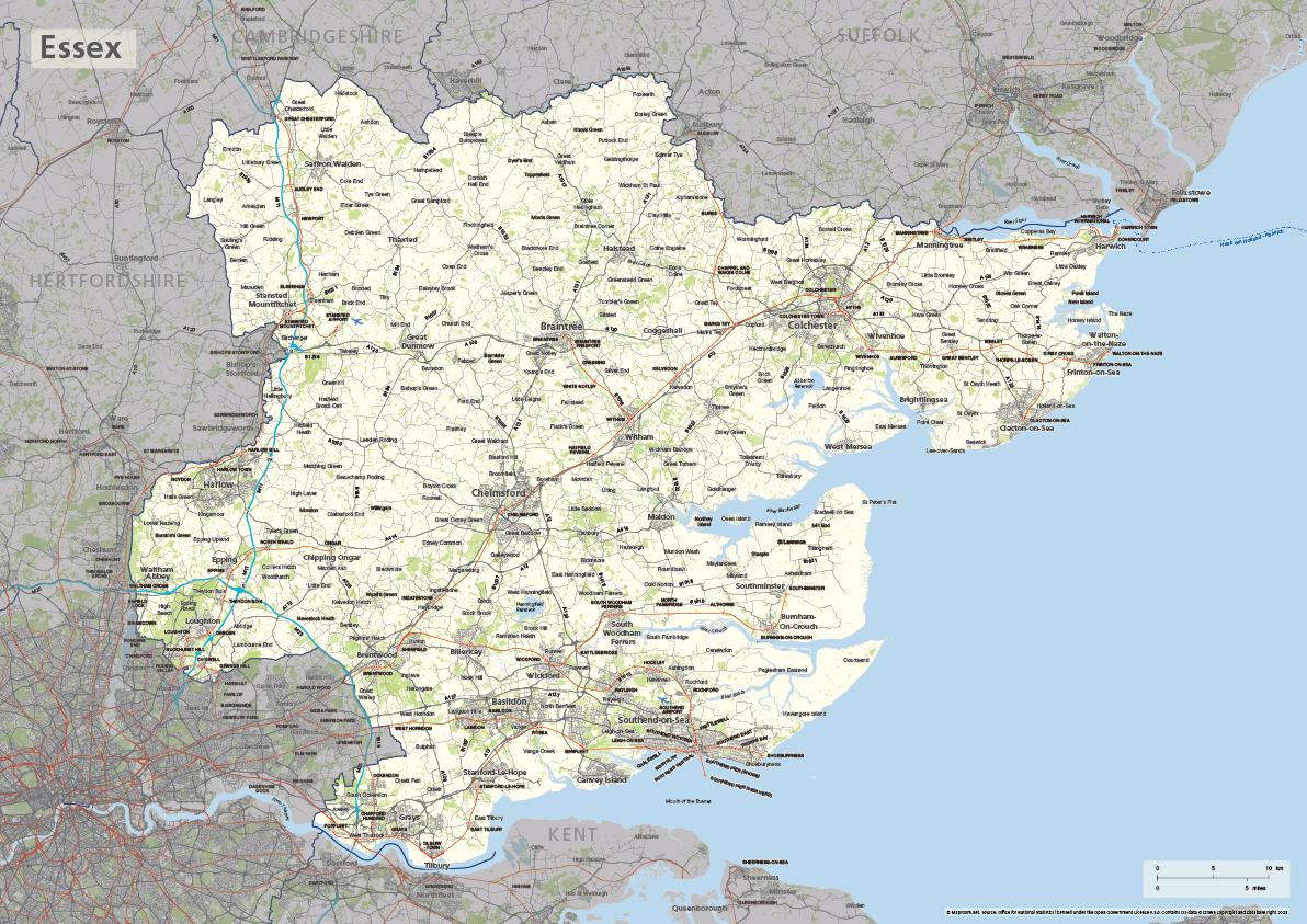
The ceremonial county of Essex is highlighted on this editable vector art map. The towns, villages, roads, railway lines, lakes, rivers, woodland and green spaces of Essex are all included in a default easy-to-read neutral colour scheme suitable for a wide variety of uses in graphic design, marketing, planning and other applications.
The product bundle includes a print-ready high-resolution PDF scaled for A-format printing, with the smallest labels legible when printed at A3 or bigger.
Also in the bundle are Adobe Illustrator, SVG and layered PDF file formats suitable for editing in standard vector art software (see how to edit).
Furthermore, this great value bundle comes with a Limited Free Pass for Maproom’s Dynamic Mapping Suite, which contains online maps and mapping tools. This is a separate system in which you can plot your own locations of interest and feed data dynamically to Essex plus other counties, local government and postcode boundary maps.

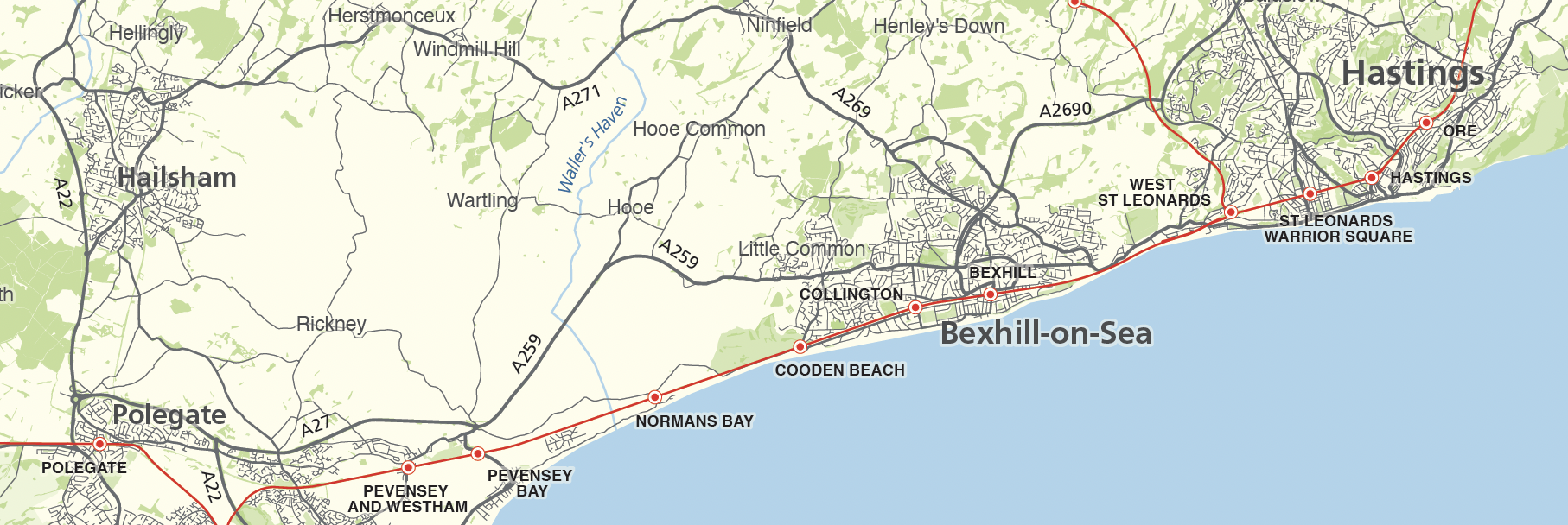
East Sussex county map
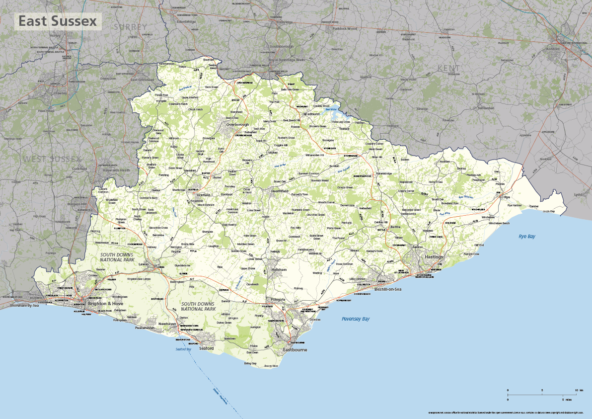
The ceremonial county of East Sussex is highlighted on this editable vector art map. The towns, villages, roads, railway lines, lakes, rivers, woodland and green spaces of East Sussex are all included in a default easy-to-read neutral colour scheme suitable for a wide variety of uses in graphic design, marketing, planning and other applications.
The product bundle includes a print-ready high-resolution PDF scaled for A-format printing, with the smallest labels legible when printed at A3 or bigger.
Also in the bundle are Adobe Illustrator, SVG and layered PDF file formats suitable for editing in standard vector art software (see how to edit).
Furthermore, this great value bundle comes with a Limited Free Pass for Maproom’s Dynamic Mapping Suite, which contains online maps and mapping tools. This is a separate system in which you can plot your own locations of interest and feed data dynamically to East Sussex plus other counties, local government and postcode boundary maps.
Dorset county map
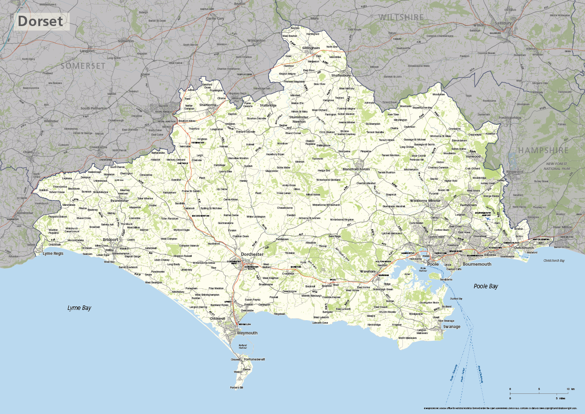
The ceremonial county of Dorset is highlighted on this editable vector art map. The towns, villages, roads, railway lines, lakes, rivers, woodland and green spaces of Dorset are all included in a default easy-to-read neutral colour scheme suitable for a wide variety of uses in graphic design, marketing, planning and other applications.
The product bundle includes a print-ready high-resolution PDF scaled for A-format printing, with the smallest labels legible when printed at A3 or bigger.
Also in the bundle are Adobe Illustrator, SVG and layered PDF file formats suitable for editing in standard vector art software (see how to edit).
Furthermore, this great value bundle comes with a Limited Free Pass for Maproom’s Dynamic Mapping Suite, which contains online maps and mapping tools. This is a separate system in which you can plot your own locations of interest and feed data dynamically to Dorset plus other counties, local government and postcode boundary maps.
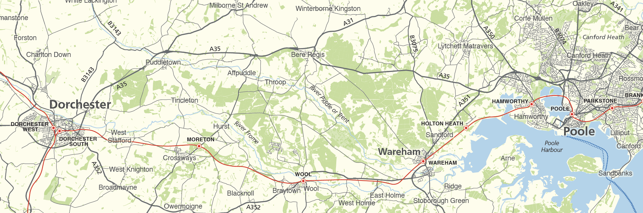
Devon county map

The ceremonial county of Devon is highlighted on this editable vector art map. The towns, villages, roads, railway lines, lakes, rivers, woodland and green spaces of Devon are all included in a default easy-to-read neutral colour scheme suitable for a wide variety of uses in graphic design, marketing, planning and other applications.
The product bundle includes a print-ready high-resolution PDF scaled for A-format printing, with the smallest labels legible when printed at A3 or bigger.
Also in the bundle are Adobe Illustrator, SVG and layered PDF file formats suitable for editing in standard vector art software (see how to edit).
Furthermore, this great value bundle comes with a Limited Free Pass for Maproom’s Dynamic Mapping Suite, which contains online maps and mapping tools. This is a separate system in which you can plot your own locations of interest and feed data dynamically to Devon plus other counties, local government and postcode boundary maps.
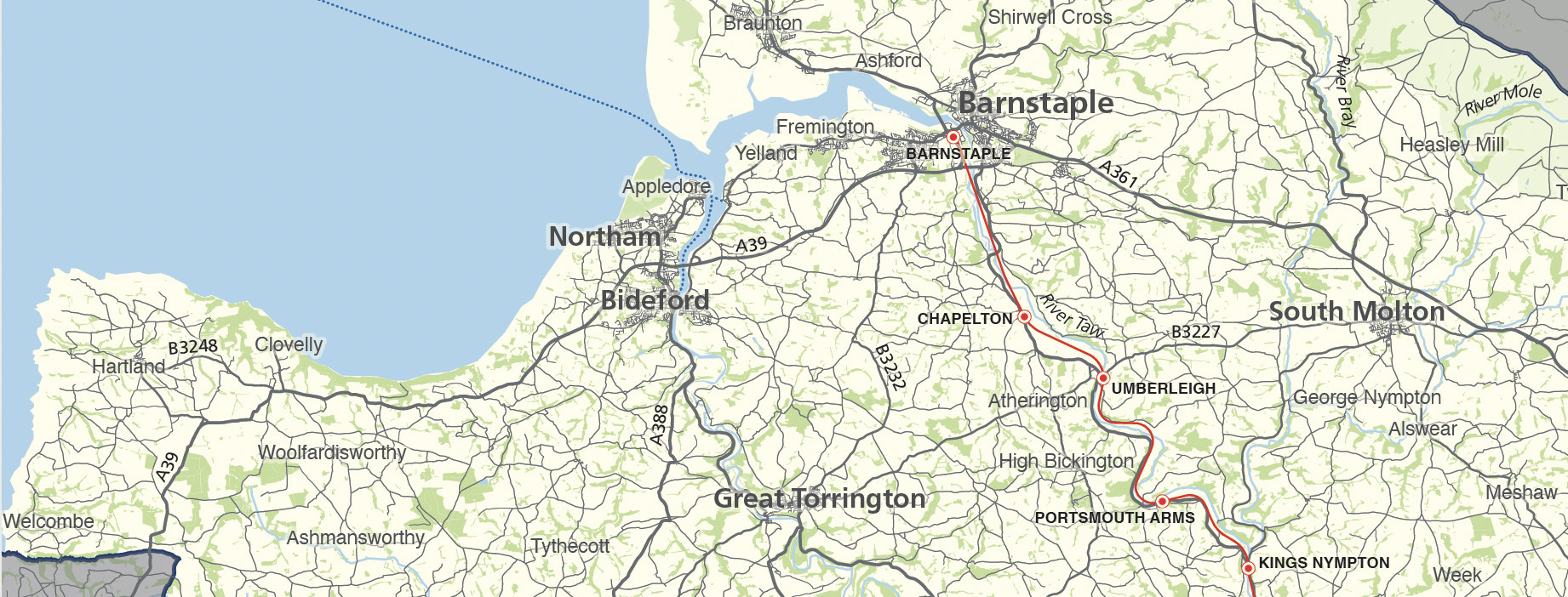
Cornwall county map with Isles of Scilly
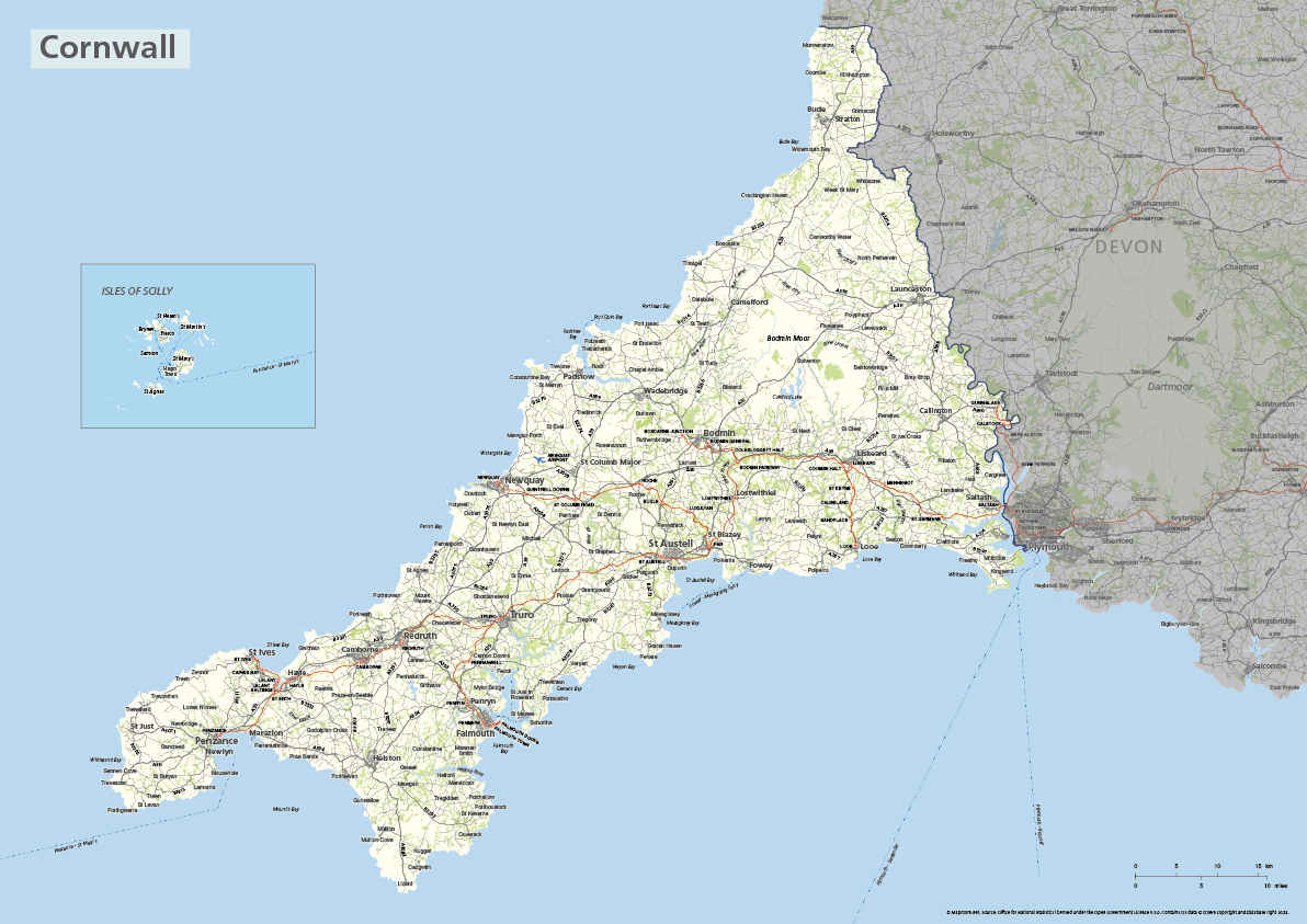
The ceremonial county of Cornwall is highlighted on this editable vector art map. The towns, villages, roads, railway lines, lakes, rivers, woodland and green spaces of Cornwall are all included in a default easy-to-read neutral colour scheme suitable for a wide variety of uses in graphic design, marketing, planning and other applications.
The product bundle includes two print-ready high-resolution PDFs. One version has the Isles of Scilly in its natural geographic position. The other version has the Isles of Scilly in an inset box and is scaled for A-format printing. The smallest labels are legible when printed at A3 or bigger.
Also in the bundle are Adobe Illustrator, SVG and layered PDF file formats suitable for editing in standard vector art software (see how to edit).
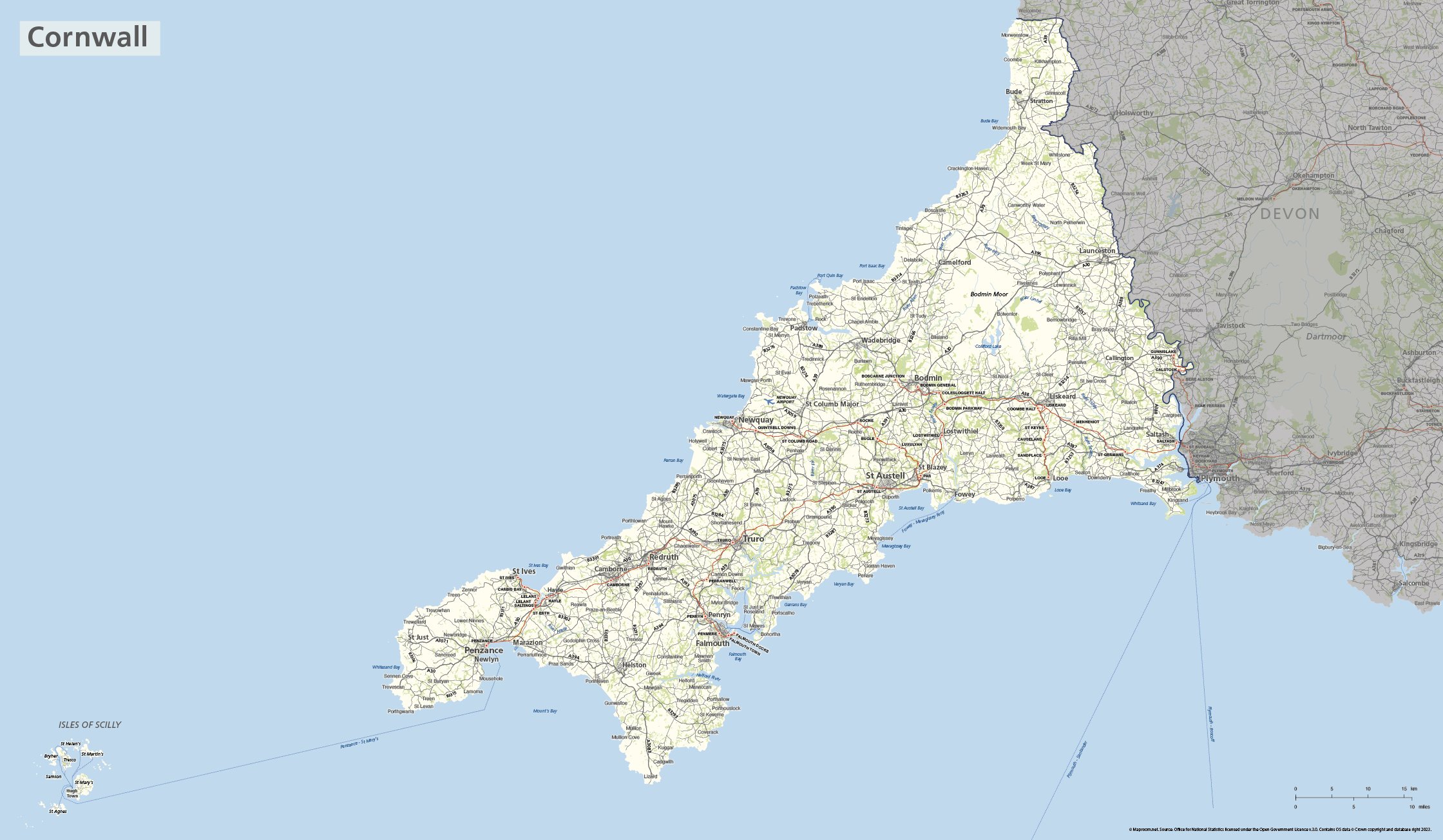

In addition to the downloadable artwork file versions supplied, this great value bundle also comes with a Limited Free Pass for Maproom’s Dynamic Mapping Suite, which contains online maps and mapping tools. This is a separate system in which you can plot your own locations of interest and feed data dynamically to Cornwall plus other counties, local government and postcode boundary maps.
Buckinghamshire county map

The ceremonial county of Buckinghamshire is highlighted on this editable vector art map. The towns, villages, roads, railway lines, lakes, rivers, woodland and green spaces of Buckinghamshire are all included in a default easy-to-read neutral colour scheme suitable for a wide variety of uses in graphic design, marketing, planning and other applications.
The product bundle includes a print-ready high-resolution PDF scaled for A-format printing, with the smallest labels legible when printed at A3 or bigger.
Also in the bundle are Adobe Illustrator, SVG and layered PDF file formats suitable for editing in standard vector art software (see how to edit).
Furthermore, this great value bundle comes with a Limited Free Pass for Maproom’s Dynamic Mapping Suite, which contains online maps and mapping tools. This is a separate system in which you can plot your own locations of interest and feed data dynamically to Buckinghamshire plus other counties, local government and postcode boundary maps.
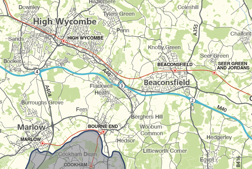
Bristol county map
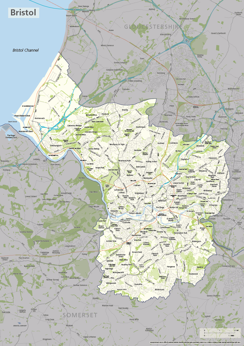
The ceremonial county and unitary authority of Bristol is highlighted on this editable vector art map. The towns, villages, roads, railway lines, lakes, rivers, woodland and green spaces of Bristol are all included in a default easy-to-read neutral colour scheme suitable for a wide variety of uses in graphic design, marketing, planning and other applications.
The product bundle includes a print-ready high-resolution PDF scaled for A-format printing, with the smallest labels legible when printed at A3 or bigger.
Also in the bundle are Adobe Illustrator, SVG and layered PDF file formats suitable for editing in standard vector art software (see how to edit).
Furthermore, this great value bundle comes with a Limited Free Pass for Maproom’s Dynamic Mapping Suite, which contains online maps and mapping tools. This is a separate system in which you can plot your own locations of interest and feed data dynamically to Bristol plus other counties, local government and postcode boundary maps.
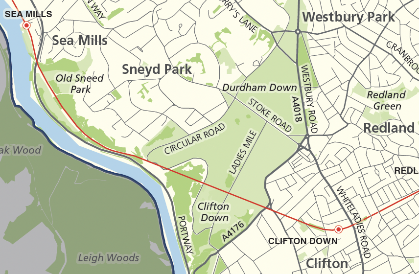
Berkshire county map
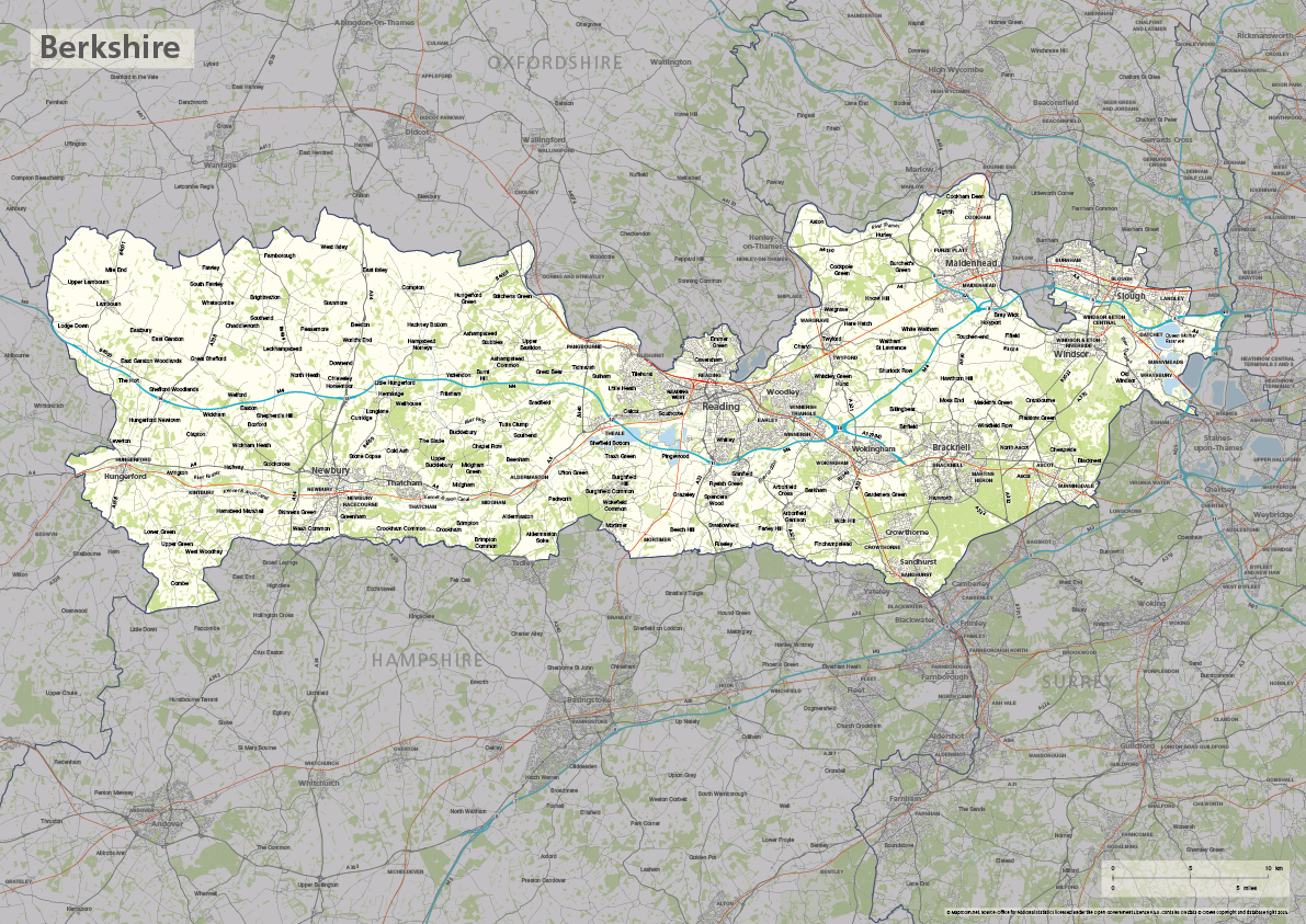
The ceremonial county of Berkshire is highlighted on this editable vector art map. The towns, villages, roads, railway lines, lakes, rivers, woodland and green spaces of Berkshire are all included in a default easy-to-read neutral colour scheme suitable for a wide variety of uses in graphic design, marketing, planning and other applications.
The product bundle includes a print-ready high-resolution PDF scaled for A-format printing, with the smallest labels legible when printed at A3 or bigger.
Also in the bundle are Adobe Illustrator, SVG and layered PDF file formats suitable for editing in standard vector art software (see how to edit).
Furthermore, this great value bundle comes with a Limited Free Pass for Maproom’s Dynamic Mapping Suite, which contains online maps and mapping tools. This is a separate system in which you can plot your own locations of interest and feed data dynamically to Berkshire and its unitary authorities, plus other counties and local government areas, and postcode boundary maps.
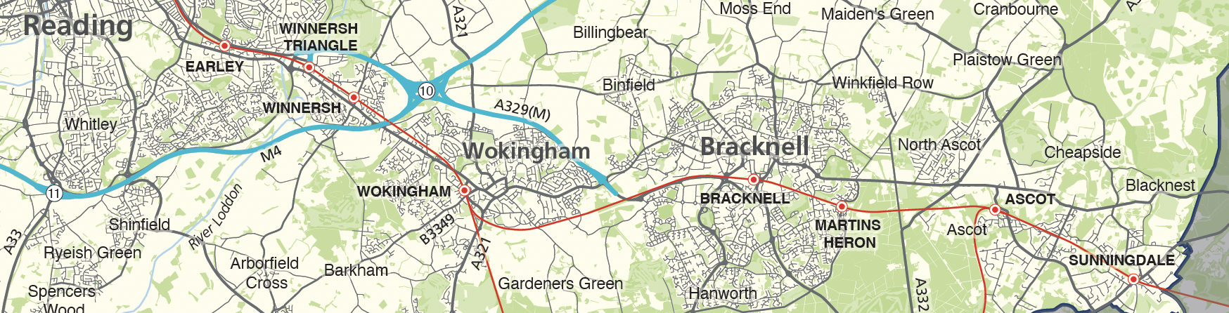
Bedfordshire county map
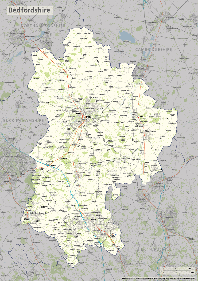
The ceremonial county of Bedfordshire is highlighted on this editable vector art map. The towns, villages, roads, railway lines, lakes, rivers, woodland and green spaces of Bedfordshire are all included in a default easy-to-read neutral colour scheme suitable for a wide variety of uses in graphic design, marketing, planning and other applications.
The product bundle includes a print-ready high-resolution PDF scaled for A-format printing, with the smallest labels legible when printed at A3 or bigger.
Also in the bundle are Adobe Illustrator, SVG and layered PDF file formats suitable for editing in standard vector art software (see how to edit).
Furthermore, this great value bundle comes with a Limited Free Pass for Maproom’s Dynamic Mapping Suite, which contains online maps and mapping tools. This is a separate system in which you can plot your own locations of interest and feed data dynamically to Bedfordshire plus other counties, local government and postcode boundary maps.
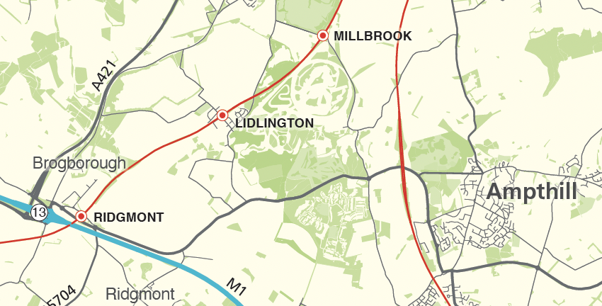
New Local Authorities maps from April 2023 – Cumberland, Westmorland and Furness, North Yorkshire and Somerset
We have updated all our Local Authority map bases in line with changes that have come into effect on 1 April 2023. As far as we can see, we have actually beaten the Government itself in issuing the new boundary data!
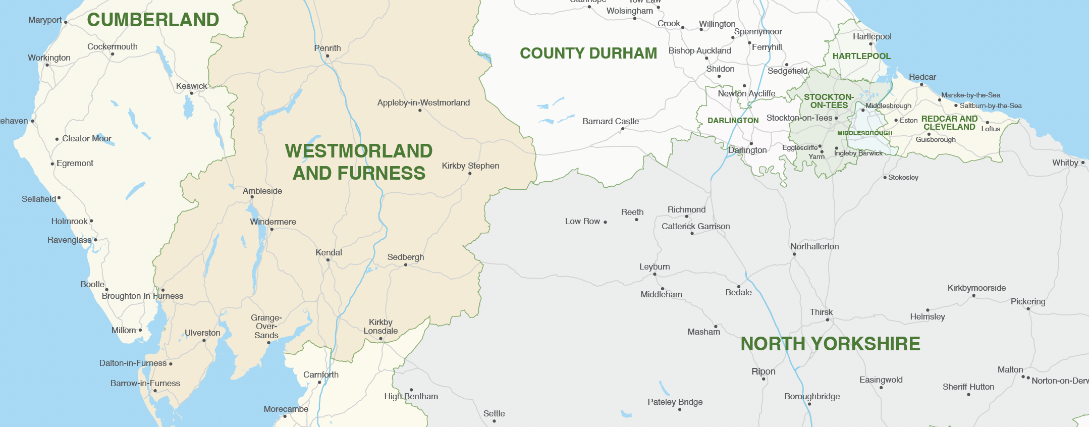
The changes are as follows:
Cumberland – formerly Allerdale, Carlisle, Copeland
Westmorland and Furness – formerly Barrow-in-Furness, Eden, South Lakeland
North Yorkshire – formerly Craven, Hambleton, Harrogate, Richmondshire, Ryedale, Scarborough, Selby
Somerset – formerly Mendip, Sedgemoor, Somerset West and Taunton, South Somerset
We sell two vector art packages for the Local Authorities: one juxtaposed with postcodes and the other without. Both are bundled with a premium pass for the Dynamic Mapping Suite, which contains interactive online maps of the new Local Authorities with advanced search. Users can colour and caption the Local Authorities online with their own data.
If you have data you want to feed to the old Local Authorities, before the April 2023 mergers in Cumbria, Yorkshire and Somerset, we have included an older version in both the download package and in the spreadsheets to polygons system in the Dynamic Mapping Suite. This is handy if, for example, your data relates to the 2021 census.
For more details see UK local authorities maps.
Connecting a Google Sheet
If you are making frequent changes to your spreadsheet, consider using Google Sheets to connect it with the map. Then, every change you make will feed instantly to the map, allowing the map to change labels and colours on the fly. We highly recommend this method. NOTE ABOUT PRIVACY: Your spreadsheet data will be on […]
Choropleth heat maps
You've come to the right place if you want to show your data in the form of a heat map with interactive shapes. A "choropleth map", as this is called, shows administrative areas with aggregated data coloured in bands. We add interactivity to a choropleth map by feeding the data to each area. Tap or slide over the local authorities, key and listings for statistics. The choropleth maps on this page were created directly in our Dynamic Mapping Suite.
Bases available for choropleth heat maps with dynamic data feeds
- Local authorities
- Parliamentary constituencies
- Counties, London boroughs, unitary authorities and metropolitan and non-metropolitan districts
- Postcode districts and sectors
- Health geographies, wards, output areas, police force areas and other ONS boundaries on request
Our 3d map of British and Irish mountains is an immersive demo of new techniques with advanced satellite imagery and filters
Mapbox – our favourite dynamic mapping base system – released a new system based on Maxar satellite imagery last year, whereby geospatial developers such as us can tap into elevation and projection for satellite views layered with our own points, lines and polygons. We have experimented with the new 3d system in conjunction with our own techniques developed for listing and filtering, and come up with a rather sublime demo using data from The Database of British and Irish Hills.
Open full-size dynamic mountains map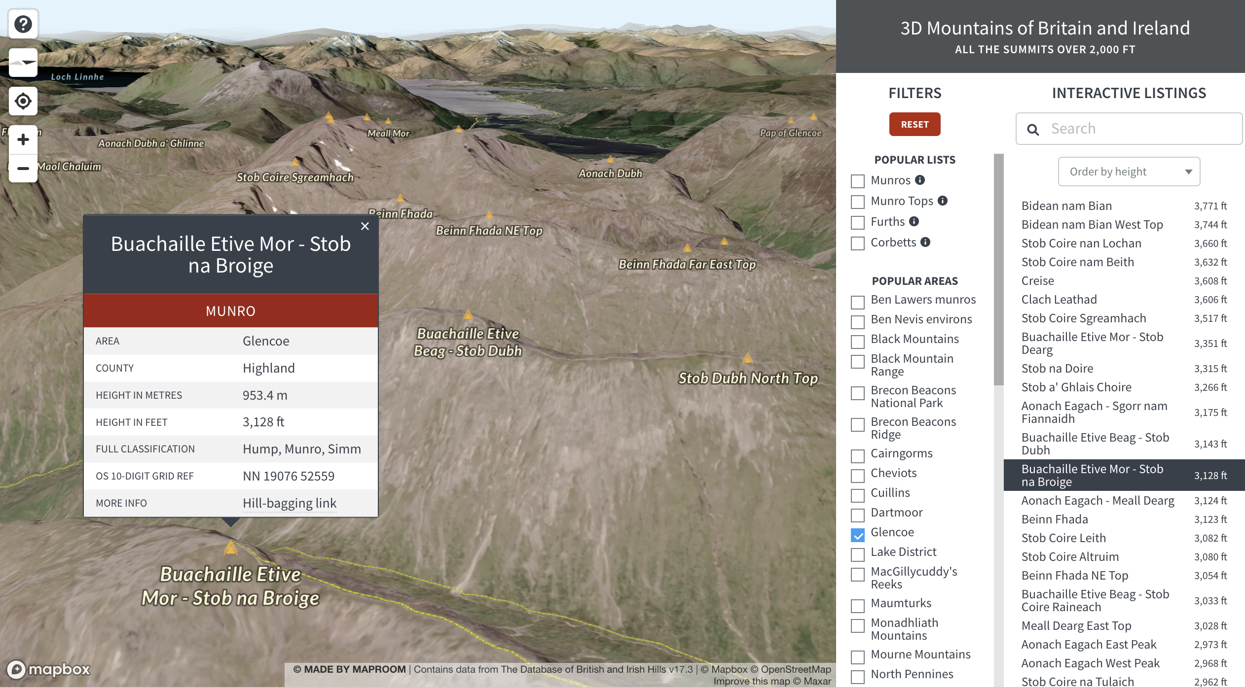
Learn more about how we feed data to dynamic maps like this on the 3d mountains exploration demo page.
Mapbox and Google Maps fees for high web traffic
At Maproom we build most of our interactive web maps on a Mapbox base. We also sometimes use Google Maps as a base. Both systems have their merits and weaknesses; both charge fees for high usage; and both are in a constant state of development and competition with each other and the smaller players on the dynamic mapping scene. Here’s a current comparison of Mapbox and Google Maps.
| System | Pros | Cons |
|---|---|---|
| Mapbox – used to power reference maps in our Dynamic Mapping Suite | Far more customisable than Google Maps Cheaper than Google Maps for high traffic Various ways to handle large data feeds | No Streetview Mediocre search Not the highest resolution for satellite maps |
| Google Maps – used by us for some bespoke dynamic maps requiring Streetview or the highest resolution satellite imagery of London | Streetview and the best search of all mapping systems | Completely unable to handle advance styling or large data feeds |
Usage
All web maps built with Mapbox and Google Maps are metered for usage. Usage means the number of times per month that a Google Map or Mapbox map is loaded. If, say, your website has a page with a Google Map embedded on it, the number of hits that page gets each month will count as the load.
Free tiers
Currently at the time of writing, the free threshold traffic for Google Maps is up to 28,500 loads per month, and for Mapbox it is up to 50,000 loads per month.
The majority of websites fall well below these thresholds and thus have free usage of the Google Maps and Mapbox bases upon which Maproom builds dynamic maps.
However, organisations with busy websites need to know about possible charges!
High traffic charges
(As at June 2022)
| System | Costs per 1,000 Monthly Map Loads |
|---|---|
| Mapbox | FREE up to 50,000 monthly map loads and 100,000 monthly search terms $5 per 1,000 from 50,001 – 100,000 loads $4 per 1,000 from 100,001 – 200,000 loads $3 per 1,000 from 200,001 – 1,000,000 loads negotiable from 1,000,000+ loads More details at Mapbox pricing |
| Google Maps | FREE up to 28,500 monthly map loads $7 per 1,000 above 28,500 map loads $14 per 1,000 for Street View $5 per 1,000 search terms More details at Google Maps pricing |
Bespoke mapping services
Can’t find the right map base, or in need of specialist help?
We can create map artwork for any part of the world depending on the availability of suitable data for your mapping project. Below are examples of both dynamic and static bespoke maps, and at the bottom is an enquiry form.
Examples of bespoke dynamic maps
Interactive dynamic web maps are not supplied as files but as hosted web pages, usually with a feed from a spreadsheet or database. Public examples like these can potentially be embedded on the client’s website.
NOTE: Tap on preview images to open full size interactive maps

MRP (Material Requirements Planning) polling data by FocalData – feed for map used by animal welfare consortium
Smarkets political map game (pre 2024 GE)
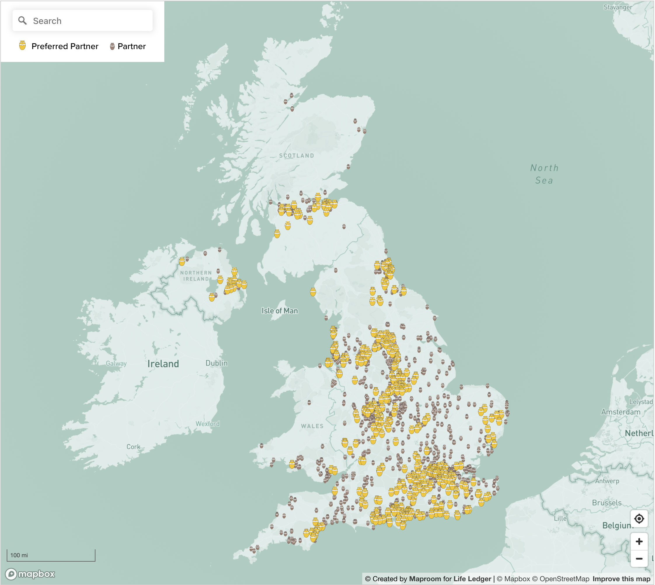
Find a Funeral Director dynamic map for Life Ledger
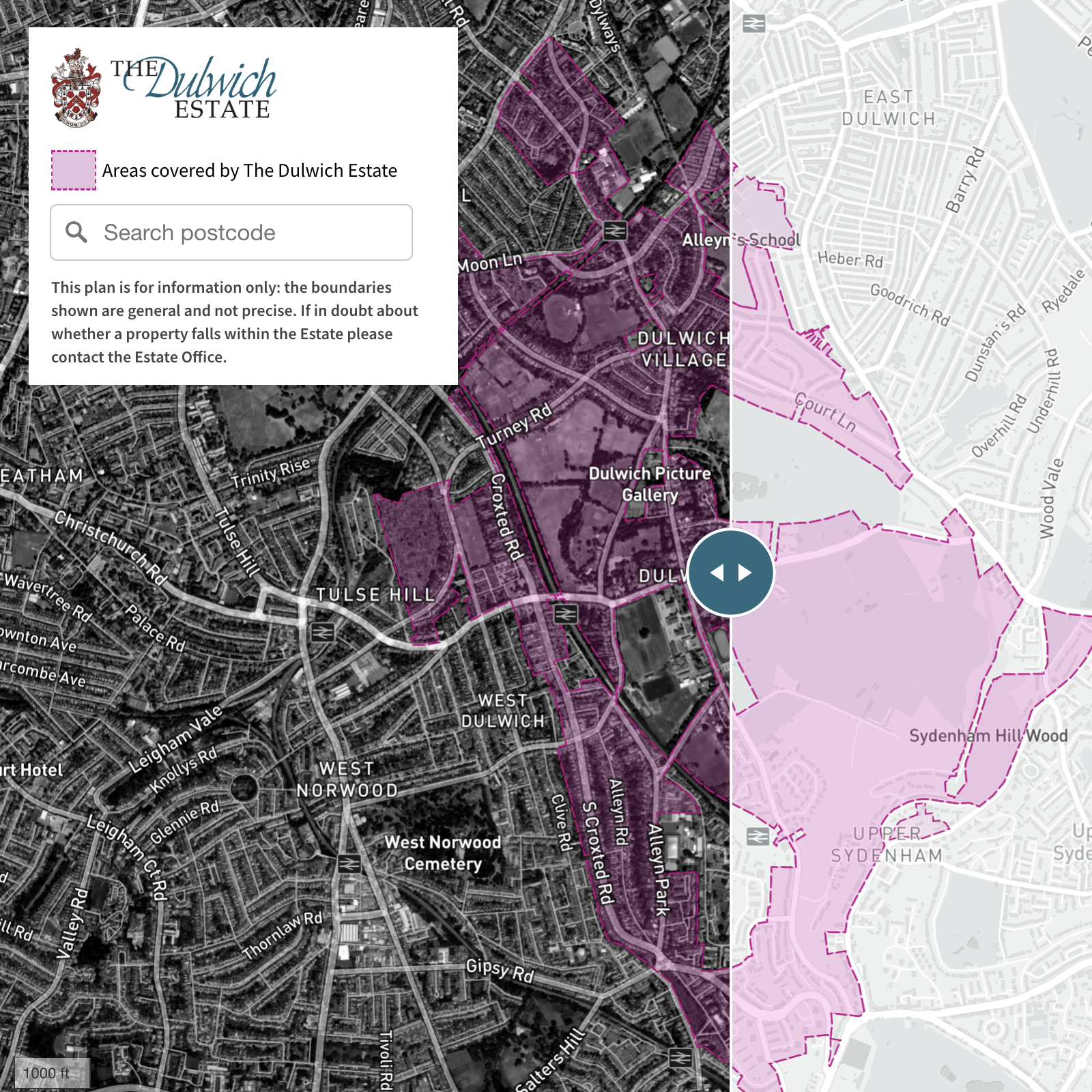
Dulwich Estate boundaries satellite/streets swipe map and localised search
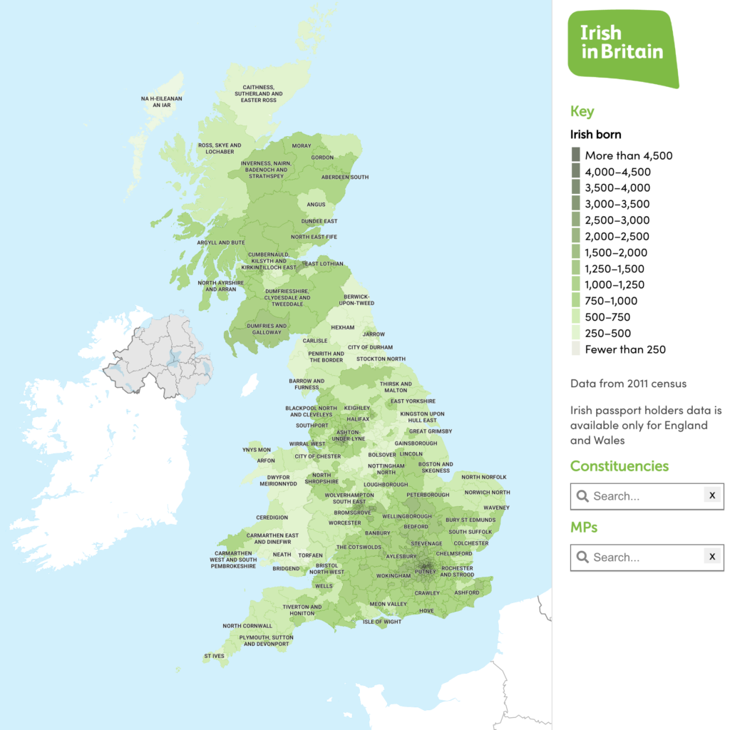
Irish in Britain heat map with constituency data
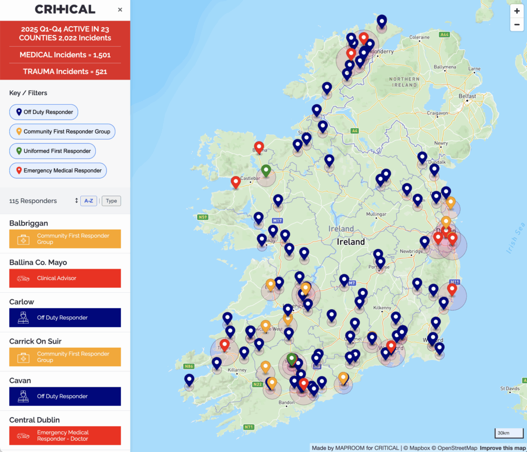
Emergency responders coverage for Critical Charity, Republic of Ireland
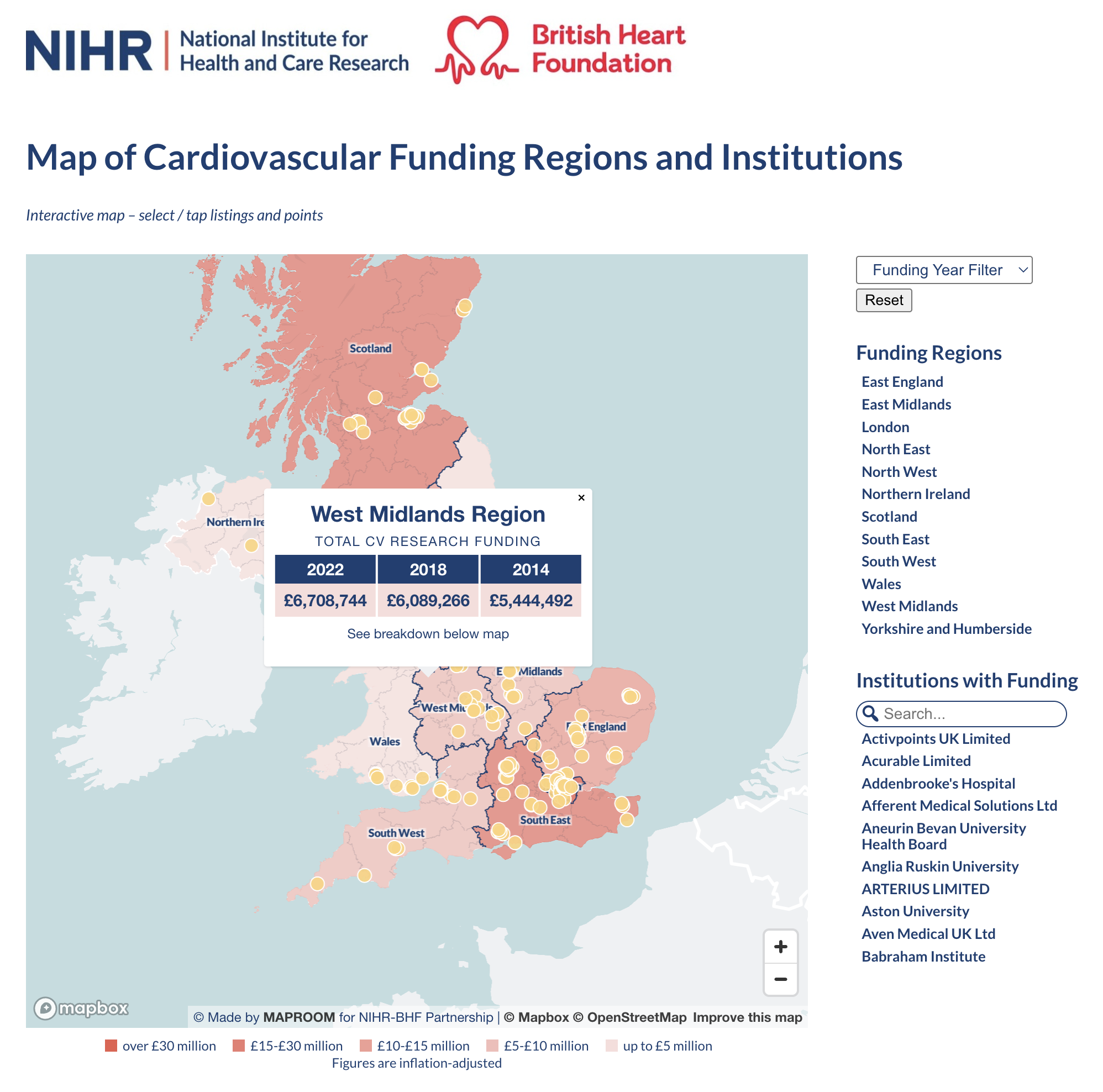
See more live examples in our Dynamic Maps Showcase
Examples of bespoke static maps
These examples were supplied by us either as PDFs ready for high-resolution printing, or in layered formats suitable for editing with Adobe Illustrator, Photoshop or other professional graphics software
NOTE: Tap on images to open in high-resolution PDF viewer – some take a while to load
Ordnance Survey base with transport network

Tiny sample from Caravan and Motorhome Club map

Locality detail

Pin markers on simple backdrop
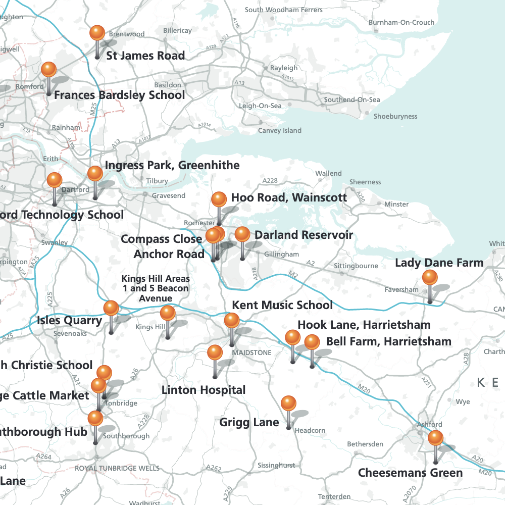
Pin markers with labels on a regional backdrop
Route plotting
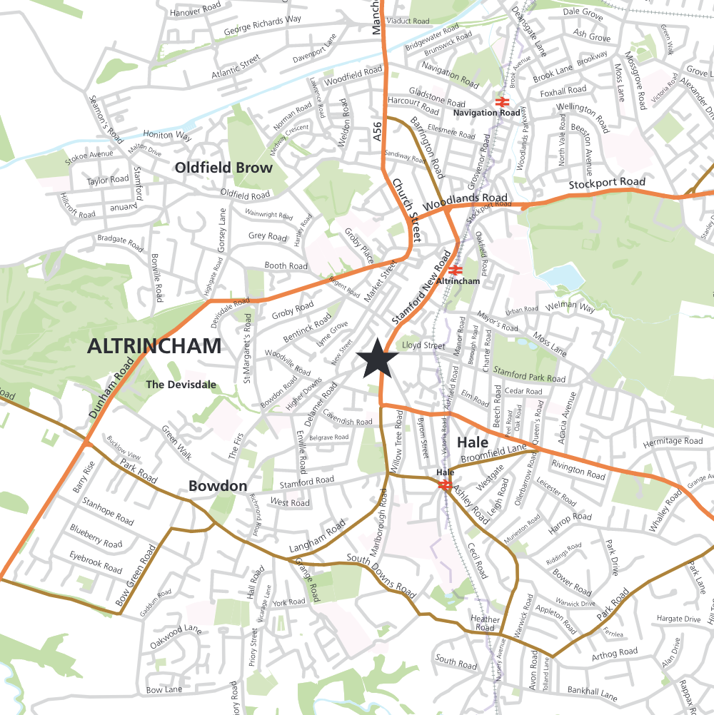
Map for estate agency
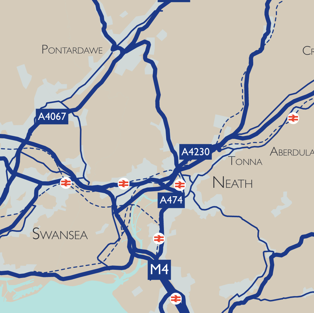
Towns and major roads in client’s brand colours
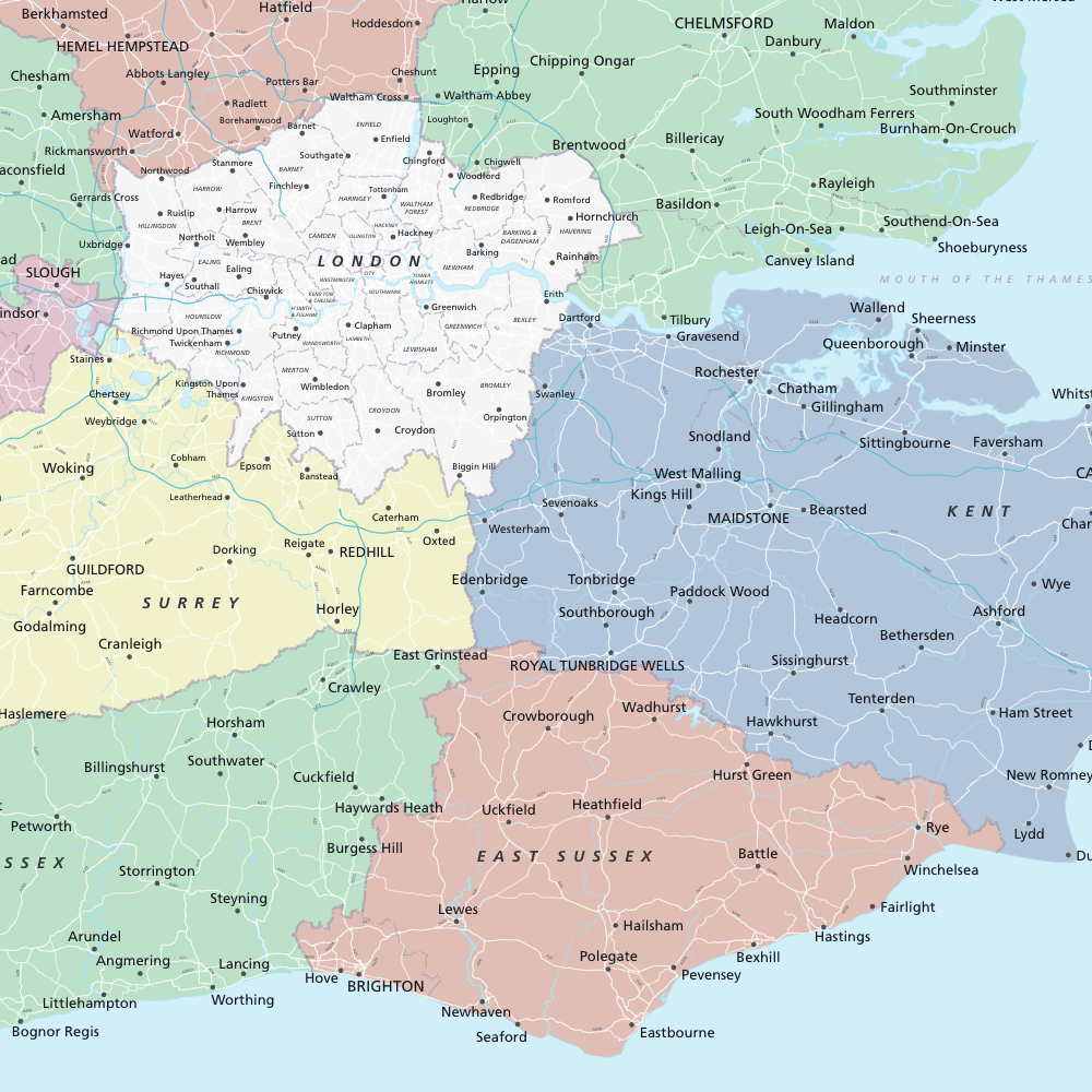
Counties highlighted
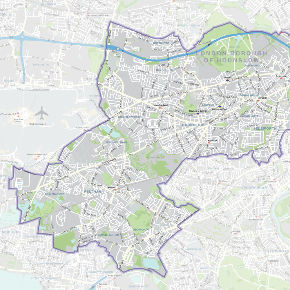
Borough highlight
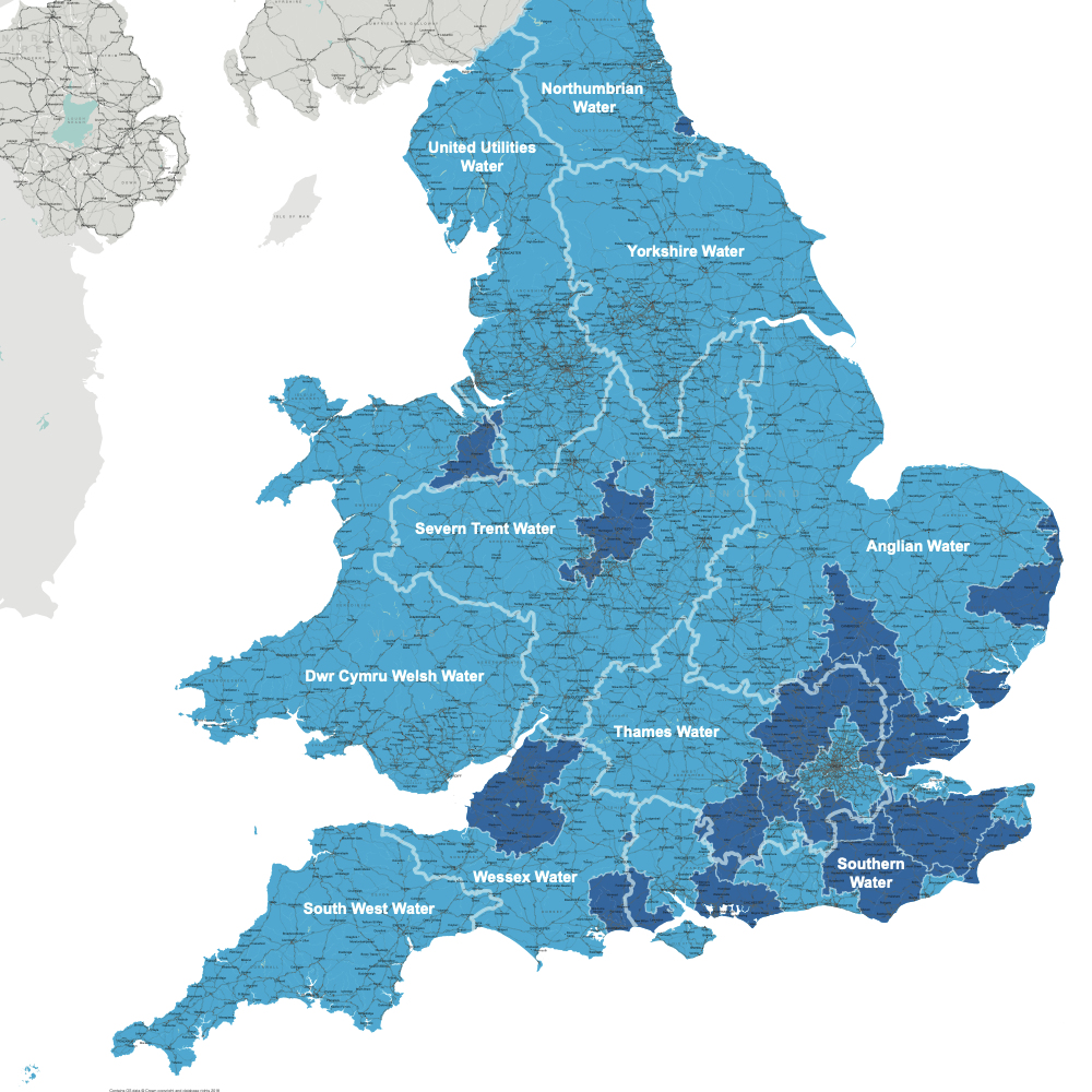
Water Utilities map (newer base also available)
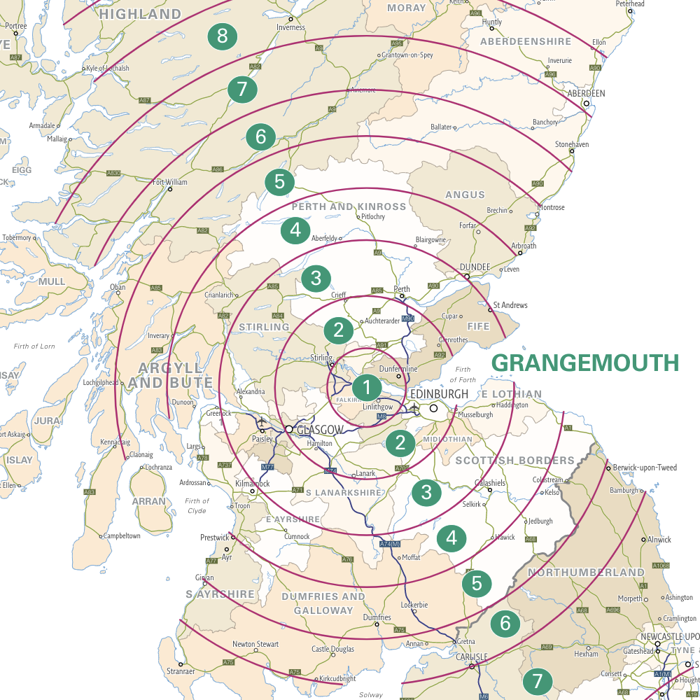
Zone map

Delivery map
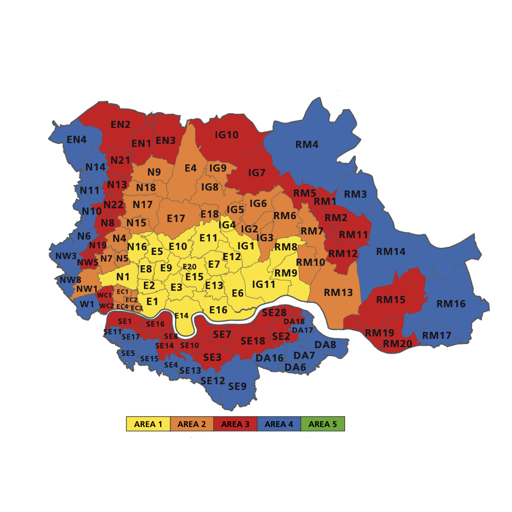
Service coverage map
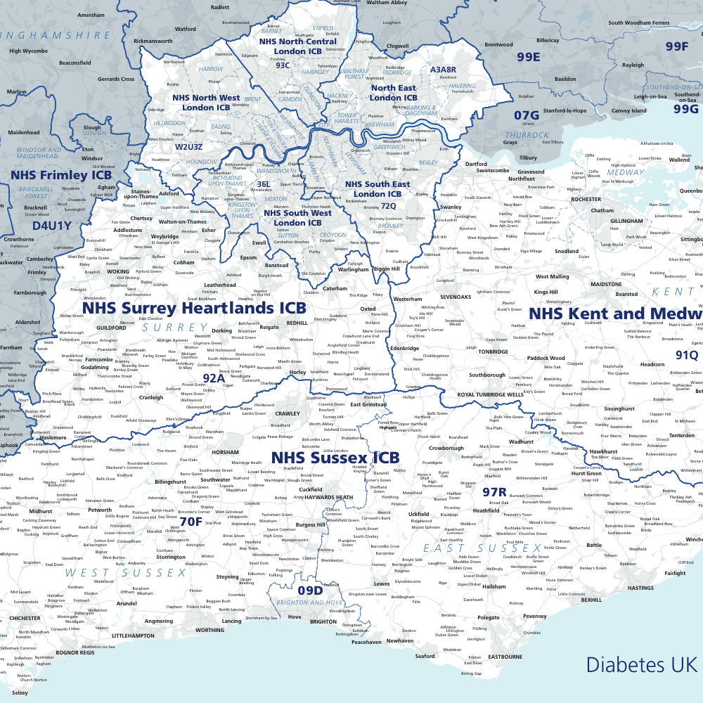
Map highlighting Integrated Care Boards in client’s SE England region

Historic parishes
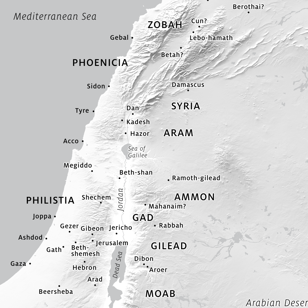
Ancient history map

Base for film production company
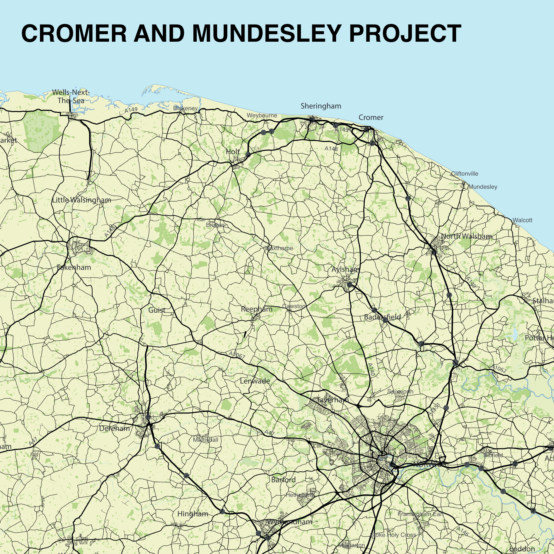
Balfour Beatty project map
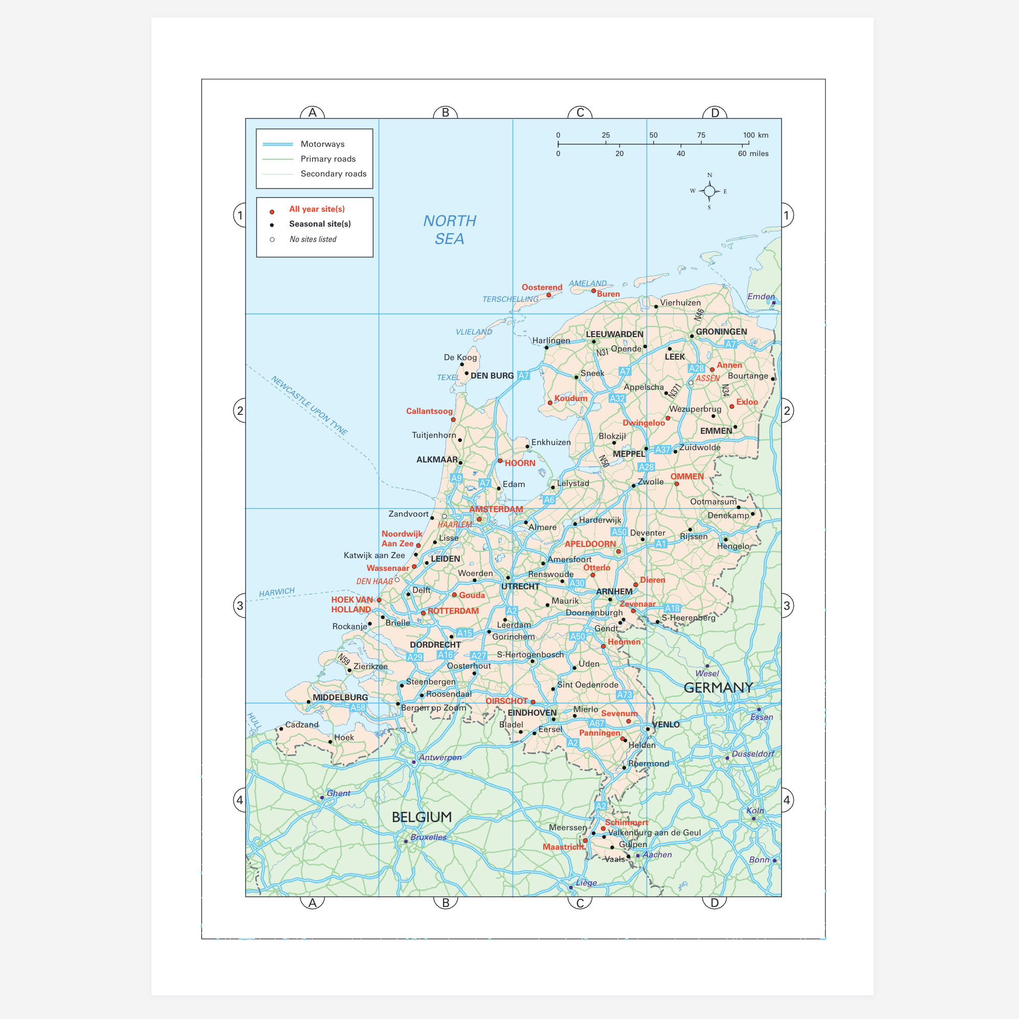
Map of the Netherlands for motoring guide to Europe
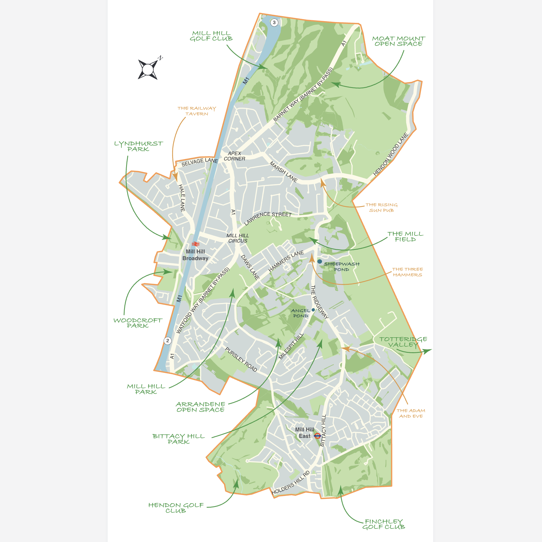
Mill Hill Preservation Society map
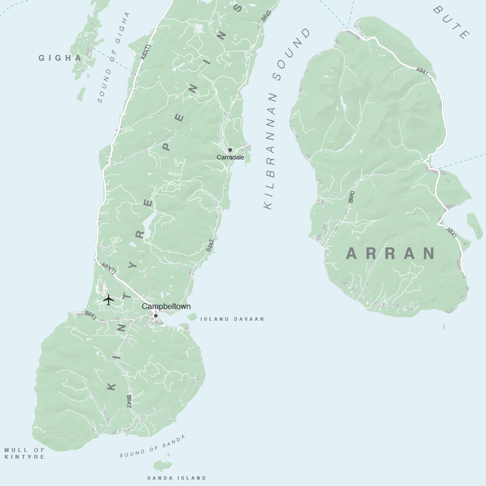
Hillshading 1 – subtle
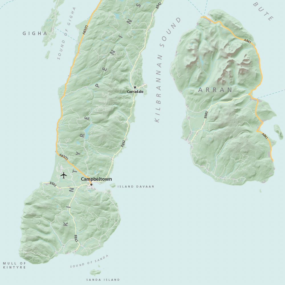
Hillshading 2 – medium
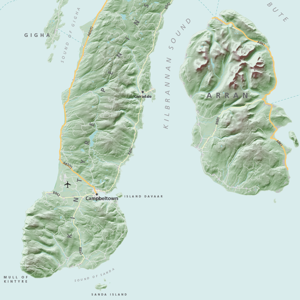
Hillshading 3 – dramatic
3d mountains exploration
Open full size map (recommended)
This map is an absolute show-off in multiple ways. Its 3d clarity alone is immersive enough to explore happily for ages, especially if you want to plan or recreate a leisure walk in the great outdoors. Unlike most web maps you will find on other websites, this one lets you tilt the horizon and change your bearing to face any point of the compass. Then, on top of that, we have fed in the data for 3,658 mountains which you can interact with in various ways through direct tap of summits on the map or using a multitude of filters for listings in the side panel. Oh, and you can search for any mountain by name and choose to see listings alphabetically or by height.
We’ve made this demo for two reasons: one is because we like hill-walking and think this is a genuinely useful map for it, and the other is to try to persuade more clients to use 3d mapping and understand how filters might be deployed with their own data.
Below is a view of the spreadsheet feeding data directly to the 3d mountains map. (The original data comes from the Database of British and Irish Hills.) The filters are created by our programming for content in the Range and Classification columns.
3d map bases are available in the Dynamic Mapping Suite for you to plot your own labels and routes.
Dynamic UK Reference Maps
Interactive deep-zoom maps with search and popup data feeds Maps will open full size in their own windows The new all-in-one Postcodes Reference map with census data Absolutely all the UK geographic postcodes in one map, including 1.8 million units with population and demographic data. The nested index lets you drill down from Areas > […]
UK administrative region maps
We offer a number of mapping solutions based on geographies defined by the UK’s Office for National Statistics (ONS), local authorities and other public bodies. Public data is typically aimed at local and national government, but is also of great interest to many commercial companies and marketeers, particularly in combination with postcode mapping. You can commission us for bespoke dynamic web maps with data feeds using ONS-defined boundaries such as for local authorities, super output areas, counties, unitary authorities, NHS and ICB (old CCG) areas, parliamentary constituencies, wards, work zones and police force areas.

Public demo map of UK parliamentary constituencies and MPs
We published one of our ONS-based dynamic maps publicly, which rapidly rose to No.1 on Google, above the BBC’s election maps! This immensely popular online web map demonstrates how we can feed data from a spreadsheet to form interactive listings with popup info boxes.
Read about how we constructed this map
Dynamic ONS-based web maps available in the Dynamic Mapping Suite
At a similar level of detail and interactivity to our publicly published parliamentary constituencies map mentioned above, our other ONS-based web maps are available in the Dynamic Mapping Suite. Juxtaposed with postcode layers, these form a superb suite of reference maps for administrators and marketers needing both ONS and postcode datasets. You can also commission a bespoke map using these map bases, and even marry up your own data with ONS-coded boundary areas on the maps.
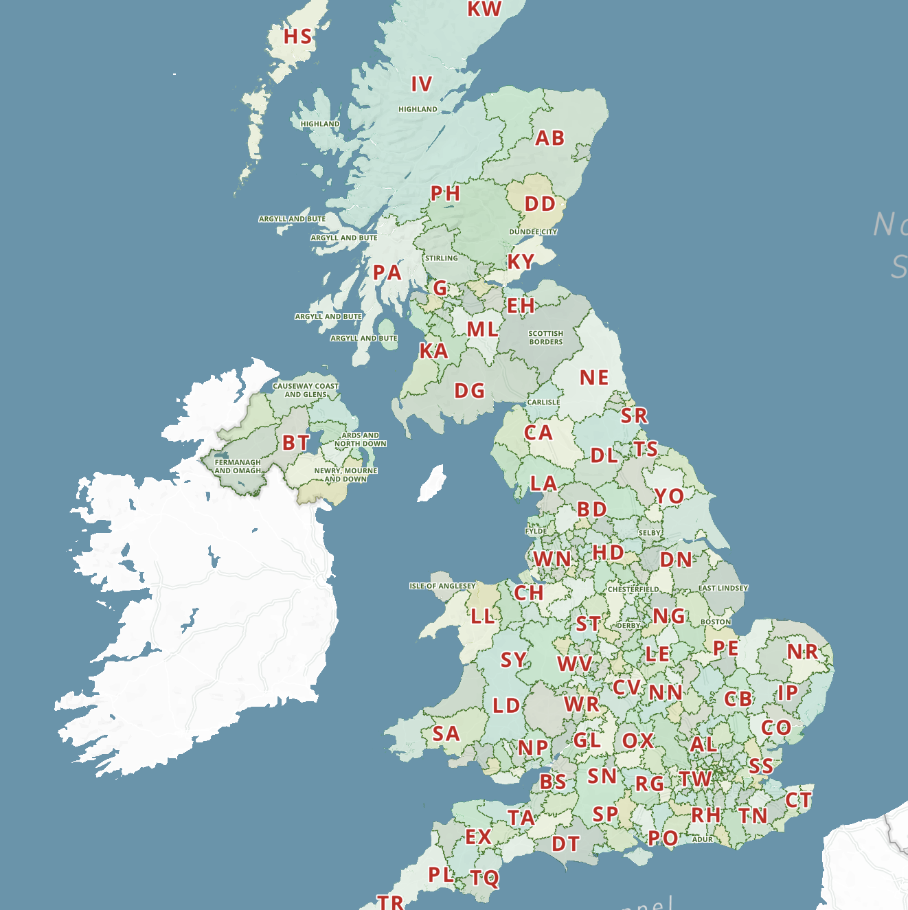
Local authorities of the United Kingdom
All the UK’s Local Authority Districts with popup info and postcode options.

Electoral Wards
The basic unit of UK administrative geography – 8,694 Wards in context with Constituency and Local Authority boundaries.
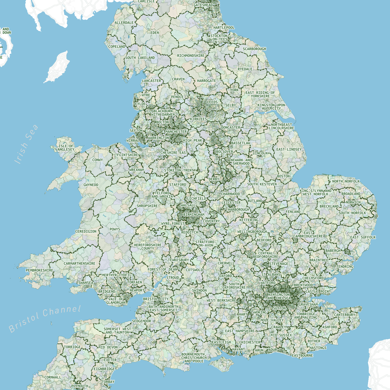
Super Output Areas
The Super Output Areas of England and Wales including 34,753 lower layer SOAs at street level.
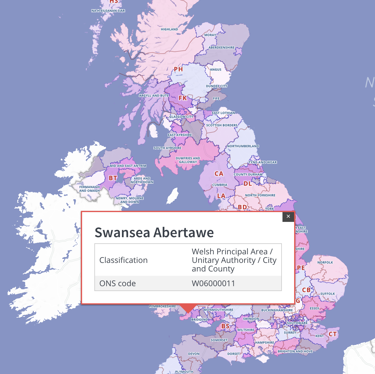
Counties and unitary authorities
A high tier of authority used by the ONS. Dynamic search plus postcodes and colour classification toggling.
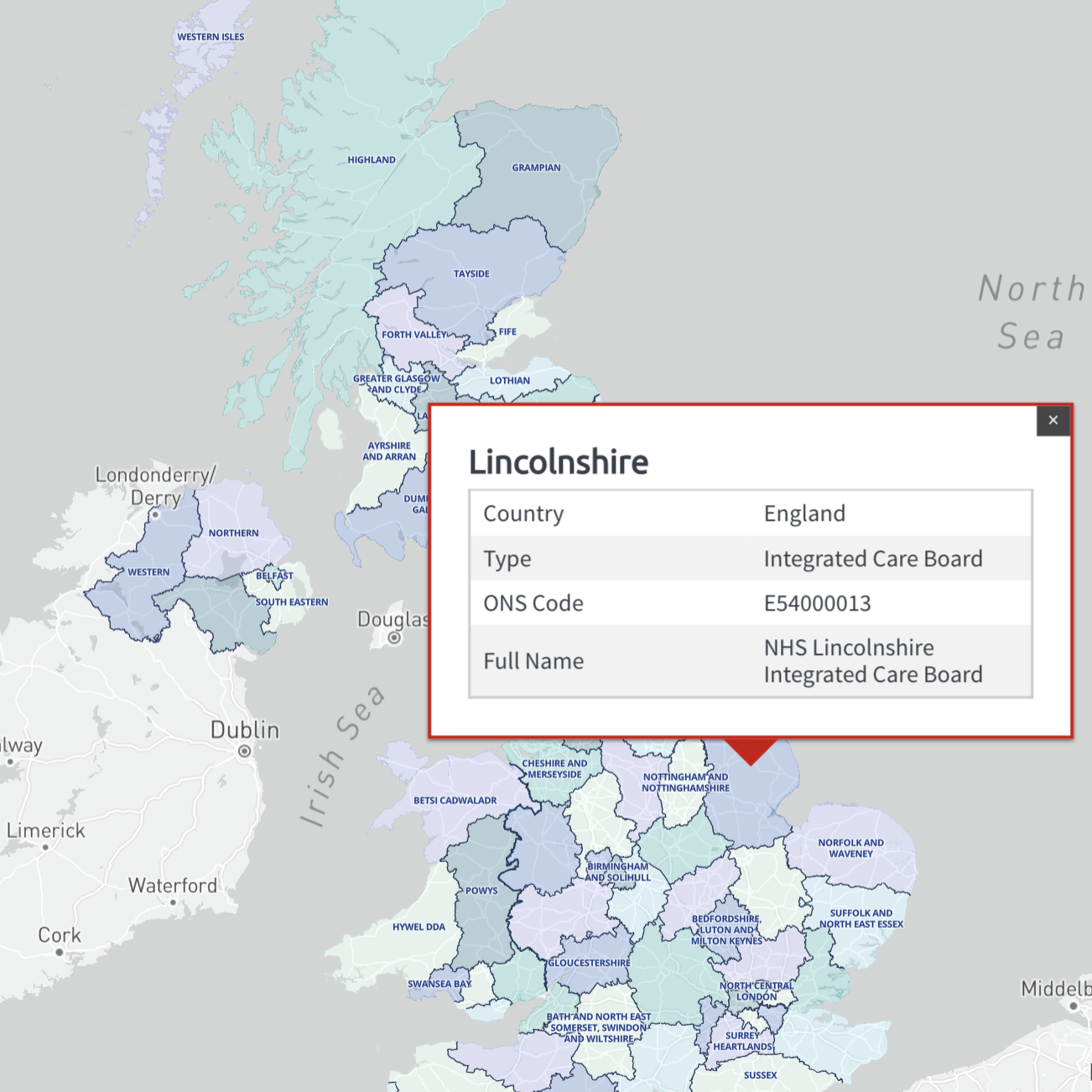
Health authorities
The 68 principal health authority areas of the UK, updated for 2022. Includes England’s new Integrated Care Boards and sub-Locations, plus old CCG boundaries.
Downloadable maps with ONS-based boundaries
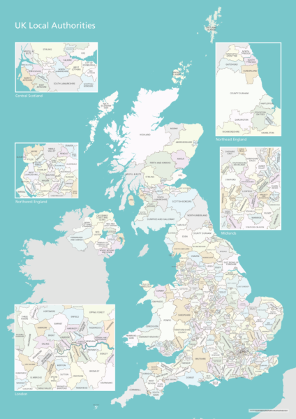
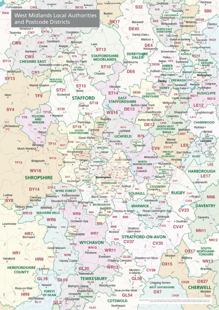

Example of dynamic choropleth heat map using ONS data
Mouseover the local authorities for population data!
Minimalist churches – demo with deceptively simple styling, interactive, clustered listings, power zoom and user locator
Open map in full screen (recommended)
This is a beautiful, minimalist style map base with custom icons, which Maproom has built for an organisation representing churches dedicated to St Laurence.
It may look like a static image on opening, but the listings and map points are all interactive.
Points are clustered with numbers at high views, allowing for step down levels to see more and more churches the deeper you zoom.
Tap on either the panel listings or the church icons for pop-up boxes with pictures of the churches.

There is also a “find my location” button at the bottom right of the map that will – on permission – identify the user’s location within the map.
Note: the accuracy of the “find my location” feature depends on the user’s device and type of internet connection (usually accurate within a few hundred metres; but never as accurate as a SatNav). Not all browsers support this feature, and some users may disable it. If user location support is not available from the user’s equipment, the “find my location” button will show as disabled.
This map’s interactivity is built with a combination of spreadsheet feed for the listings and point clusters, and a vector dataset with church icons and names loading as part of the base map style itself. The interplay of both data sources comes into its own when the user is searching for information both alphabetically and geographically.
Examples of bespoke dynamic maps
Interactive dynamic web maps are not supplied as files but as hosted web pages, usually with a feed from a spreadsheet or database. Public examples like these can potentially be embedded on the client’s website.
NOTE: Tap on preview images to open full size interactive maps
MRP (Material Requirements Planning) polling data by FocalData – feed for map used by animal welfare consortium
Smarkets political map game
Dulwich Estate boundaries satellite/streets swipe map and localised search
Irish in Britain heat map with constituency data
See more live examples in our Dynamic Maps Showcase
Dynamic postcode mapping tools
Maproom’s dynamic and interactive online postcode maps cover every geographical postcode in the UK. You can zoom deep into these maps to see postcode districts, sectors and unit centroids with the full context of roads, buildings and other geographical features. Search UK addresses and visually see postcode density in relation to local authorities, constituencies, health and police areas, and much more. These maps are invaluable for working out sales territories, marketing and mail drops, freight, fulfilment and delivery zones.
The dynamic postcode maps and online mapping tools are available in our Dynamic Mapping Suite.
Deep-zoom, searchable postcode reference maps with statistics data
We have a unique library of online postcode maps with deep zoom and search capabilities, and juxtaposition with other UK administrative boundaries. See sample data
Quick Select interface for postcode colouring and labelling
Use our Quick Select system to create your own postcode visualisations for planning and marketing. See more info

Bulk postcodes plotting
Plot all your customer postcodes in seconds simply by pasting in your list. See live demo

Postcodes within a radius
See which postcodes fall within a specified radius of your locations. How to plot a radius really easily
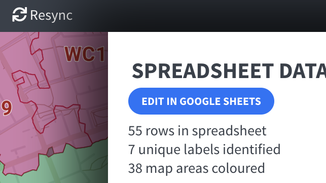
Automated postcodes mapping from spreadsheets
Available for district and sector polygon maps – connect your spreadsheet and experience the pleasure of having your data organised, coloured and feeding to thousands of live polygons. See mapping with spreadsheets
Postcodes in Clean Air and Low Emission Zones, ULEZ etc
Calculate service charge areas and delivery routes. Learn more
UK Local Authorities + Postcodes Map from April 2023

This map is aimed at professional organisations, graphic designers and data analysts who need detailed visual map reference for the UK’s local authorities shown in context with towns, roads and postcode districts. The package includes a Limited Free Pass for our Dynamic Mapping Suite. In the Dynamic Mapping Suite you can feed in spreadsheet data to an online interactive version of this map, and see how the local authorities relate to postcodes at street level.
What you get
- 1 x detailed map of the UK showing all of the UK’s local authorities from April 2023, plus hundreds of towns and the boundary lines for more than 2,800 postcode districts. This large PDF can be used for on-screen reference and for editing and large-scale high-quality printing (if printed with the smallest labels legible at 100%, this map is more than 3 metres in height).
- Limited free pass for our Dynamic Mapping Suite.
Notes for graphic designers
The PDF maps are saved with all layers editable using the most recent version of Adobe Illustrator. All elements are live, including labels and fonts. The local authority layers are available as both inland boundary lines and polygon fill areas for easy colour editing. The postcode districts are available as inland boundary lines only (not polygon fill areas).
Coterminous and non-coterminous local authority and postcode boundaries
Local Authority boundaries and postcode districts are often related but not always coterminous – not even at country borders! Use our maps to see the relationship. For the best level of detail, use the online map which lets you zoom into street level.
UK Local Authorities Map from April 2023
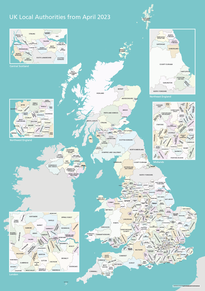
This map bundle shows the UK’s Local Authorities in several versions.
Changes from 1 April 2023:
Cumberland – formerly Allerdale, Carlisle, Copeland
Westmorland and Furness – formerly Barrow-in-Furness, Eden, South Lakeland
North Yorkshire – formerly Craven, Hambleton, Harrogate, Richmondshire, Ryedale, Scarborough, Selby
Somerset – formerly Mendip, Sedgemoor, Somerset West and Taunton, South Somerset
Included in the package are several versions supplied as high-resolution PDFs, Illustrator and SVG files.
Basic version scaled for A1+ poster printing
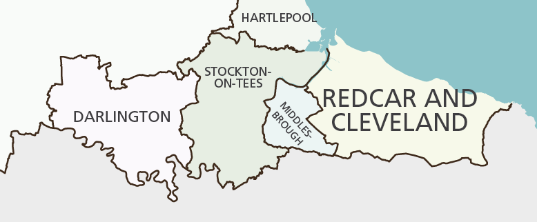
The package includes the Local Authorities before and after 1 April 2023.
On these versions scaled for poster printing, the smallest labels are legible when printed at A1 size or bigger.
In addition to the PDFs, raw Illustrator and SVG files are included for graphic designers who will find the artwork to be layered for easy manipulation and application. All elements are editable in Adobe Illustrator, including colours and fonts. Each local authority is a discrete polygon on its own sublayer interlocking perfectly with its neighbours.
View full size watermarked preview of basic version
More detailed version with towns and major roads
This more detailed version in the package works as a high-resolution PDF / AI / SVG suitable for screen zooming and designer edits, though it is not scaled specifically for poster printing (unless you want to print the whole thing at wall size).
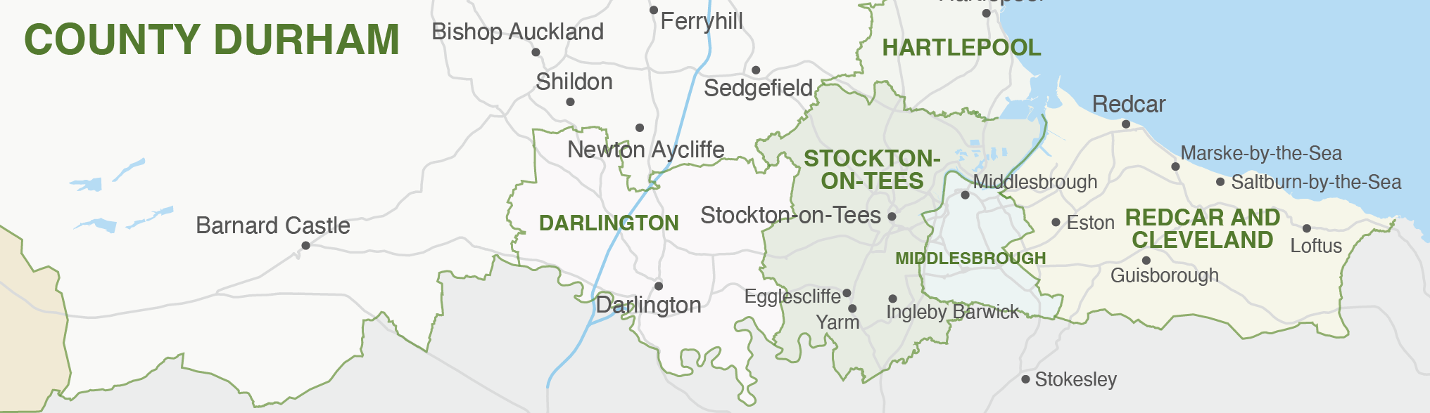
View full size watermarked preview of detailed version with towns and major roads
Access to exceptionally detailed Local Authority maps and mapping tools in the Dynamic Mapping Suite
This great value package includes a 7-Day Limited Free Pass for the Dynamic Mapping Suite. The Dynamic Mapping Suite contains online Local Authority maps with advanced interactive indexes and search, and spreadsheet mapping tools that allow you to colour and caption the Local Authorities by feeding in your own data. Local Authorities before and after April 2023 are available for mapping depending on what dataset you need to work with.
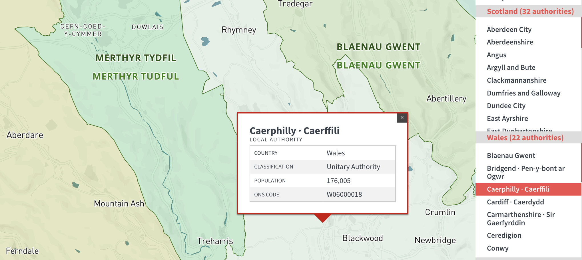
Looking for Local Authorities + Postcodes?
If you need postcode reference juxtaposed with local authority boundaries, head over to the UK Local Authorities and Postcode Districts map.
Interactive map from spreadsheet demo (Parliamentary Constituencies)
Maproom's superb interactive UK Parliamentary Constituencies map shows all 650 Parliamentary seats and helps users find constituencies and MPs with electorate info. Zoom deep, tap on areas of the map and use search to fly round the country. This political map is a great demonstration of how we can build a dynamic interactive online map fed from a spreadsheet.
How the interactive map is constructed with polygons and data from a spreadsheet
1 - Online map base
There are a number of online map services which can be manipulated by developers. The best known is Google Maps, but our current favourite is Mapbox, which allows complex styling of OpenStreetMap (OSM) data and has a range of useful functions in its javascript API. It is at the cutting edge of geocoding development, in our view.
For the UK Constituencies Map we have started by styling a Mapbox base quite simply with white landmass and a fairly strong blue-grey for the sea. The coloured constituencies are going to be overlaying the land in a later step, so having a white landmass backdrop is essential for opacity effects, whilst the blue-grey sea needs to provide enough distinction from the semi-transparent constituencies to define them without overpowering their colours.
When the user zooms in deep to the map, the road network will show up on the Mapbox base. This is one of the great features of Maproom's constituencies map – you can zoom in and out to see great detail of constituency boundaries as well as the overview of the entire UK all in one map.
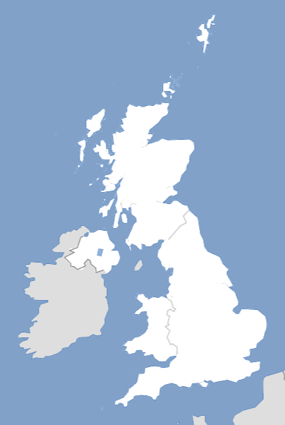
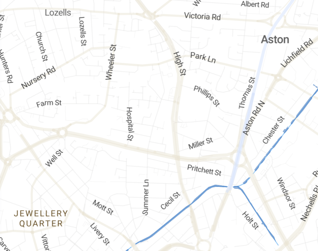
Static screenshots of the map base in Mapbox showing the whole UK and a zoomed in portion of the road network around Birmingham
2 - GIS data manipulated to create a layer of interlocking polygons for the parliamentary constituencies
Geographical Information Systems (GIS) are all about the handling of coordinates and projection systems in formats such as shapefiles, geojson, geoTiffs and many others. GIS files contain raw data - code, not imagery. However, they can be processed with specialist GIS software and turned into a map image.
The UK's 650 parliamentary constituencies are composed of interlocking polygons. Maps with interlocking polygons are some of the hardest to create because they need perfectly matching boundaries, and many map polygon datasets are extremely expensive because they are so time-consuming to produce and maintain. Fortunately for the sake of our demo, the government provides GIS data for parliamentary constituencies free of charge from the Office for National Statistics.
For the Constituencies map, using a mixture of Avenza MaPublisher and QGIS software, we cleaned up the government's dataset and produced centroid point data for labelling the constituencies. The centroid point data was uploaded separately and loaded directly to the Election map base.
The polygons data was exported in geojson format then converted into a Mapbox-specific compressed format called mbtiles using a line-command tool called Tippecanoe available from Github. We then uploaded the mbtiles file to Mapbox as a dataset layer with polygons for the parliamentary constituencies.
This manipulation and separation of GIS data makes it possible to make the map itself interactive with hover and click effects.

3 - An easy-to-edit Google spreadsheet to control the popup box information, the colours and the auto-count of seats per party
The spreadsheet element is the main reason for this demo. The online map may be highly complex, but we want non-technical editors to be able to update it easily simply by editing a spreadsheet. The spreadsheet contains all the popup box information, and it also controls the colours on the map and even the automatic count of seats per party.
With a Google spreadsheet changes save themselves instantly, and the map automatically updates itself within seconds – no need to keep uploading files. This feature really comes into its own when you have a rapidly changing situation, such as when results flood in on election night!
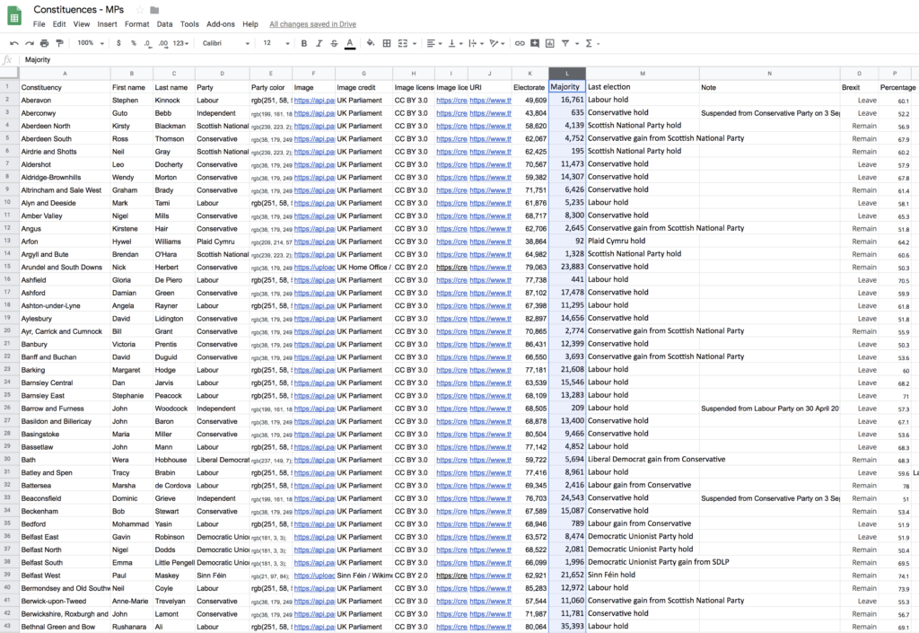
4 - HTML with javascript, geojson and the Mapbox API to bring it all together
All web designers and developers are familiar with HTML and javascript, but not many use geojson or mapping APIs. Maproom's system pulls in geojson output from the spreadsheet and compares it with the polygons data layer in Mapbox before overlaying the semi-opaque coloured constituencies on top of the map base, together with the popup-info boxes.
The final result is a highly detailed map containing literally millions of pieces of data in a compact space, which loads quickly, is interactive on multiple levels, is sharp at every zoom level and is incredibly easy and quick to update.
We hope you enjoy using Maproom's UK Parliamentary Constituencies map.
Map of Greater London postcode districts plus boroughs and major roads
This superb value downloadable map bundle covers all the postcode districts in Greater London, shown in context with the London boroughs, post towns, major roads and surrounding counties. Five PDF styles are included, which you can use royalty-free either as they are or as a starting point for editing in Adobe Illustrator or other vector graphics software. It comes bundled with free access to dynamic postcodes and mapping tools.
With easily selectable areas and all the labels in live, editable fonts, you can quickly change colours and scaling to suit your needs, such as colouring up different postcode districts in London to show salesforce coverage or delivery charges by postcode. The vector base and PDFs are fully scalable so you can zoom in and out without loss of resolution.
London postcode districts overlaid with London boroughs
By popular demand, we have included approximate London borough boundaries on this postcodes map, plus the edges of the surrounding Home Counties. Royal Mail does not always follow borough or county boundaries with its postcode divisions, but our customers have told us that it helps to see the approximate shape of the London boroughs and also the Home Counties when using the postcodes map for planning purposes.

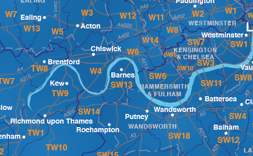
Bundled with free 7-day access to our dynamic postcode mapping tools
On a separate (non-downloadable) system, you can edit London postcodes online with the free bundled dynamic postcode mapping tools. Zoom down to street level, colour and caption London postcodes, get population and demographic info, feed in your own data and more.
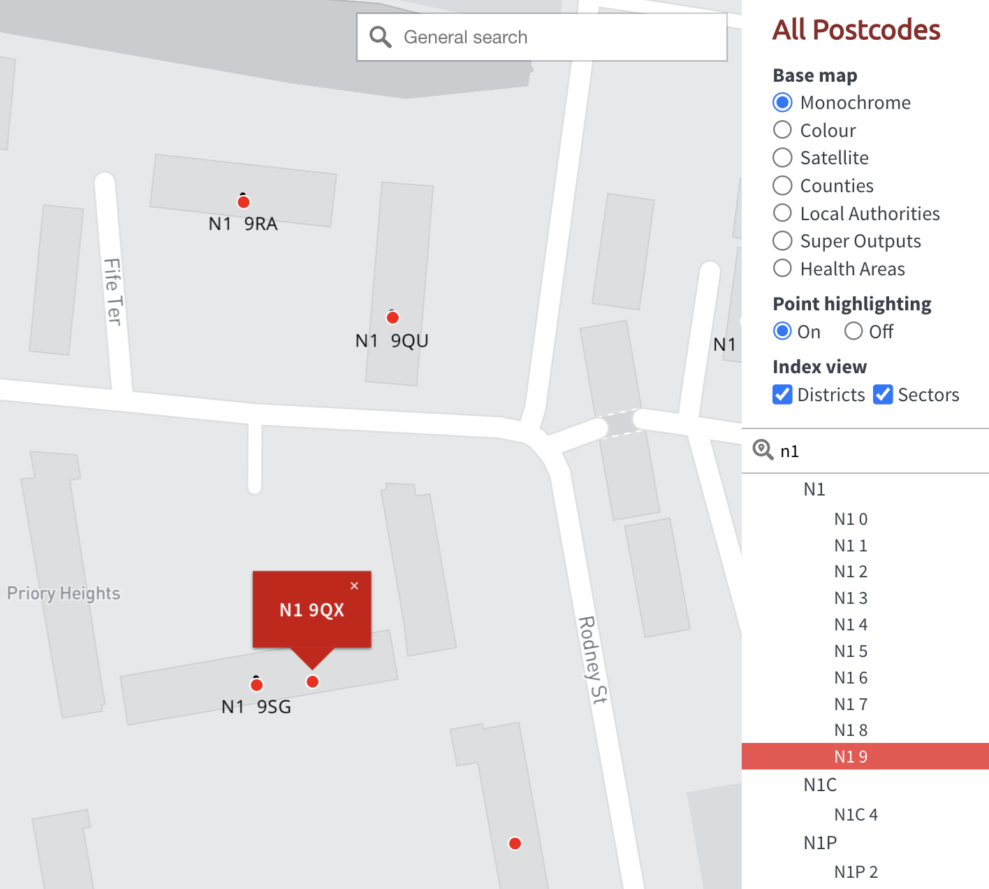
Dynamic mapping – interactive web maps
Dynamic online maps – also known as web maps and slippy maps – have capabilities to contain far more information than you could ever hope to fit onto a printed map, plus search, pop-up captions, filters and calculated data on the fly. With a dynamic map you can feed data into our cloud mapping system to change colours and captions automatically. This is state-of-the-art mapping.
A few examples
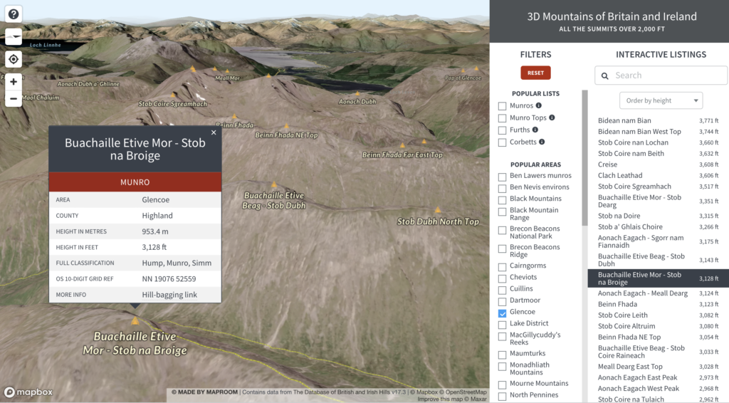

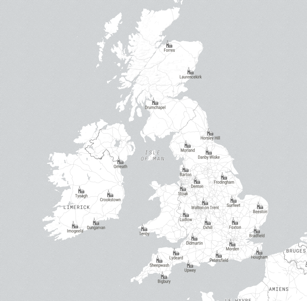
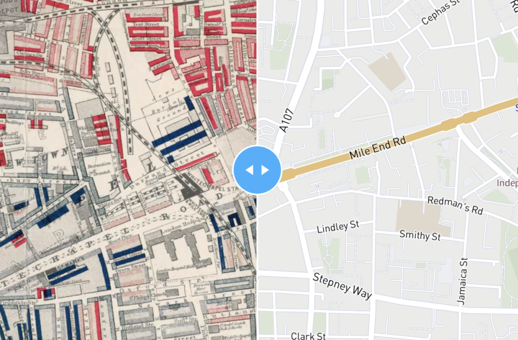
5 benefits of dynamic online maps
- The deeper you zoom, the more you interact, the more you see
- Dynamic keys, popups and searchable listings may be the ONLY way to map all your data
- Mapping with spreadsheets is fast and efficient for business users
- You may be able to embed dynamic maps on your website, and they will autoscale for legibility on all devices
- Dynamic mapping is the best option if you need to update maps on a regular basis
About us
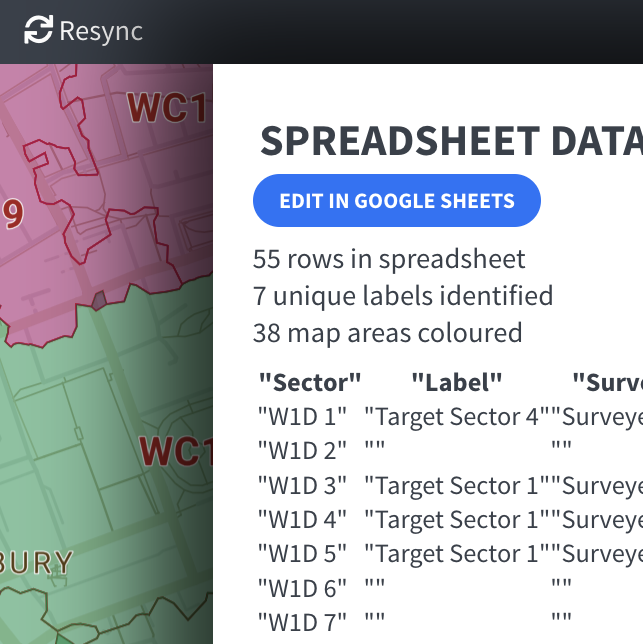
Maproom is an arm of Blue Island Media Ltd, whose projects include the award-winning World Whisky, travel guides and commerce sites, plus work for the BBC, Oxford University Hospitals, Ministry of Defence, schools, local authorities, major publishers and hundreds of businesses across Britain.
We know that maps are among the hardest artworks to create, even for seasoned graphic designers and web developers. The process of plotting and labelling can often be so difficult, time-consuming and costly that many people give up trying, and do without a map even where having a map would be extremely helpful. How many times have you seen a long description of geographical directions or written list of locations when a visual map would be far better? Why do so many websites have postcode proximity finders without any maps? Why do the online mapping giants charge upwards of £20,000 for a commercial print licence?
Our mission is to help businesses and organisations make informative and appealing maps at a reasonable budget. Graphic designers, developers, marketeers and planners: we are your friends.
We are continually striving to improve our mapping products and services. You are welcome to make comments or suggestions. See our contact page.
Our trading address is:
Maproom at Blue Island Media Ltd
5 Highcroft Court
Exeter
EX4 4RW
United Kingdom
Company Registered in England No. 6179445
VAT No. 907 0351 51