Shop
Showing 151–251 of 251 results
-
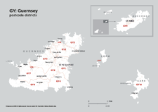
Map of GY postcode districts – Guernsey
£15.00The GY – Guernsey postcode districts scaled for A4+ printing
PDF -
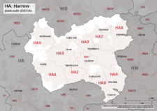
Map of HA postcode districts – Harrow
£15.00The HA – Harrow postcode districts scaled for A4+ printing
PDF -
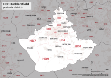
Map of HD postcode districts – Huddersfield
£15.00The HD – Huddersfield postcode districts scaled for A4+ printing
PDF -
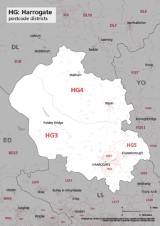
Map of HG postcode districts – Harrogate
£15.00The HG – Harrogate postcode districts scaled for A4+ printing
PDF -
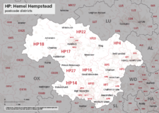
Map of HP postcode districts – Hemel Hempstead
£15.00The HP – Hemel Hempstead postcode districts scaled for A4+ printing
PDF -

Map of HR postcode districts – Hereford
£15.00The HR – Hereford postcode districts scaled for A4+ printing
PDF -
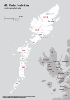
Map of HS postcode districts – Outer Hebrides
£15.00The HS – Outer Hebrides postcode districts scaled for A4+ printing
PDF -
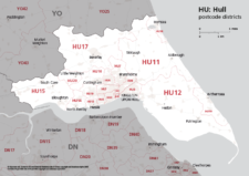
Map of HU postcode districts – Hull
£15.00The AB – Aberdeen postcode districts scaled for A4+ printing
PDF -
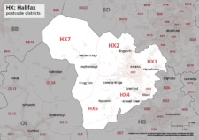
Map of HX postcode districts – Halifax
£15.00The HX – Halifax postcode districts scaled for A4+ printing
PDF -
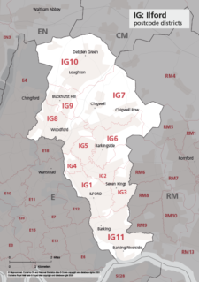
Map of IG postcode districts – Ilford
£15.00The IG – Ilford postcode districts scaled for A4+ printing
PDF -
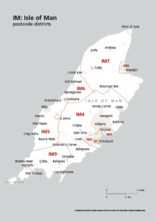
Map of IM postcode districts – Isle of Man
£15.00The IM – Isle of Man postcode districts scaled for A4+ printing
PDF -
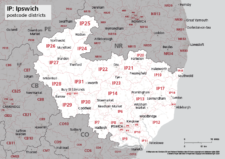
Map of IP postcode districts – Ipswich
£15.00The IP – Ipswich postcode districts scaled for A4+ printing
PDF -
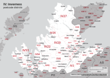
Map of IV postcode districts – Inverness
£15.00The IV – Inverness postcode districts scaled for A4+ printing
PDF -
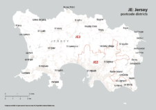
Map of JE postcode districts – Jersey
£15.00The JE – Jersey postcode districts scaled for A4+ printing
PDF -
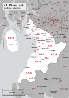
Map of KA postcode districts – Kilmarnock
£15.00The KA – Kilmarnock postcode districts scaled for A4+ printing
PDF -
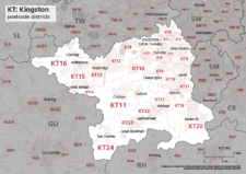
Map of KT postcode districts – Kingston-upon-Thames
£15.00The KT – Kingston upon Thames postcode districts scaled for A4+ printing
PDF -
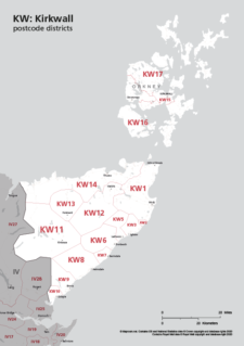
Map of KW postcode areas – Kirkwall
£15.00The KW – Kirkwall postcode districts scaled for A4+ printing
PDF -
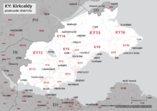
Map of KY postcode districts – Kirkcaldy
£15.00The KY – Kirkcaldy postcode districts scaled for A4+ printing
PDF -
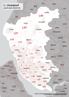
Map of L postcode districts – Liverpool
£15.00The L – Liverpool postcode districts scaled for A4+ printing
PDF -
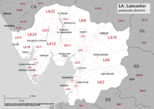
Map of LA postcode districts – Lancaster
£15.00The LA – Lancaster postcode districts scaled for A4+ printing
PDF -
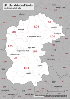
Map of LD postcode districts – Llandrindod Wells
£15.00The LD – Llandrindrod Wells postcode districts scaled for A4+ printing
PDF -
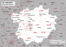
Map of LE postcode districts – Leicester
£15.00The LE – Leicester postcode districts scaled for A4+ printing
PDF -
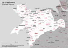
Map of LL postcode districts – Llandudno
£15.00The LL – Llandudno postcode districts scaled for A4+ printing
PDF -
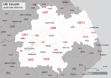
Map of LN postcode districts – Lincoln
£15.00The LN – Lincoln postcode districts scaled for A4+ printing
PDF -
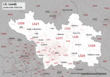
Map of LS postcode districts – Leeds
£15.00The LS – Leeds postcode districts scaled for A4+ printing
PDF -
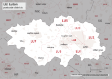
Map of LU postcode districts – Luton
£15.00The LU – Luton postcode districts scaled for A4+ printing
PDF -
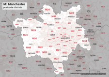
Map of M postcode districts – Manchester
£15.00The M – Manchester postcode districts scaled for A4+ printing
PDF -
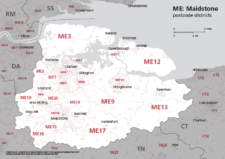
Map of ME postcode districts – Rochester / Medway
£15.00The ME – Maidstone postcode districts scaled for A4+ printing
PDF -
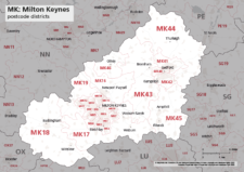
Map of MK postcode districts – Milton Keynes
£15.00The MK – Milton Keynes postcode districts scaled for A4+ printing
PDF -
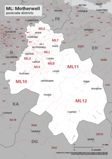
Map of ML postcode districts – Motherwell
£15.00The ML – Motherwell postcode districts scaled for A4+ printing
PDF -
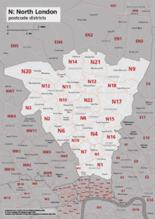
Map of N postcode districts – North London
£15.00The N – North London postcode districts scaled for A4+ printing
PDF -
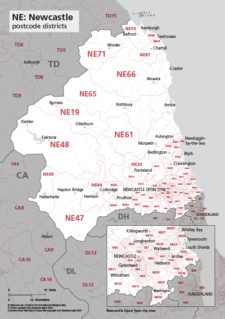
Map of NE postcode districts – Newcastle-upon-Tyne
£15.00The AB – Aberdeen postcode districts scaled for A4+ printing
PDF -
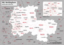
Map of NG postcode districts – Nottingham
£15.00The NG – Nottingham postcode districts scaled for A4+ printing
PDF -

Map of NN postcode districts – Northampton
£15.00The NN – Northampton postcode districts scaled for A4+ printing
PDF -
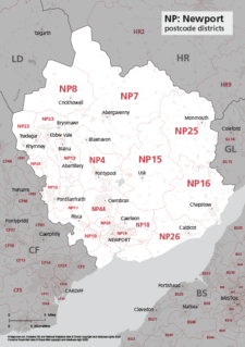
Map of NP postcode districts – Newport
£15.00The NP – Newport postcode districts scaled for A4+ printing
PDF -
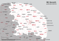
Map of NR postcode districts – Norwich
£15.00The NR – Norwich postcode districts scaled for A4+ printing
PDF -
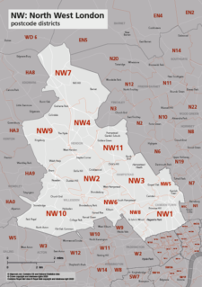
Map of NW postcode districts – North West London
£15.00The NW – North West London postcode districts scaled for A4+ printing
PDF -
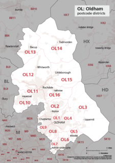
Map of OL postcode districts – Oldham
£15.00The OL – Oldham postcode districts scaled for A4+ printing
PDF -
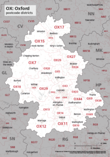
Map of OX postcode districts – Oxford
£15.00The OX – Oxford postcode districts scaled for A4+ printing
PDF -
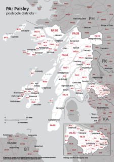
Map of PA postcode districts – Paisley
£15.00The PA – Paisley postcode districts scaled for A4+ printing
PDF -

Map of PE postcode districts – Peterborough
£15.00The PE – Peterborough postcode districts scaled for A4+ printing
PDF -
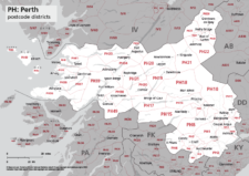
Map of PH postcode districts – Perth
£15.00The PH – Perth postcode districts scaled for A4+ printing
PDF -

Map of PL postcode districts – Plymouth
£15.00The PL – Plymouth postcode districts scaled for A4+ printing
PDF -
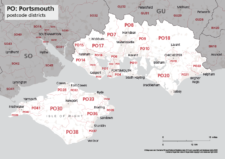
Map of PO postcode districts – Portsmouth
£15.00The PO – Portsmouth postcode districts scaled for A4+ printing
PDF -
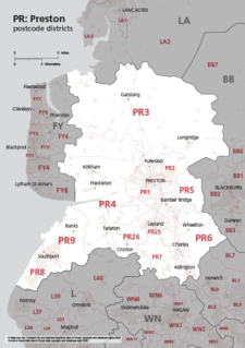
Map of PR postcode districts – Preston
£15.00The PR – Preston postcode districts scaled for A4+ printing
PDF -
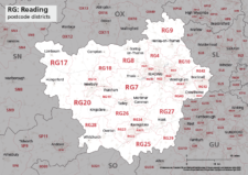
Map of RG postcode districts – Reading
£15.00The RG – Reading postcode districts scaled for A4+ printing
PDF -
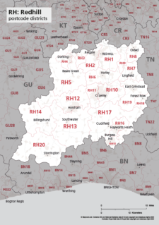
Map of RH postcode districts – Redhill
£15.00The RH – Redhill postcode districts scaled for A4+ printing
PDF -
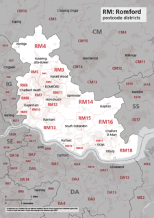
Map of RM postcode districts – Romford
£15.00The RM – Romford postcode districts scaled for A4+ printing
PDF -
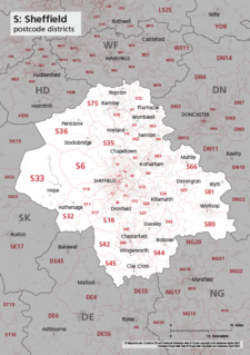
Map of S postcode districts – Sheffield
£15.00The S – Sheffield postcode districts scaled for A4+ printing
PDF -
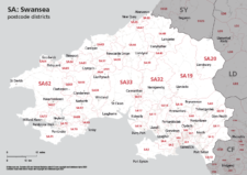
Map of SA postcode districts – Swansea
£15.00The SA – Swansea postcode districts scaled for A4+ printing
PDF -
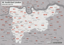
Map of SE postcode districts – South East London
£15.00The SE – South East London postcode districts scaled for A4+ printing
PDF -
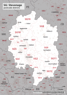
Map of SG postcode districts – Stevenage
£15.00The SG – Stevenage postcode districts scaled for A4+ printing
PDF -

Map of SK postcode districts – Stockport
£15.00The SK – Stockport postcode districts scaled for A4+ printing
PDF -
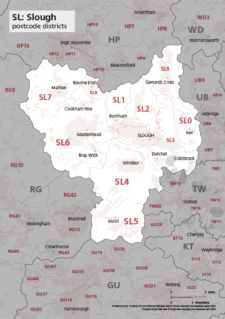
Map of SL postcode districts – Slough
£15.00The SL – Slough postcode districts scaled for A4+ printing
PDF -
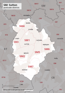
Map of SM postcode districts – Sutton
£15.00The SM – Sutton postcode districts scaled for A4+ printing
PDF -
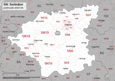
Map of SN postcode districts – Swindon
£15.00The SN – Swindon postcode districts scaled for A4+ printing
PDF -
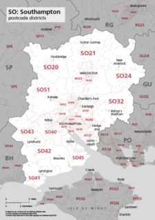
Map of SO postcode districts – Southampton
£15.00The SO – Southampton postcode districts scaled for A4+ printing
PDF -
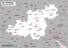
Map of SP postcode districts – Salisbury
£15.00The SP – Salisbury postcode districts scaled for A4+ printing
PDF -
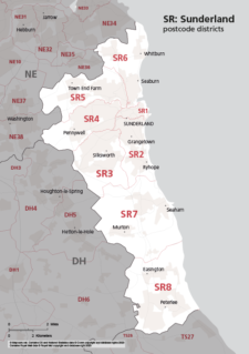
Map of SR postcode districts – Sunderland
£15.00The SR – Sunderland postcode districts scaled for A4+ printing
PDF -
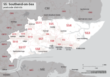
Map of SS postcode districts – Southend-on-Sea
£15.00The SS – Southend-on-Sea postcode districts scaled for A4+ printing
PDF -

Map of ST postcode districts – Stoke-on-Trent
£15.00The ST – Stoke-on-Trent postcode districts scaled for A4+ printing
PDF -
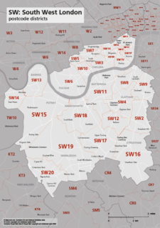
Map of SW postcode districts – South West London
£15.00The SW – South West London postcode districts scaled for A4+ printing
PDF -
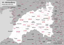
Map of SY postcode districts – Shrewsbury
£15.00The SY – Shrewsbury postcode districts scaled for A4+ printing
PDF -
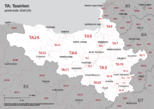
Map of TA postcode districts – Taunton
£15.00The TA – Taunton postcode districts scaled for A4+ printing
PDF -
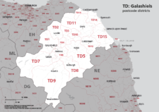
Map of TD postcode districts – Galashiels / Tweeddale
£15.00The TD – Galshiels postcode districts scaled for A4+ printing
PDF -
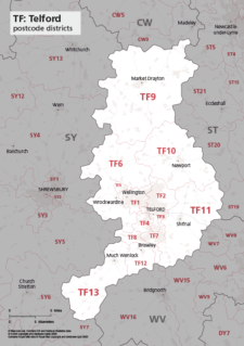
Map of TF postcode districts – Telford
£15.00The TF – Telford postcode districts scaled for A4+ printing
PDF -
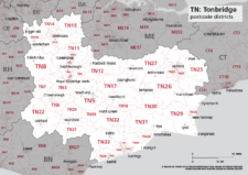
Map of TN postcode districts – Tonbridge
£15.00The TN – Tonbridge postcode districts scaled for A4+ printing
PDF -
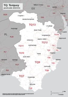
Map of TQ postcode districts – Torquay
£15.00The TQ – Torquay postcode districts scaled for A4+ printing
PDF -
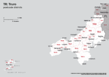
Map of TR postcode districts – Truro
£15.00The TR – Truro postcode districts scaled for A4+ printing
PDF -
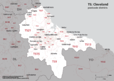
Map of TS postcode districts – Cleveland / Teesside
£15.00The TS – Cleveland postcode districts scaled for A4+ printing
PDF -
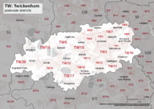
Map of TW postcode districts – Twickenham
£15.00The TW – Twickenham postcode districts scaled for A4+ printing
PDF -
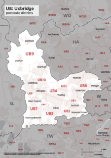
Map of UB postcode districts – Uxbridge / Southall
£15.00The UB – Uxbridge postcode districts scaled for A4+ printing
PDF -
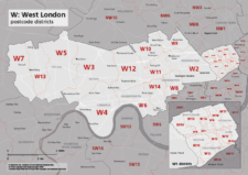
Map of W postcode districts – West London
£15.00The W – West London postcode districts scaled for A4+ printing
PDF -
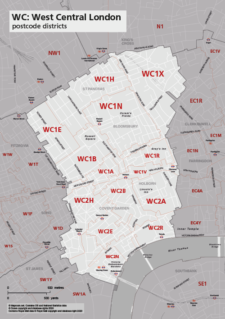
Map of WC postcode districts – West Central London
£15.00The WC – West Central London postcode districts scaled for A4+ printing
PDF -
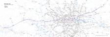
Elizabeth Line map with rail and road networks
£75.00Editable map of the entire length of the Elizabeth Line from Reading in the west to Shenfield in Essex to the east, with southern branch lines to Heathrow and Abbey Wood. The entire Ordnance Survey road network, other railways and Tube, DLR and tram lines are also included on the map for geographical context.
PDFsSVGLayered AI file -
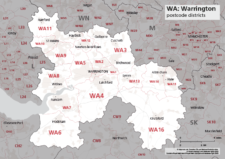
Map of WA postcode districts – Warrington
£15.00The WA – Warrington postcode districts scaled for A4+ printing
PDF -
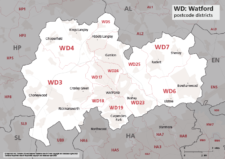
Map of WD postcode districts – Watford
£15.00The WD – Watford postcode districts scaled for A4+ printing
PDF -
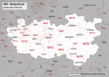
Map of WF postcode districts – Wakefield
£15.00The WF – Wakefield postcode districts scaled for A4+ printing
PDF -
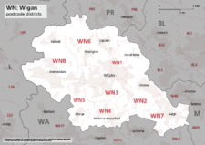
Map of WN postcode districts – Wigan
£15.00The WN – Wigan postcode districts scaled for A4+ printing
PDF -
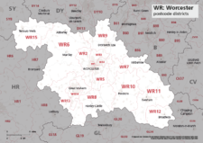
Map of WR postcode districts – Worcester
£15.00The WR – Worcester postcode districts scaled for A4+ printing
PDF -
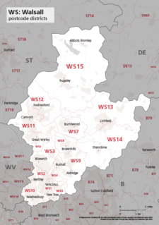
Map of WS postcode districts – Walsall
£15.00The WS – Walsall postcode districts scaled for A4+ printing
PDF -
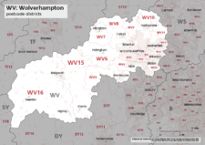
Map of WV postcode districts – Wolverhampton
£15.00The WV – Wolverhampton postcode districts scaled for A4+ printing
PDF -
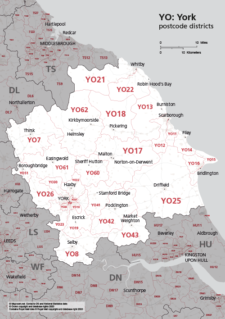
Map of YO postcode districts – York
£15.00The YO – York postcode districts scaled for A4+ printing
PDF -

Map of ZE postcode districts – Lerwick
£15.00The ZE – Lerwick postcode districts scaled for A4+ printing
PDF -
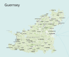
Maps of Guernsey
£30.00Editable maps of Guernsey and the Bailiwick of Guernsey which includes Alderney, Sark, Herm, Jethou and Brecqhou
PDFsSVGLayered AI file -
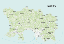
Maps of Jersey
£30.00Maps of Jersey with towns, villages, roads, parishes, postcode districts, urban and green areas, airport and ferry routes
PDFsSVGLayered AI file -
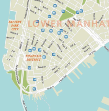
Maps of New York and environs
£75.00Multi-use editable maps of New York and environs, with districts, detailed roads, green areas and stations.
PDFsSVGLayered AI file -
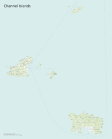
Maps of the Channel Islands
£40.00This superb value bundle of maps for the Channel Islands includes 11 ready-to-use PDF versions plus raw Illustrator base files
PDFsSVGLayered AI file -
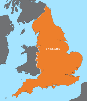
Outline map of England
£15.00A detailed outline map of England, with parts of the surrounding countries for context.
PDFsSVGLayered AI file -
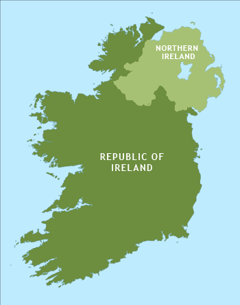
Outline map of Ireland
£15.00An outline map of Ireland with exceptional detail on the coastlines. Includes the border between the Republic and Northern Ireland.
PDFsSVGLayered AI file -
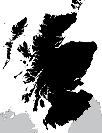
Outline map of Scotland
£15.00A highly detailed outline map of Scotland, with an exceptional number of islands plotted, including many that do not appear on popular online maps!
PDFsSVGLayered AI file -
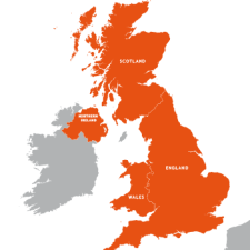
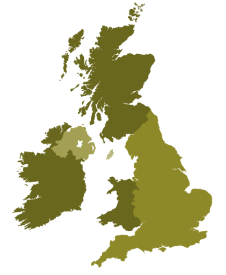
Outline map of the UK / United Kingdom
£20.00A detailed outline map of the UK with paths for the component countries of England, Scotland, Wales and Northern Ireland.
PDFsSVGLayered AI file -
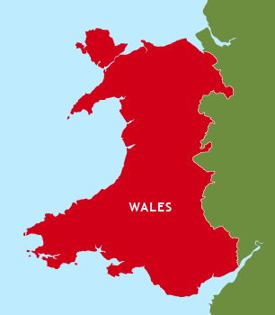
Outline map of Wales
£15.00A detailed outline map of Wales, which shows Anglesey separate from the mainland and includes the little Welsh islands. You can colour it however you want.
PDFsSVGLayered AI file -

Oxford Street Maps
£60.00Street maps of Oxford city centre and environs reaching out to Headington, Cowley, Cumnor, Kidlington and Oxford Airport
PDFsSVGLayered AI file -
Political map of England
£40.00Shows all the counties of England, plus the principal towns and transport network.
PDFsSVGLayered AI file -
Political map of Ireland
£40.00Shows all the counties plus the principal towns and transport systems across both the Republic of Ireland and Northern Ireland.
PDFsSVGLayered AI file -
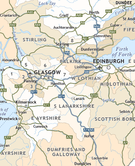
Political map of Scotland
£40.00Includes all the modern counties of Scotland, plus the principal towns and transport network.
PDFsSVGLayered AI file -
Simple outline map of Britain and Ireland
£15.00A simple outline map of Britain and Ireland with the main islands of the British Isles. Looks elegant and accurate when used as a small image up to about A5.
PDFsSVGLayered AI file -

Touring / physical map of Britain and Ireland (low-resolution)
£30.00Perfect for tourist industry projects with its coastal features, lakes, rivers, national parks, historic towns and resorts.
PDFsSVGLayered AI file -
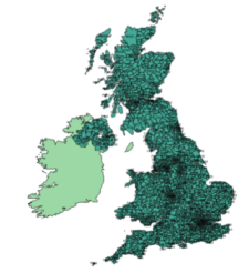
UK postcodes – Esri shapefiles and geojson sets for postcode areas and districts
£1,000.00All the UK postcode areas, districts, sectors and units in formats for developers and geocoders. A valuable and comprehensive GIS dataset that is capable of deep zooming down to street level. Includes Northern Ireland. Licensing restrictions apply.
-

Vector World Map With All Countries
£25.00Versatile editable vector world map with all the countries plotted and labelled
PDFsSVGLayered AI file